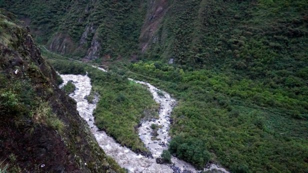
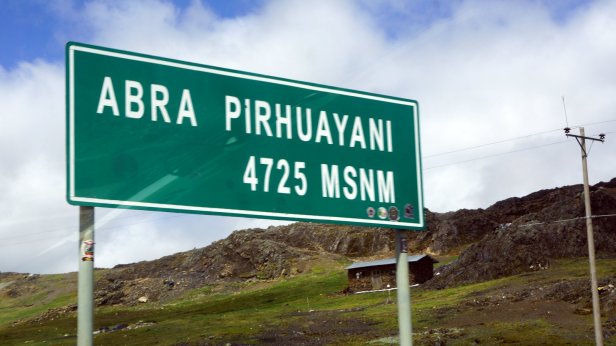
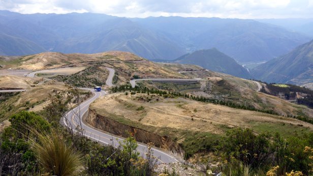
The long climb to Cusco first started by driving along the Rio Inambari through the jungle till the foot of the Andes. Initial the climb was gradual till around 2000 m where we stopped at a roadside restaurant for the night. They opened the restaurant especially for us. The meal was filling but that was all. The next day the real climb started. The first pass was at 4725 m. With the reduced turbo power the climb was slow. Whole stretches were done in first gear but we made it.

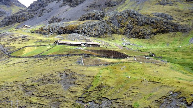

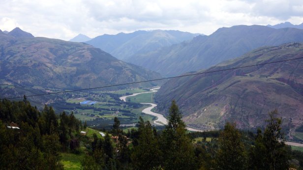
After that there were 2 more climbs till over 4000 m before we descended down into Urcos, around 3200 m. Just there after you hit the first impressive Inca structure, Rumicolca. It is the entrance gat to the Cusco area.


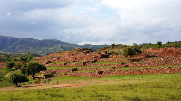
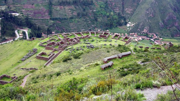
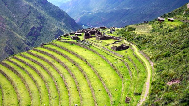
A bit further are the ruins of Piquillacta. This is a pre-Inca city of the Warri culture. Maybe because it was on the outskirts of their empire, which was centred in the Arequipa area, it was already abandoned in 1100 AD. The ruins cover a large area. You can walk over the old streets and get a feel of what it used to be.

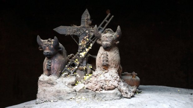
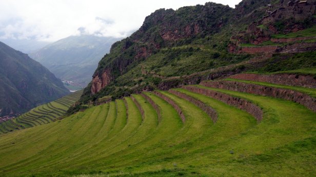
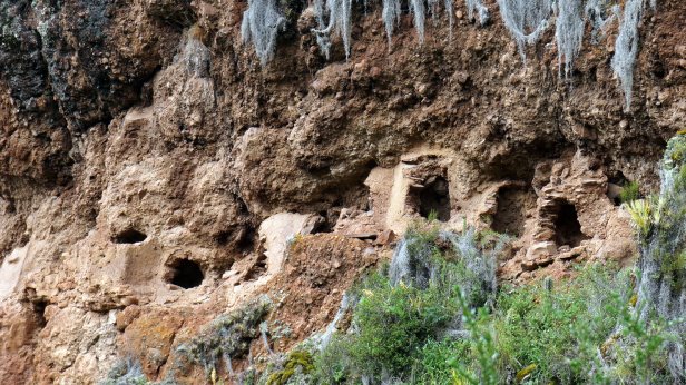
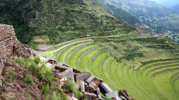
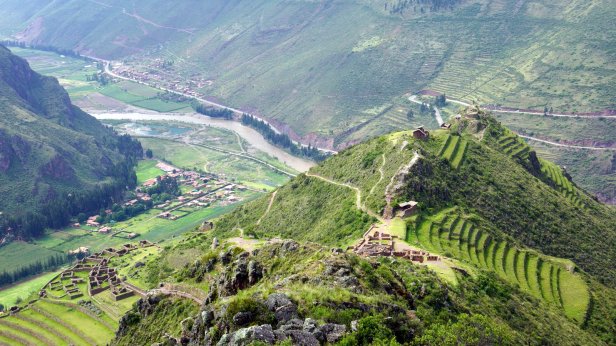
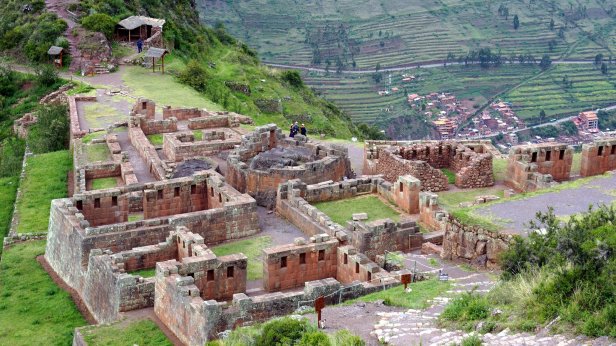
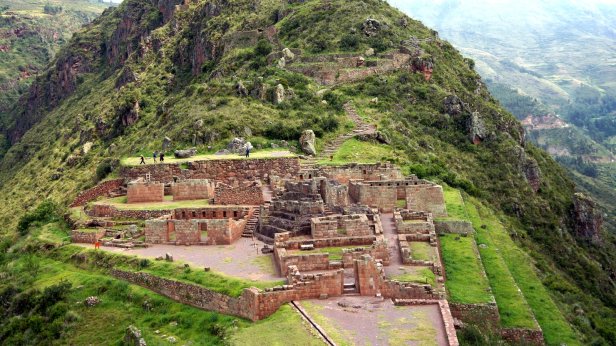
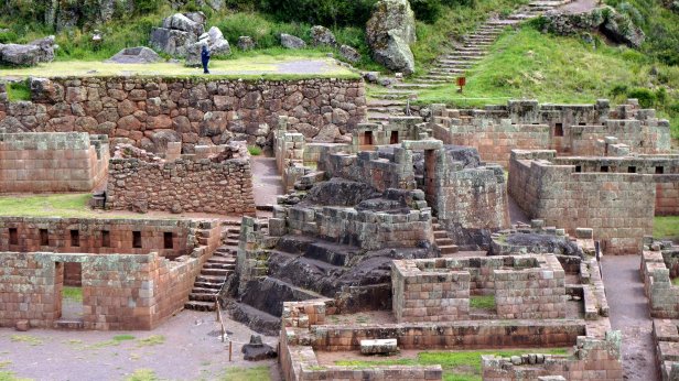
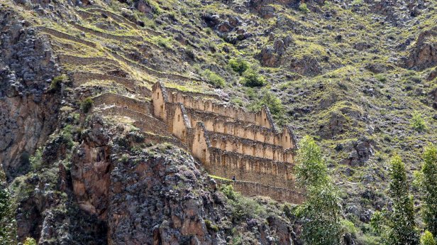
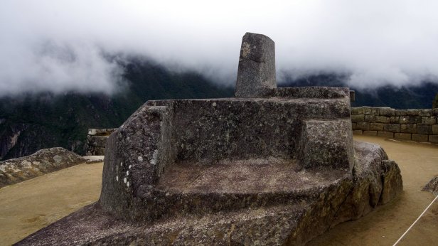
Instead of going to Cusco we decided to first visit the towns in the Sacred Valley. We started with Pisaq. The town itself is very touristy with many eating and sleeping places. Above the town on the slopes of the mountain the Inca had built their terraces together with temples and a ceremonial centre. In the side of the cliff you could see the broken open burial jars/tombs. We climb all the way to the top of the terraced mountain and descended down into the ceremonial area. It was a steep descent. We even had to go through a small tunnel. The ceremonial centre was the Intihuatana. This is a large natural rock which is carved in such a way that the sides align with the various annual positions of the sun and some stars.
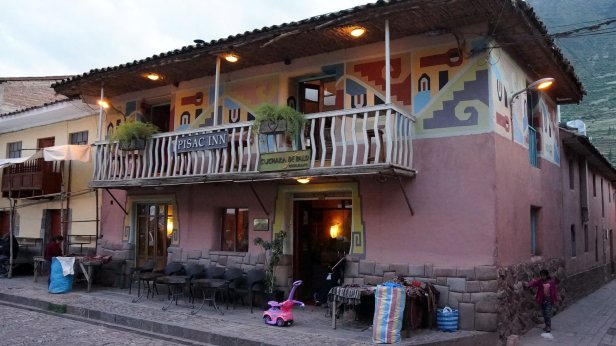


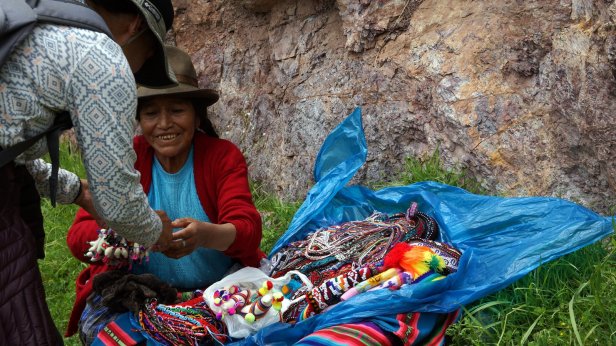

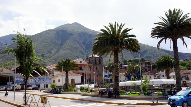
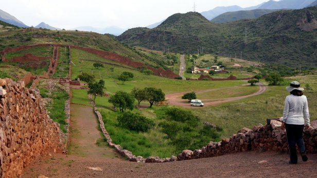
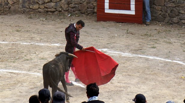
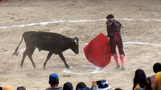
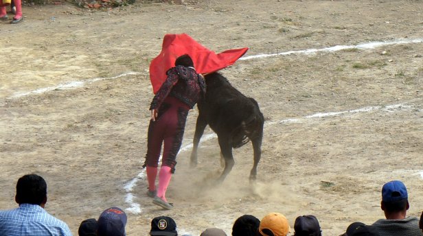
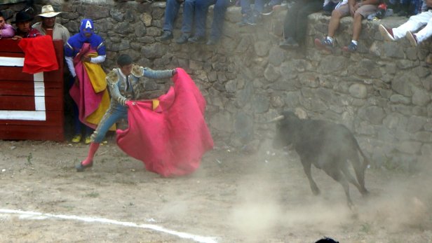
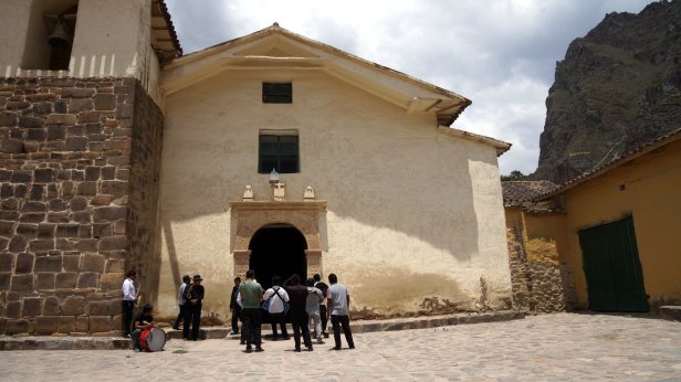
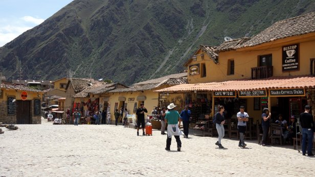
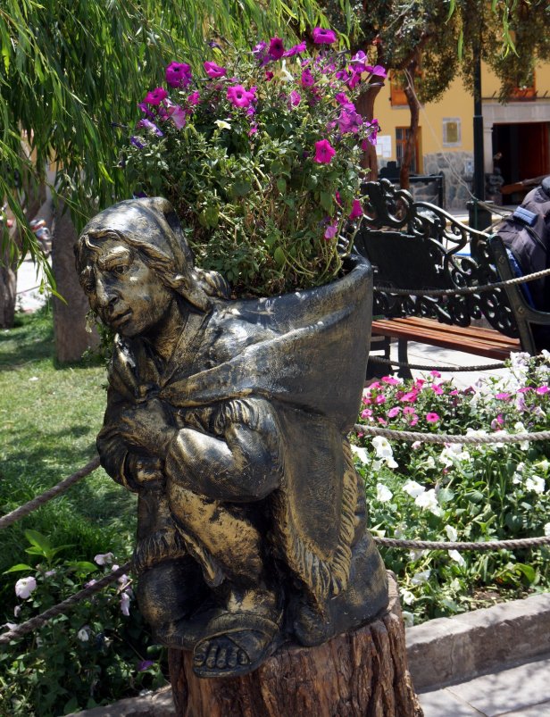
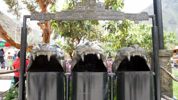
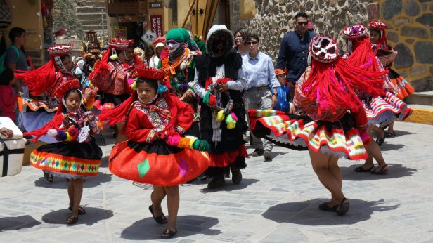
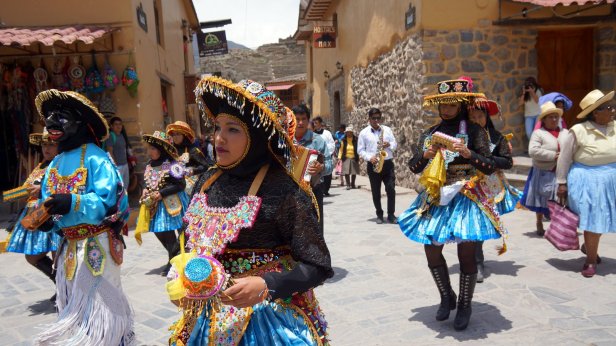
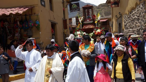
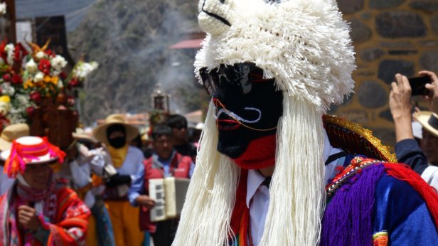
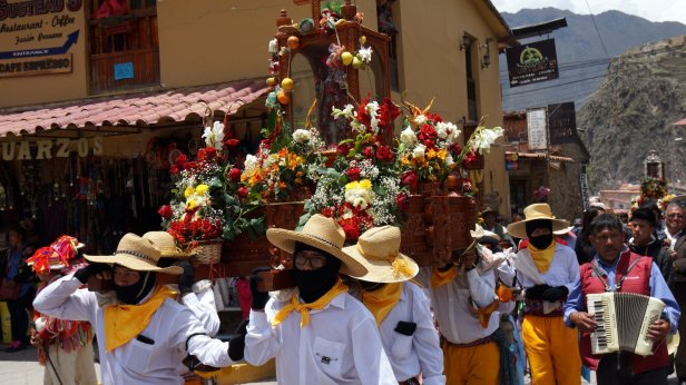
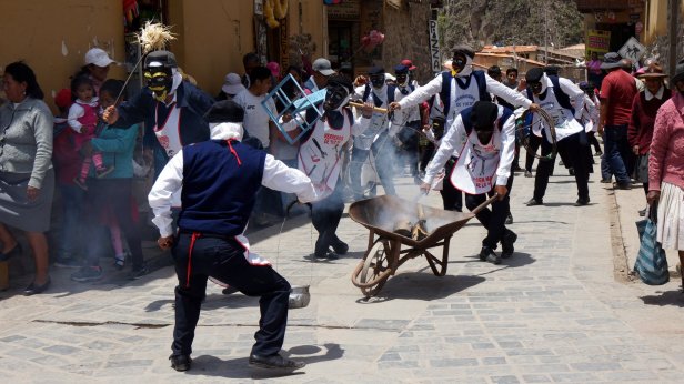
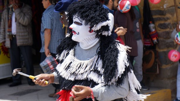
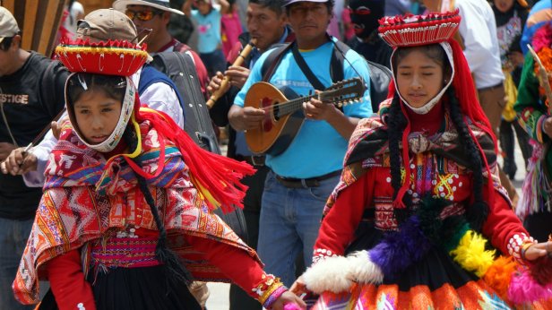
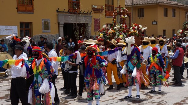
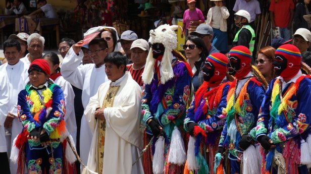
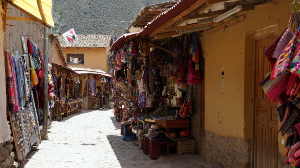
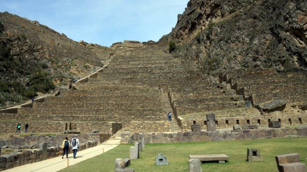
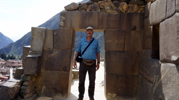
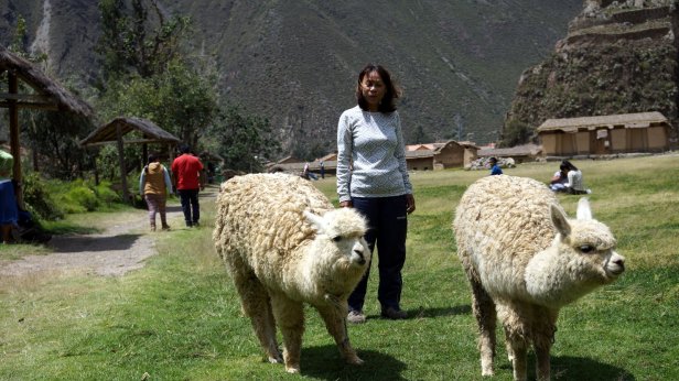
Driving along the Urubamba river through the Sacred Valley we reach the Inca fortress town of Ollantaytambo. The fortress and terraces dominate the mountain sides above the town. We parked the camper for the next 2 nights on a large guarded parking place on the outskirts of the town. It was the sixth of January i.e. Epiphany. There is then a 3 day festival in town. We were in time to see the bullfight. In this case the bull does not get killed but just annoyed with a red cloth by the matador.
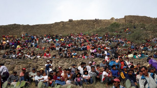
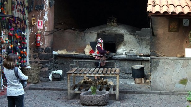
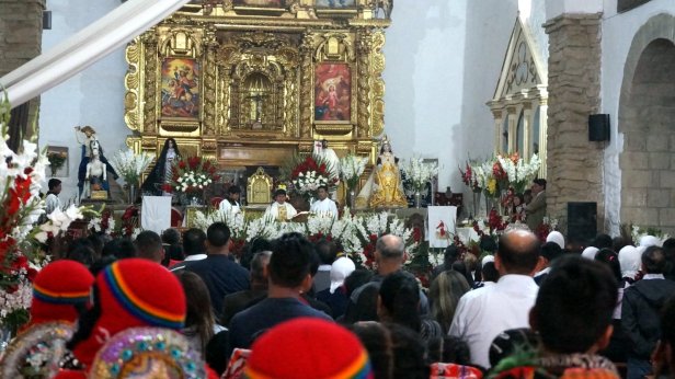
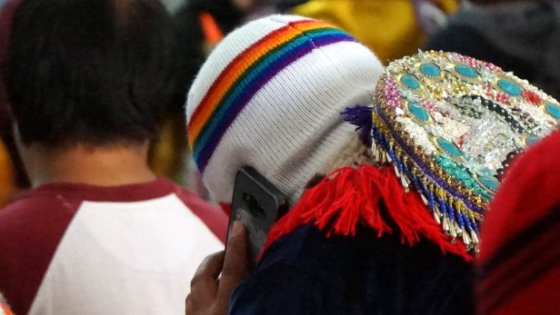
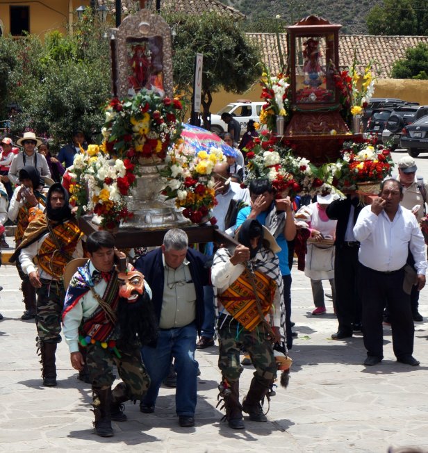
Before we left town we also saw the closing ceremony. This started off in church and was followed by a procession through town with marching bands, dancers and the carrying of local saints through streets and around the main plaza.


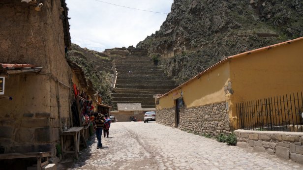
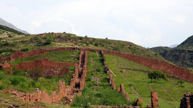
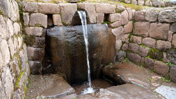
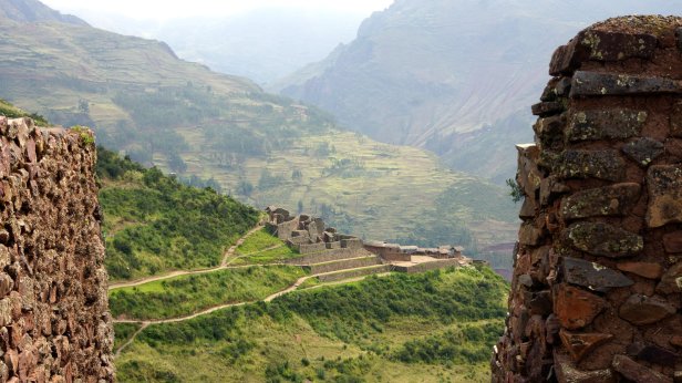
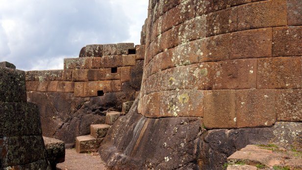
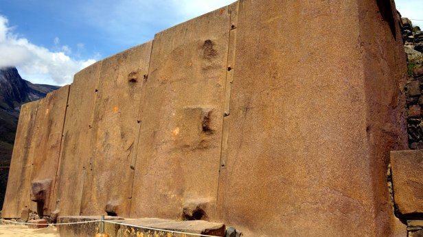
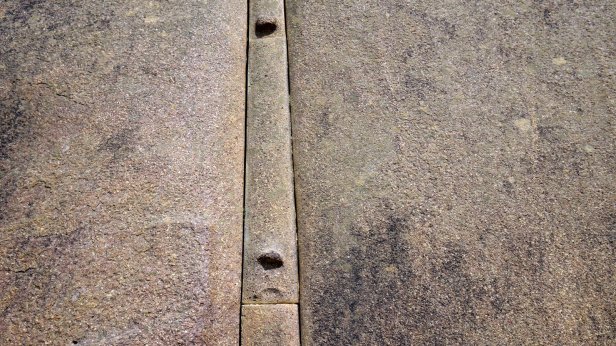
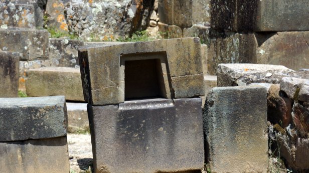
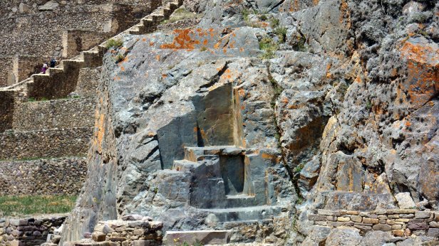
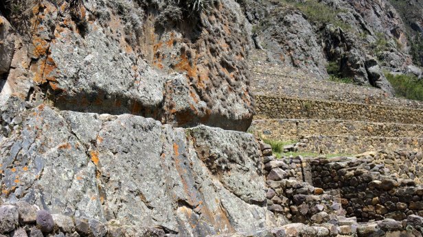
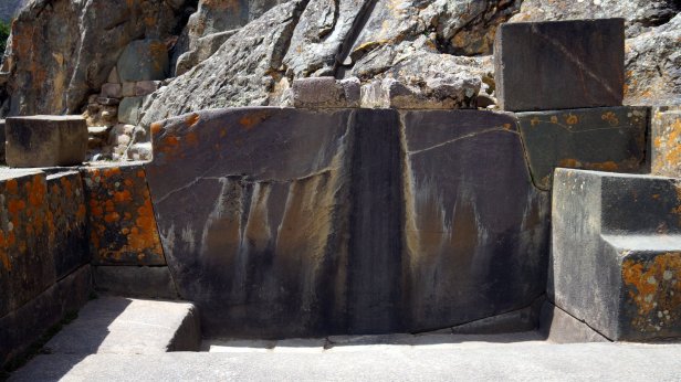
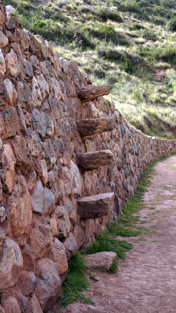
The Ollantaytambo fort was initially successfully defended against the Spanish invaders but ultimately was overrun. Construction of the fort and nearby Inca Palace was still ongoing at the time of the invasion. The area is littered with huge large stone blocks which were partly carved into shape.
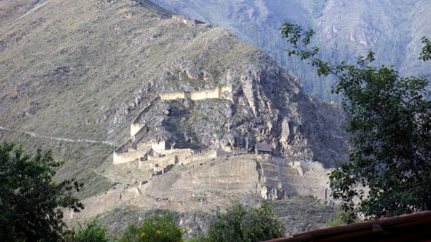

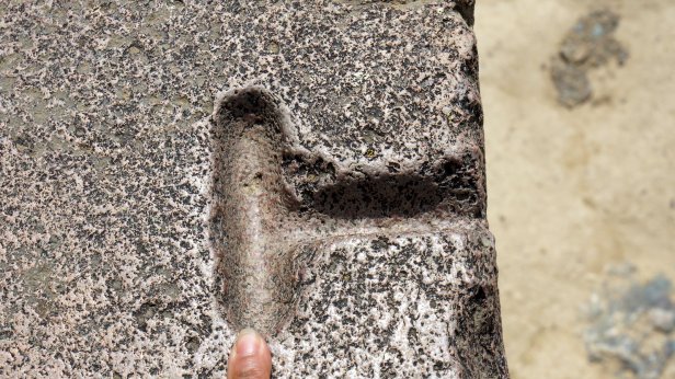

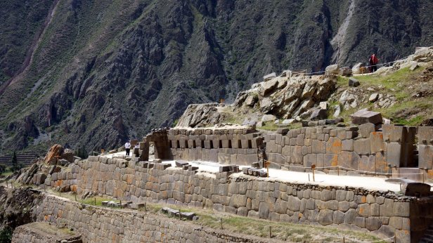

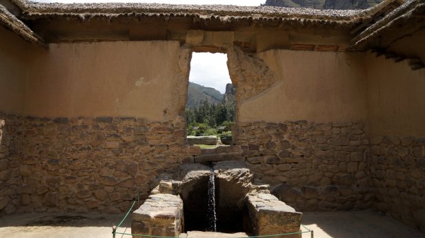
On one side the mountain was carved away and showed o.a. a bath tub which was fed by water running along the side of the mountain though a aqueduct.

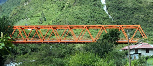
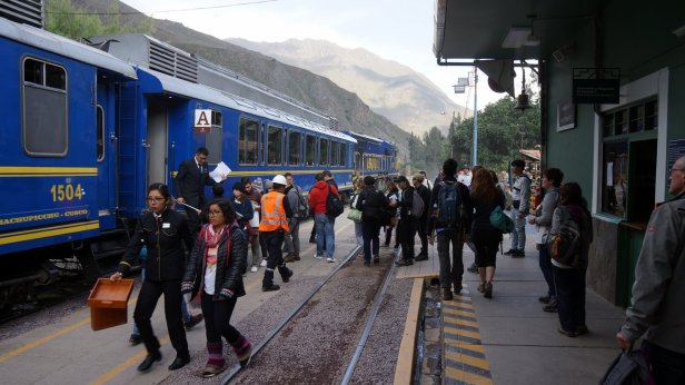
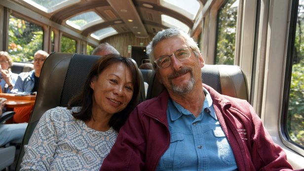
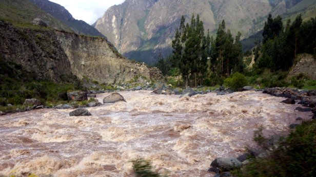
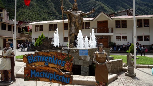
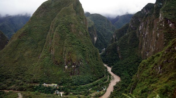
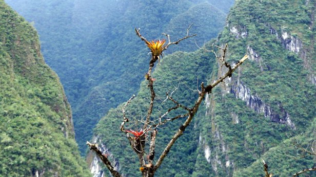
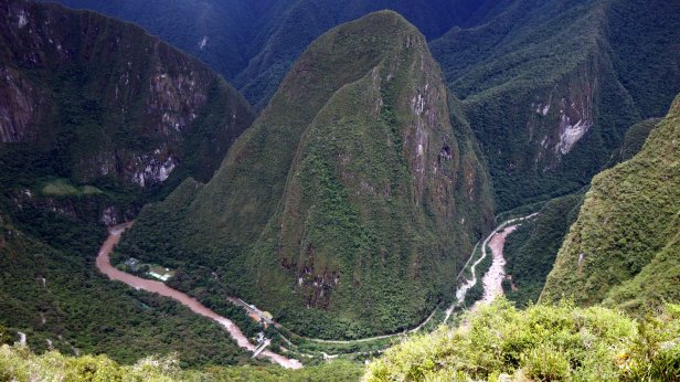
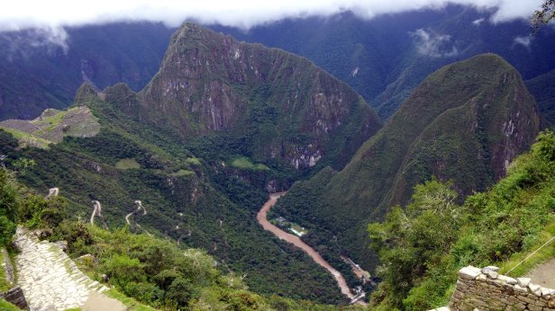
From Ollantaytambo we took the train to Machu Picchu. The train line follows the fast flowing Urubamba river which has cut a steep gorge through the mountains. In the town of Aguas Callientes you board a bus which takes you up the mountain to the ruins.
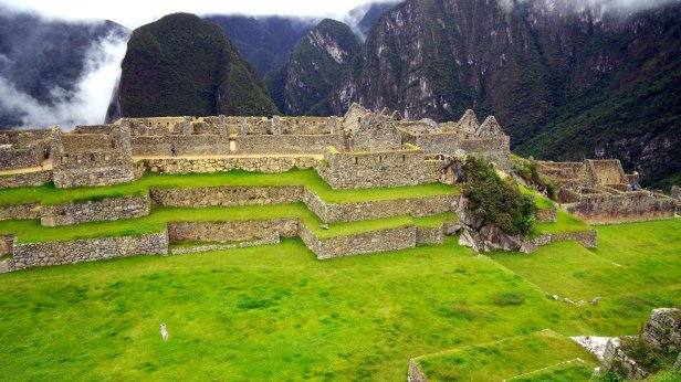
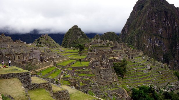
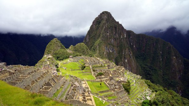
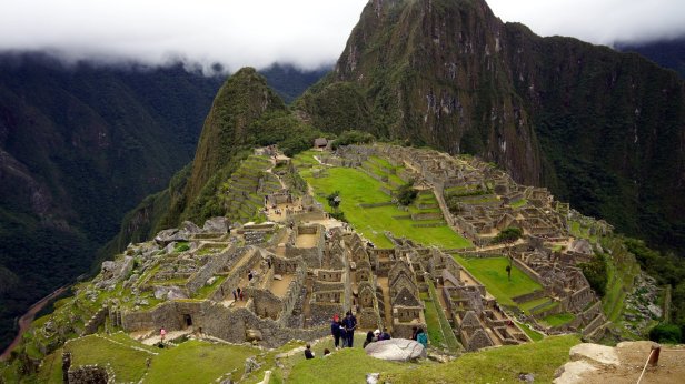
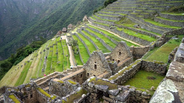
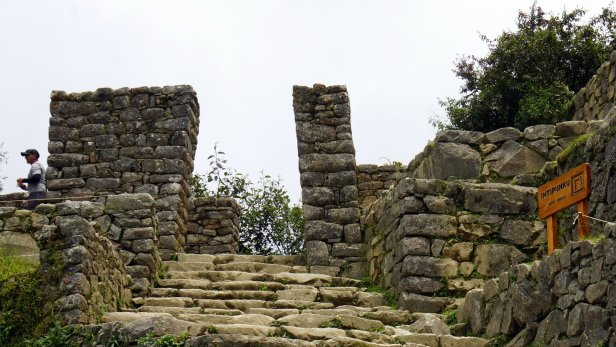
Machu Picchu was built in the 15th century by Inca Pachacutec. The is the first Inca who started to expand successfully the empire which at its peak stretched from below Santiago in Chile to past Quito in Equator. It was meant as a royal retreat. Before the Spanish arrival in 1532 it was already vacated and only rediscovered in 1911.
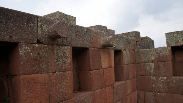
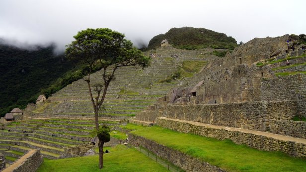
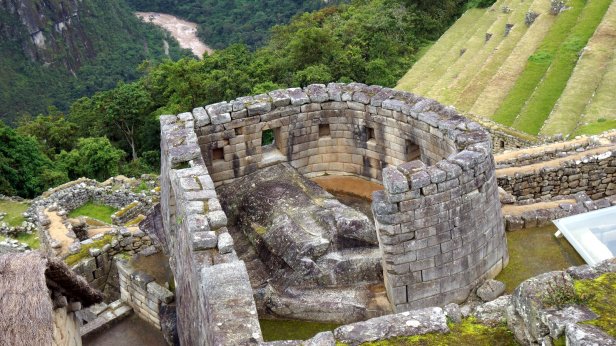
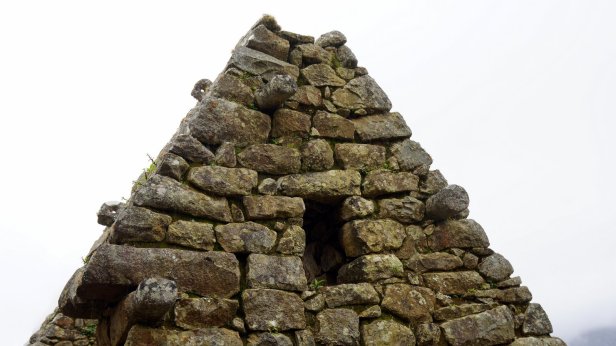
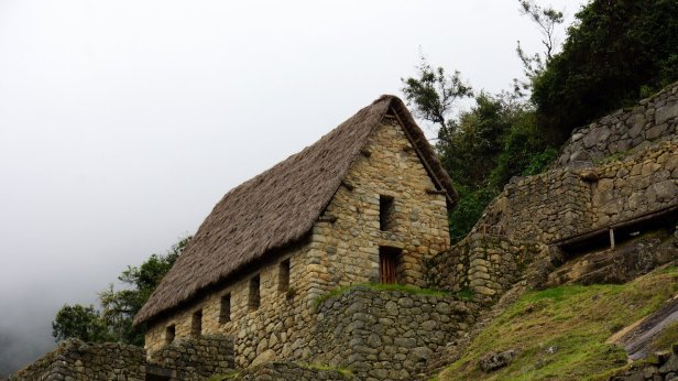
The area has a large central plaza in the middle with on one side the royal and religious buildings and on the other side the residential and industrial sector. The royal section has finely carved walls as opposed to the residential area where the walls are made of lose rocks cemented together with mud.
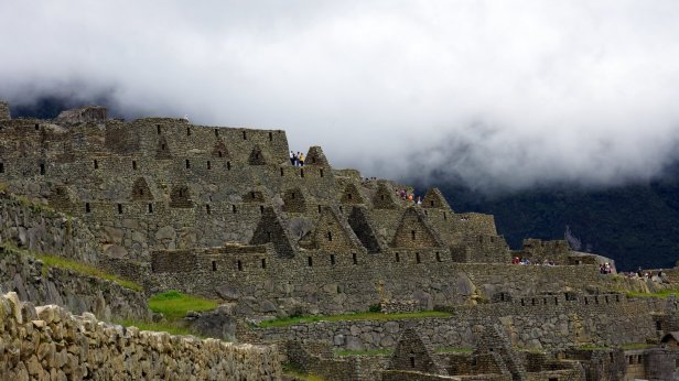
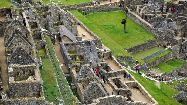
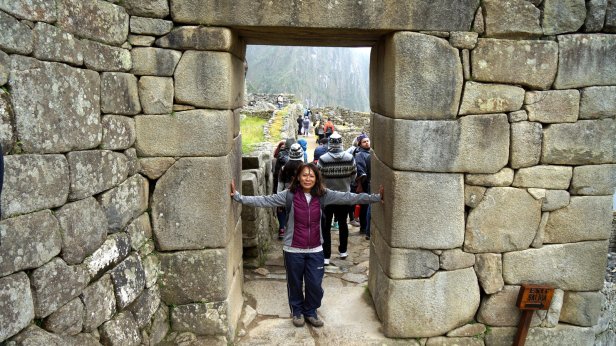


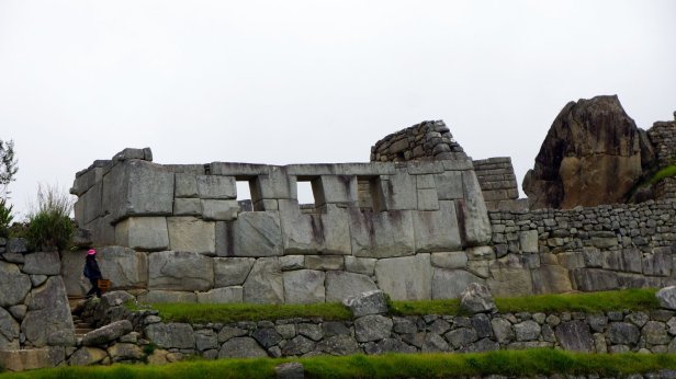
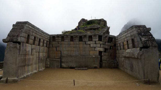
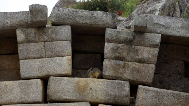
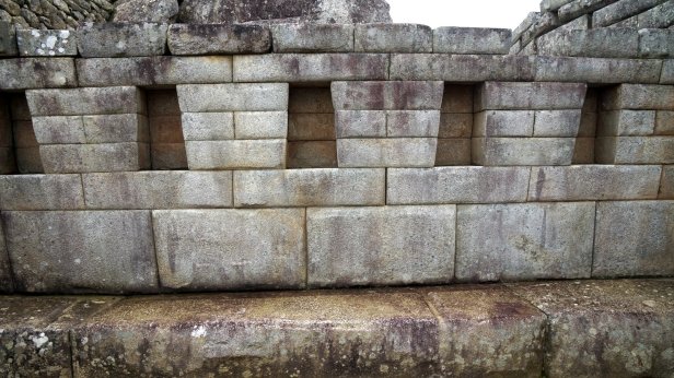
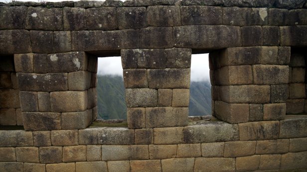


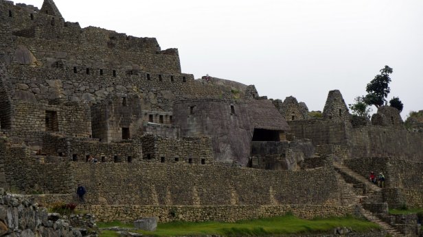
In the walls are stone pegs and stone eyes. They are used to tie the roof construction to the walls so they do not get blown away.

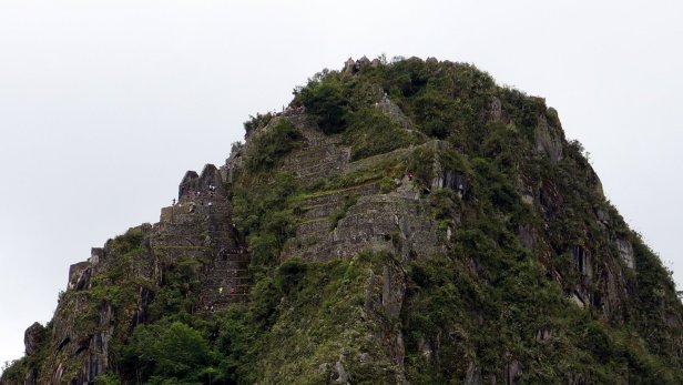
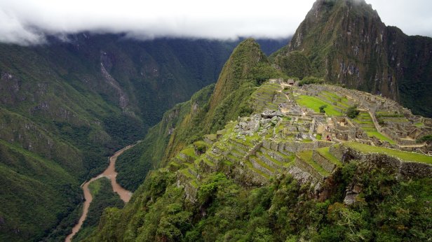
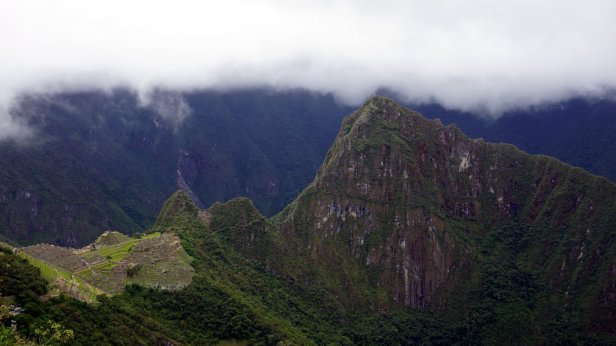
We started our visit with al long 1 ½ hr climb to the so called sun gate. This is the original entrance to the citadel and is located on the Inca trail which runs all the way to Cusco. From there you have a nice views into the river valley some 500 m below. Last time Rudy was here (1986) he made the climb to Wayna Picchu. Now this is restricted to 400 people per day and you need to book in advance. We wondered another 2 hrs through the partly reconstructed ruins and took the bus down again. That was a wise decision since all the climbing and walking causes much muscle and joint aches.


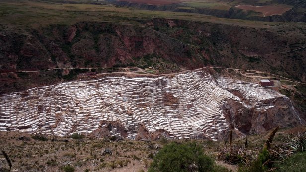
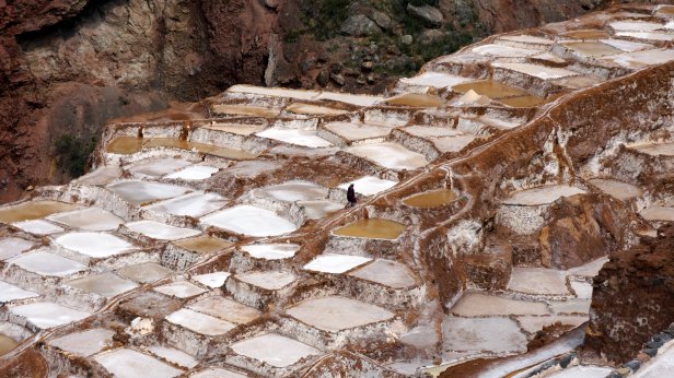
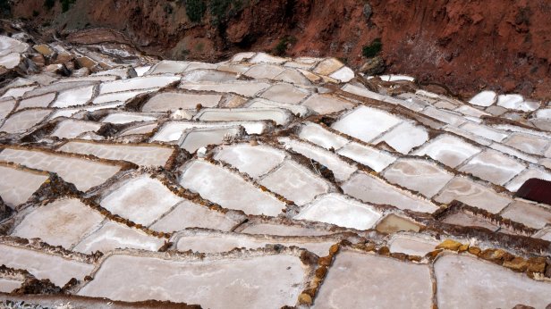
After the parades in Ollantaytambo we drove in the direction of Cusco. The first detour was to Salinas. In this valley the salty warm water from a mountain spring is collected in evaporation ponds. The slopes of the mountain are a patchwork of white ponds in various stages of evaporation. Somehow the salt must have a second treatment because otherwise if will have sand from the bottom of the pond. Untreated it is used as cowlicks.

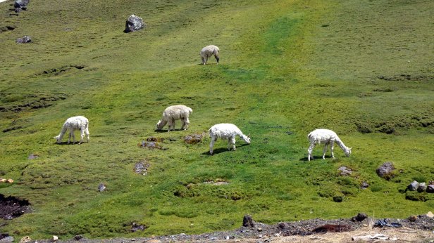
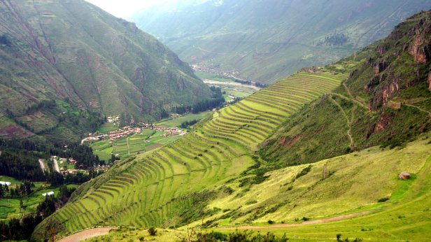
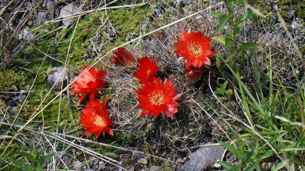
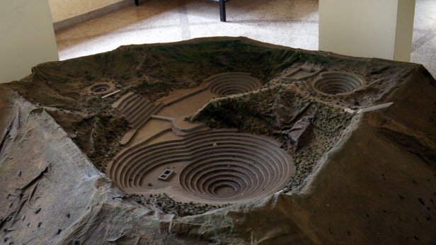
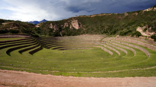
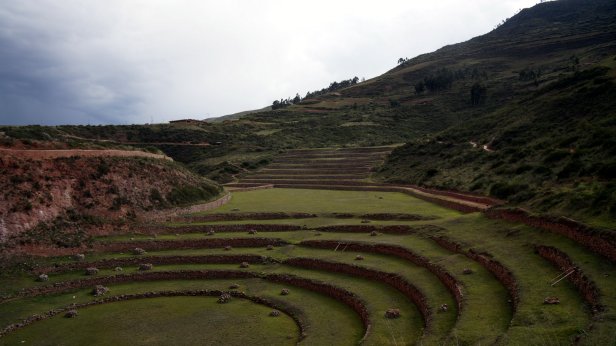
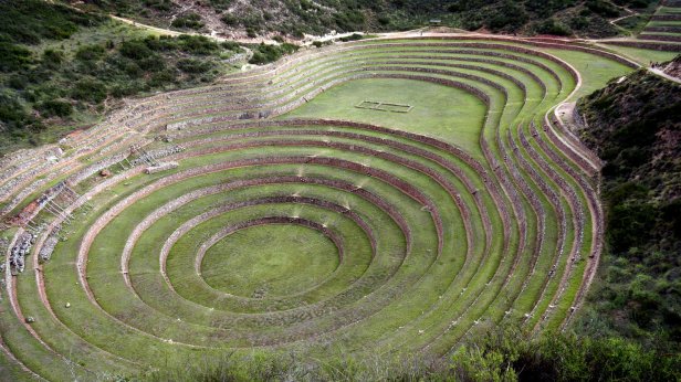
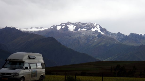
A bit further along there is a detour to Moray. Here the Inca built 3 sets of terraces in a circular shape. Some say it is to try out different crops at different sun angles. Due to its shape plants can grow at 3500 m which normally would not grow at this height. We camped near the ticket booth and had for the first time a lovely view towards snow capped mountains. Finally a quiet camping spot in nature like we had so many in Argentina and Chile.

Wat een mooi verhaal met prachtige foto’s. En de camper kon het aan dit keer:).
Wij gaan vanavond naar het NAM cabaret…
Warme groet, Jan en Jeanne
LikeLike