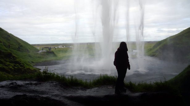
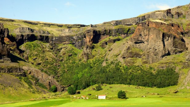
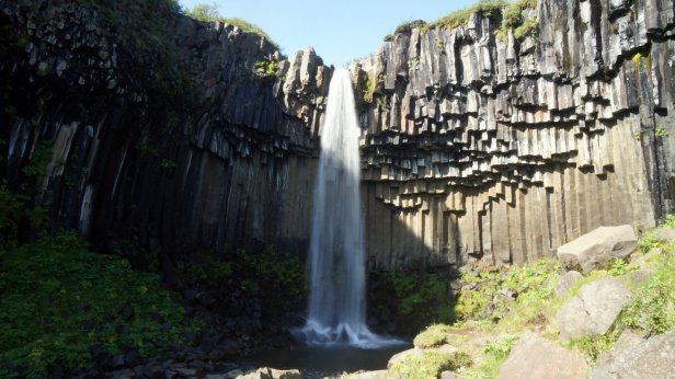
Along the southern coast of Iceland the glaciers covered volcano’s are much closer to the sea and therefore sometimes the coast is very narrow with high mountains/cliffs to the side or broad gravel plains (sandur) formed by the runoff smelt water from the many glacier tongues which slide down the mountain side. Before we left the campsite, we walked towards the largest of the 3 waterfalls dropping off the cliff. The tourist had started to arrive so it was busy on the stairs and slippery walkway behind the waterfall.
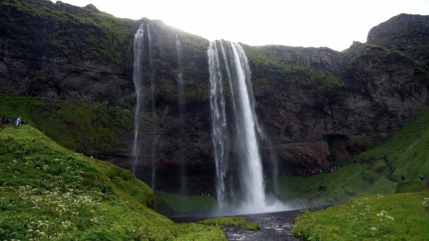
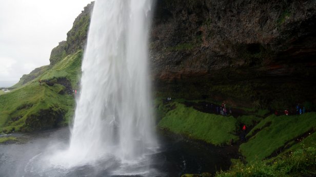
We drove only some 28 km to our first stop “the Skogar waterfall”. This 62 m high waterfall drops down a cliff. It is a powerful water stream and you can get close to the splash zone if you want to become wet. These falls are a major attraction and it has a large camping area along the walkway to the falls. Not really our style of camping and it was too early to stop anyway.

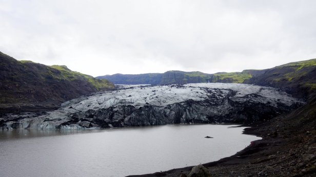
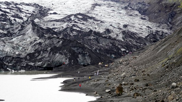
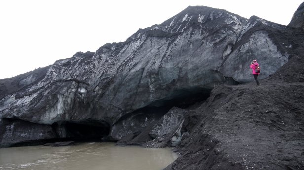
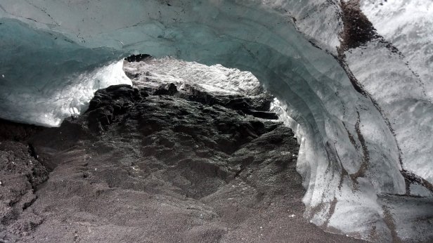
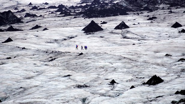
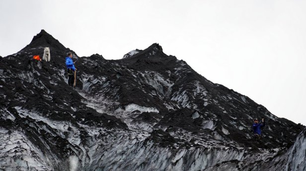
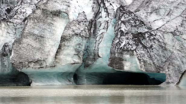
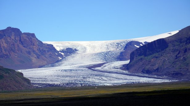
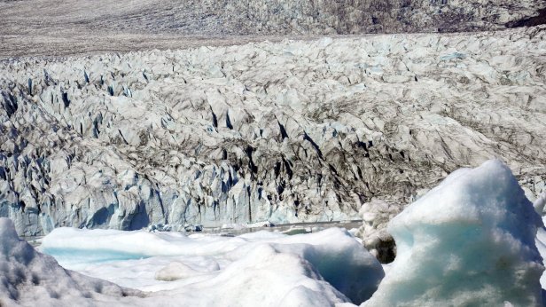
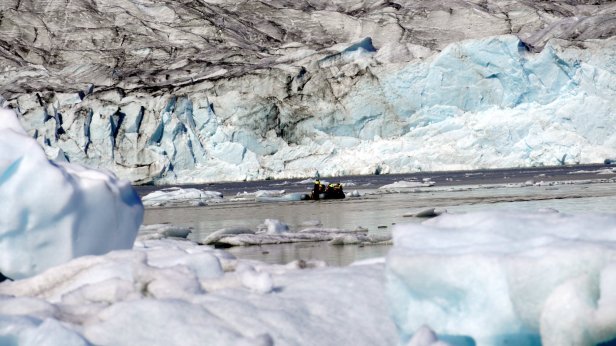
Instead, we drove further along the coast. Some 4 km later was the first of several glaciers we visited. At the Solheimajokull glacier we could walk all the way up to the ice. At the bottom there are some small ice caves and on the lagoon in front of the ice cliff are floating blocks of ice. You could book a canoe tour in-between these blocks or a glacier walk and even a ice climbing trip. But we stuck to just walking and taking photo’s.
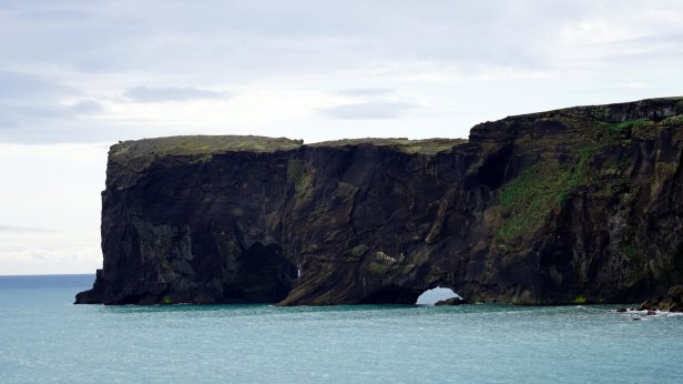
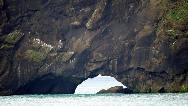
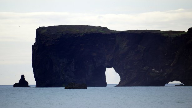
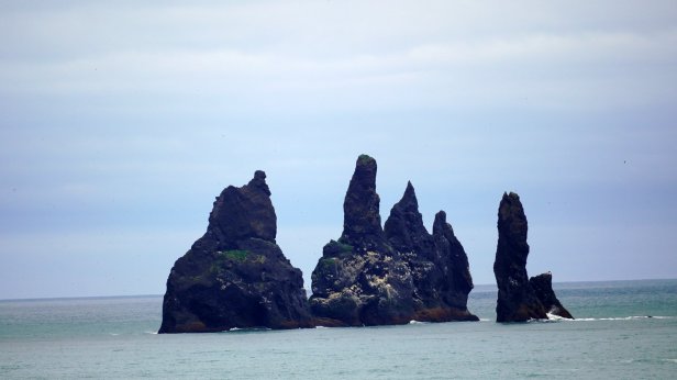
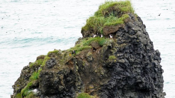
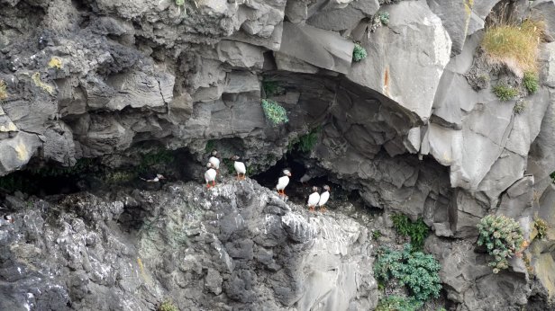
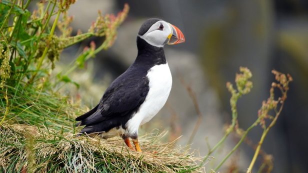
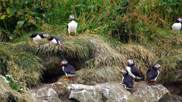
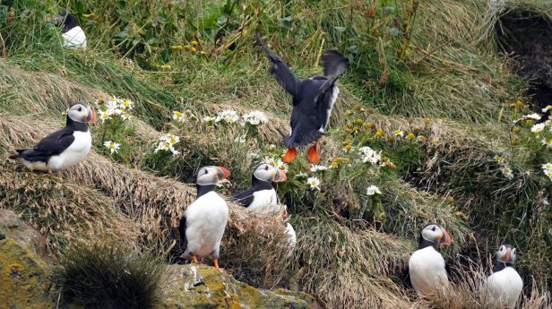
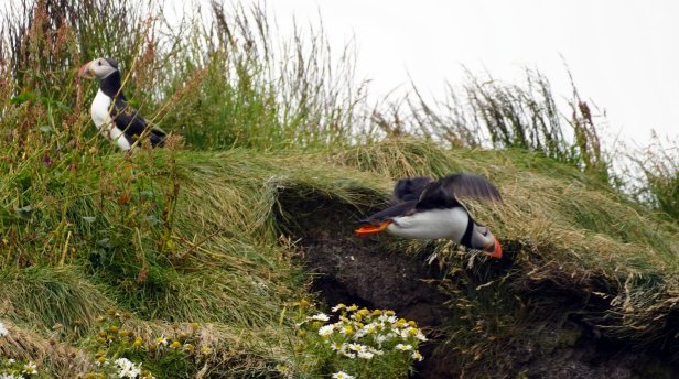
The town of Vik is some further 30 km along the southern shores. Before the town, there are two turnoffs towards bird cliffs. In the sea there are some large rocks sticking out of the water. Several of them are home to different seabird species. We are lucky to see on several cliffs large puffin colonies. It looked like all the young birds had grown up and are practicing flying. There was a steady flow of incoming and outgoing birds. Very difficult to photograph.
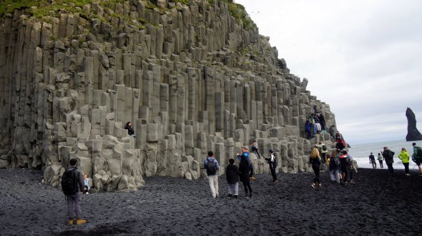
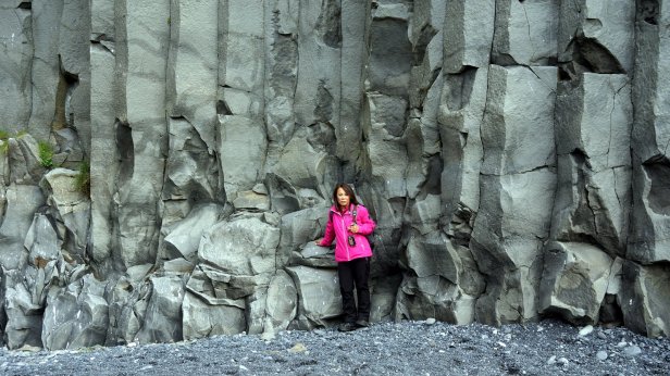
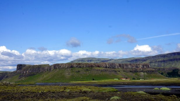
The other turnoff led to a basalt rock face with hexagonal pillars (like church organ). Everybody wanted to be photographed while standing on or in front of the pillars.
We did not want to stay in Vik but instead drove on towards Kirkjubaejarklauster. The camping is outside the town near a waterfall. It was not busy with campers. The tent area was a bit fuller. The facilities (2 toilets) is minimal. To our surprise a German, Bernd, which we met on the boat and several times along the way, later came to this remote site.
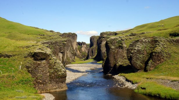
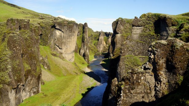
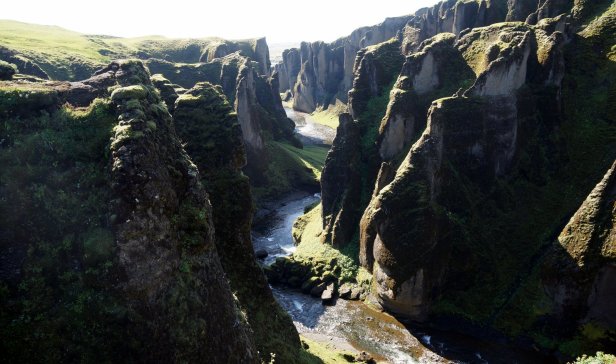
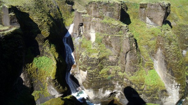
The next morning (Day 25) we drove a bit back on Rt. 1 and up a small road (F206) towards a very impressive canyon. You walked along the top side of the canyon all the way to the waterfall which created it. The walk down into the canyon is forbidden. They hope that this will allow the fish in the stream to come back.
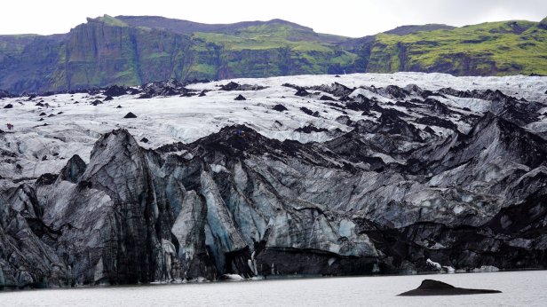
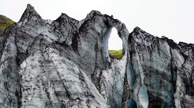
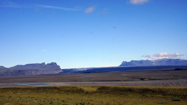
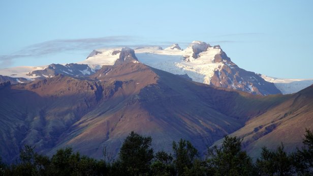
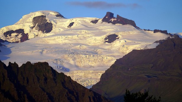
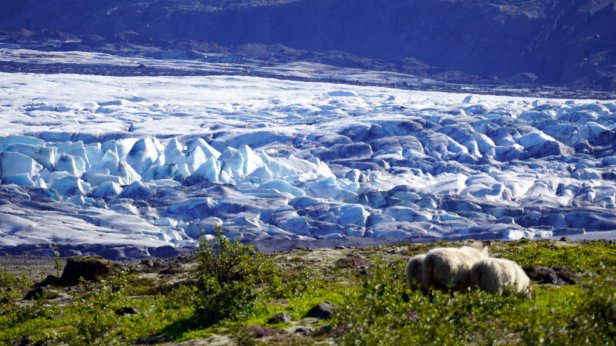
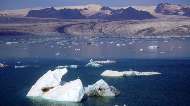
We drove further over Rt 1 (the main 2 lanes road circumventing the whole island with often 1 lane bridges) and crossing the large “sandur” plain towards the largest glacier complex of the island: Vatnajokull in the Skaftafell National park. You could see the mountains very clearly coming towards you. At one point we saw a large reasonably recent dark lava stream “flowing” out of the mountains. This stream had laid the good farmland and farm buildings which existed here to waste. We arrived early at the Skaftafell campground and relaxed in the sun. Later in the afternoon we walked up a nearby hill towards yet another waterfall. On returning to our bus, we saw the Dutch VW camper group arriving and had a few drinks with our friends. The sun is setting earlier and earlier now. This changes rapid at this latitude. Rudy was just in time to catch the last sunrays lighting up the glaciers on the mountain side.
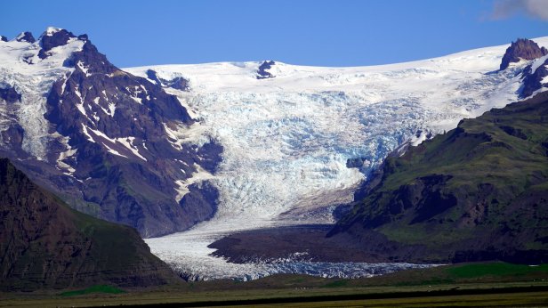
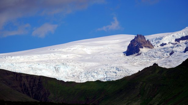
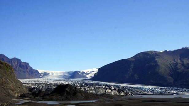
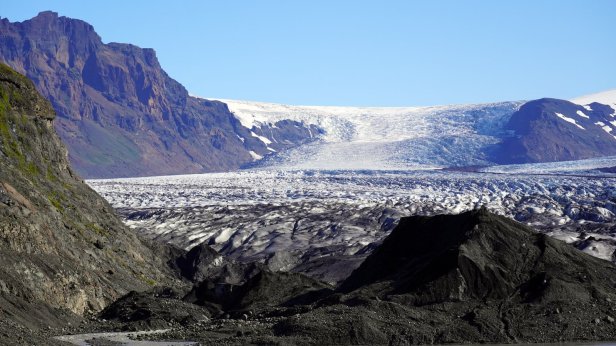
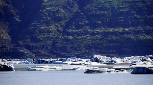
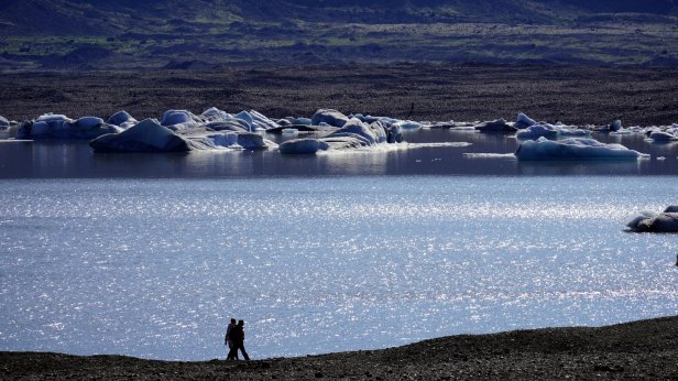

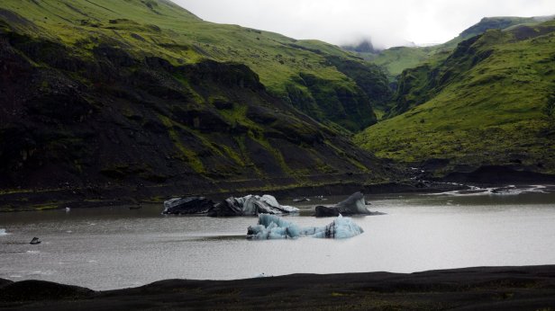
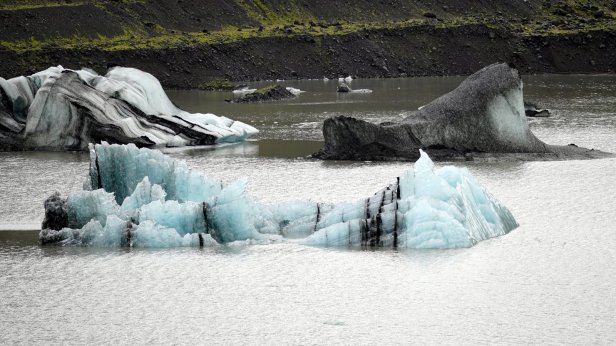
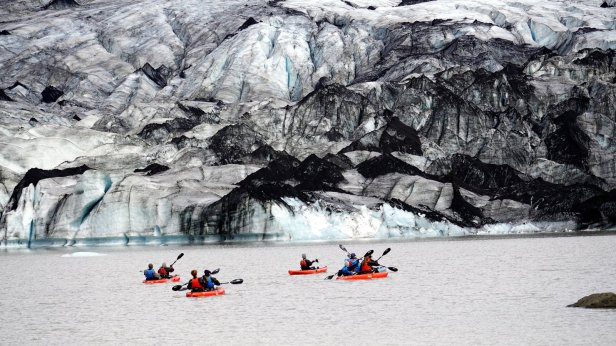
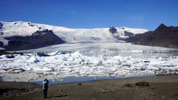
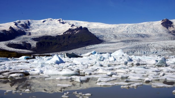
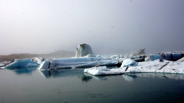
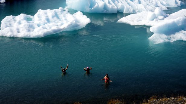
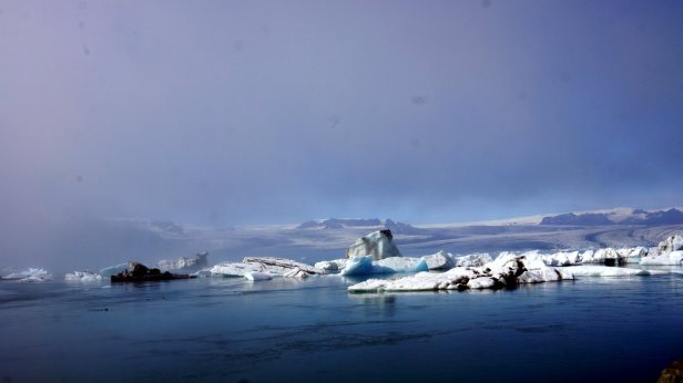
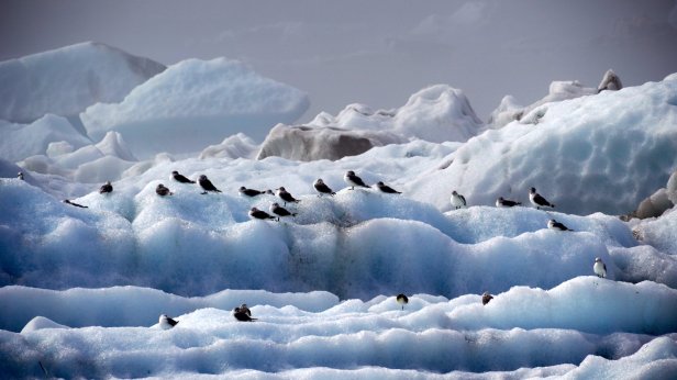
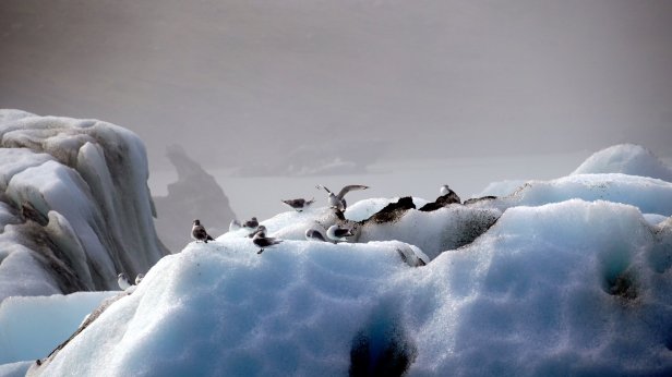
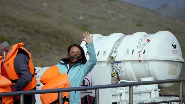
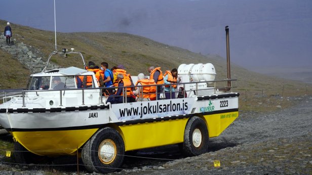
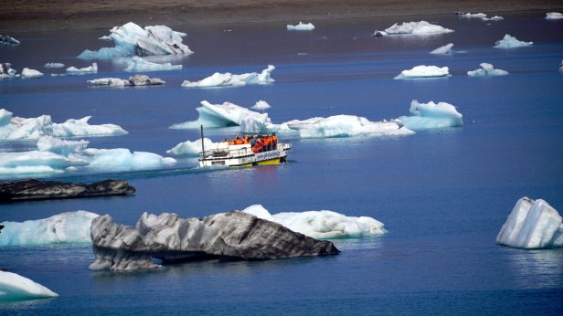
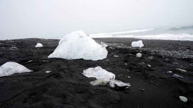
Before leaving the campsite (Day 26) we did a walk towards the glacier. Later on we made 2 stops at different glacier lagoons. These waters are just in front of the glacier tongue and large blocks of ice are floating in them. Jamaliah made a boat tour on one of these lagoons. At one point, the lake flows into the sea and takes the smaller iceblocks with it. These break up in the sea and get washed ashore and glistered like diamonds on the beach. The night was spent at a small campsite, Stokksnes, which is on a peninsula sticking into the Atlantic ocean. This is the site of a NATO radar station from WW2. That is now gone but there is a film set of a Viking village. They were busy doing some filming so we were not able to visit it. Although most of the day was very sunny, there were low clouds of mist flowing from the sea into the land. Unfortunately the campsite is in the middle of one of these clouds so it is cold and damp. One good thing though, they have good Wi-Fi. Since this place is not on the Ring Road, we thought there will be not many people around. But unfortunately, it was not so. More travellers (with campers and tents) came so the site filled up before sunset.


Good pictures of many, for Lisz and me, familiar sites. This evokes good memories. You were very lucky to see the vulcanic activity some days ago. Enjoy the last days of your holliday.
LikeLike
Prachtige foto’s!!!
LikeLike