The campsite tonight is much better than yesterday in Fairbanks. That was at a petrol station in Fox just outside of the city. We parked next to a large motor-home that looked empty. However at 23:00 hrs the generator switched on till 1:00 hrs. It was an irritating noise. We had just gone to bed and I did not want to get up and climb down to move the camper to another spot. Was it an automatic system? At 4:30am it switched on again for an hour this time. I was waiting for it to come on again but when I looked out of the window at 08:00 hrs the camper had gone. So the ghost camper was actually occupied.
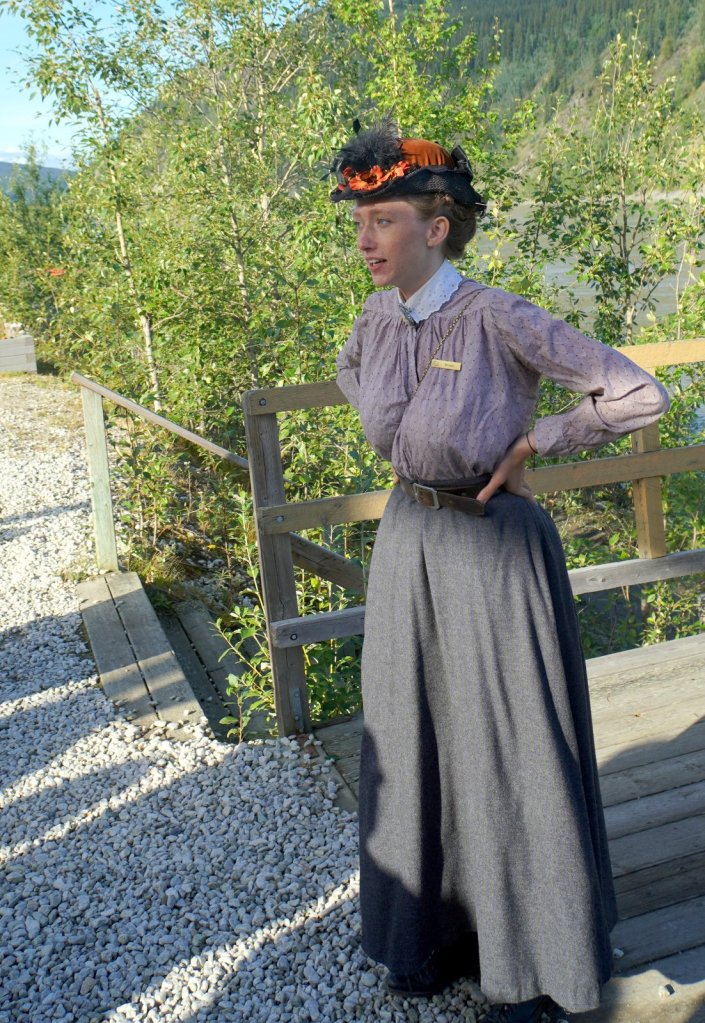
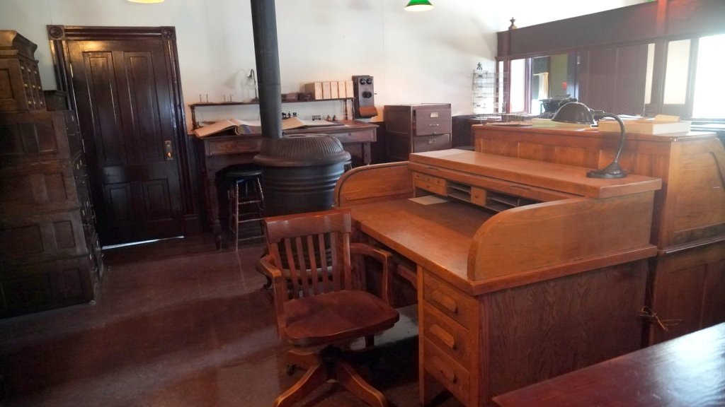
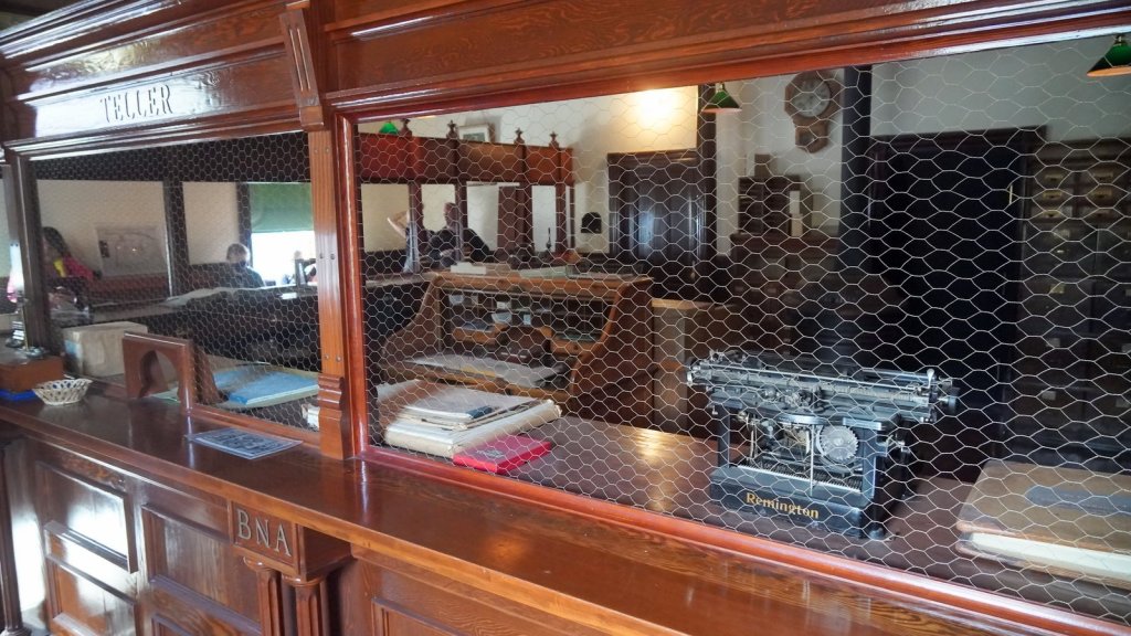
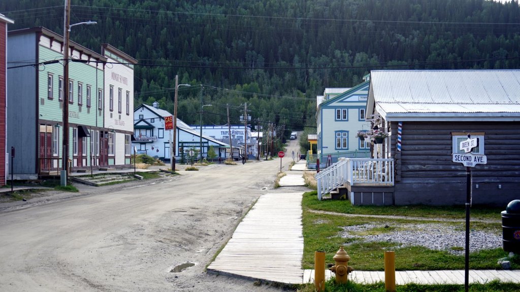
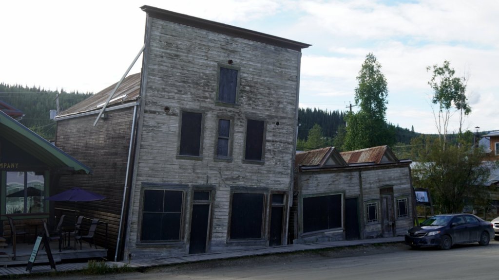
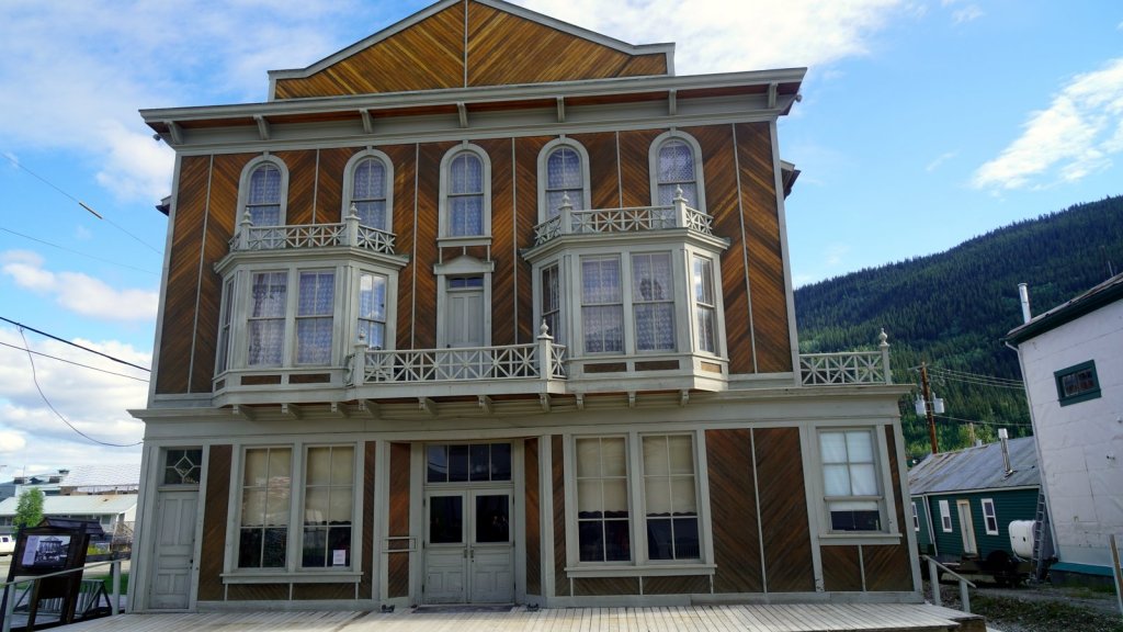
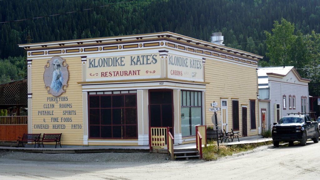
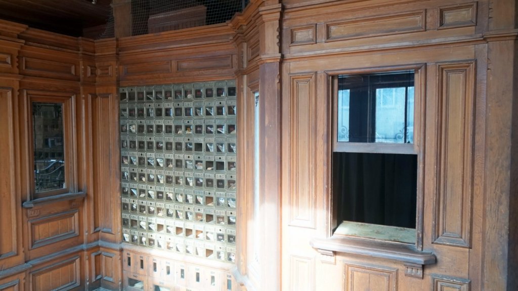
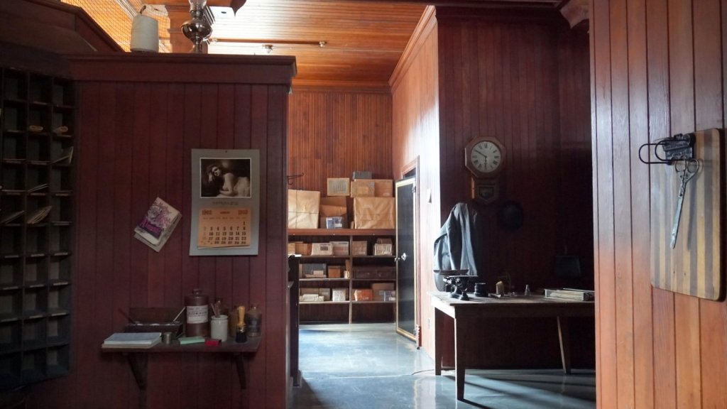
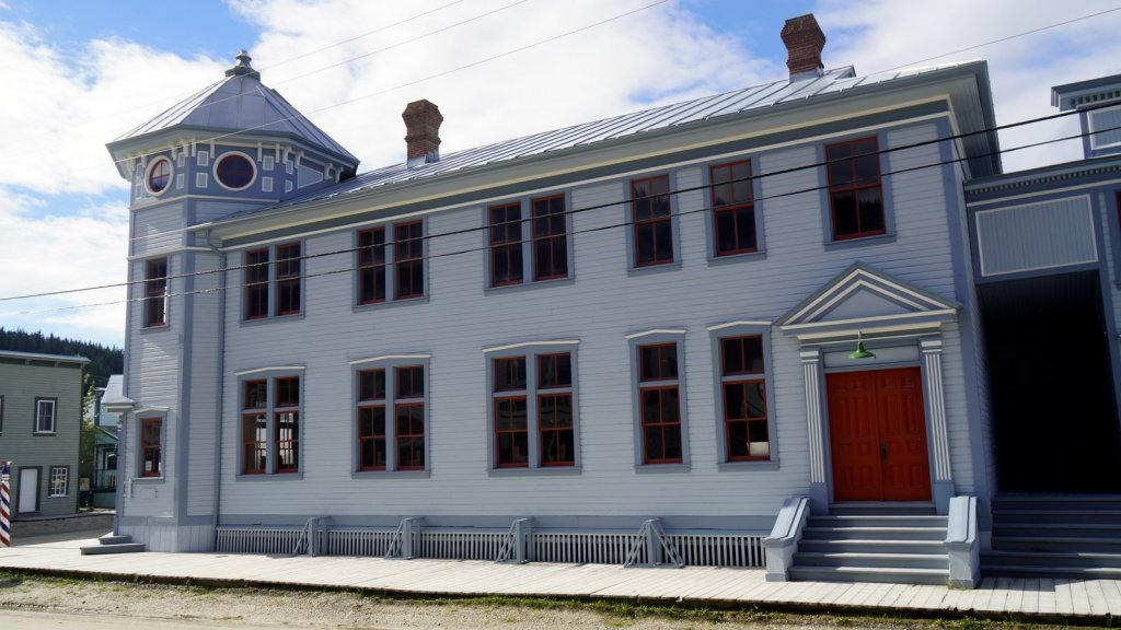
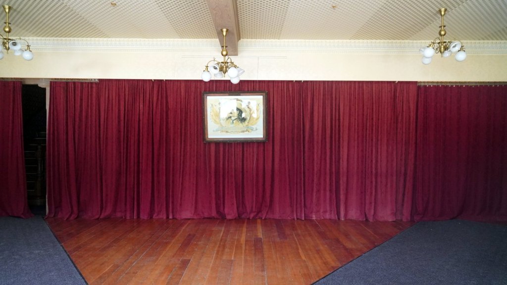
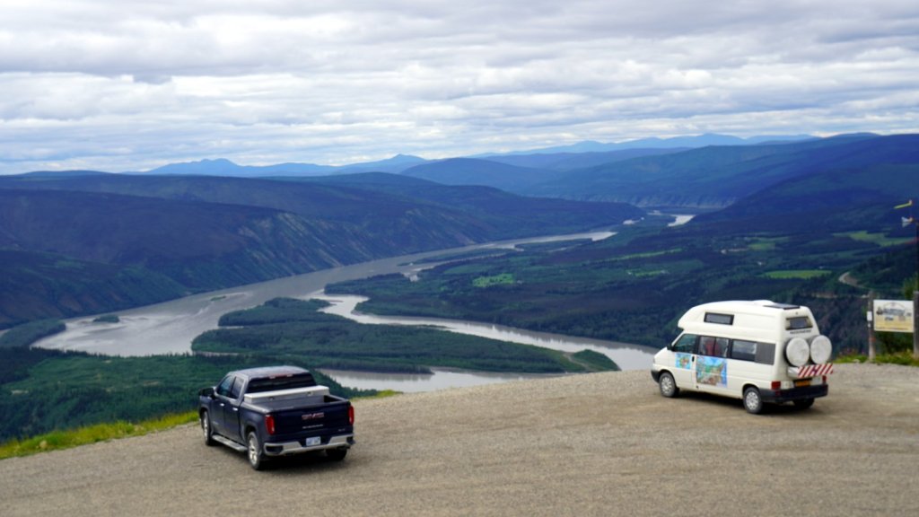
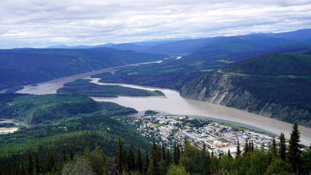
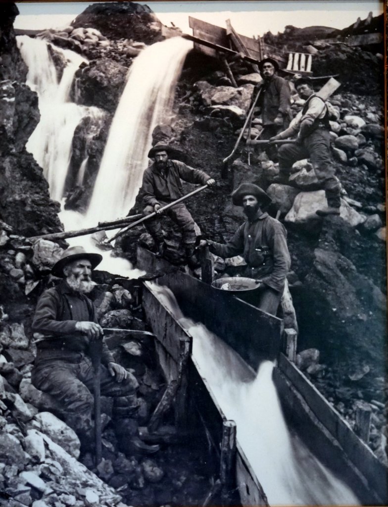
Before leaving Dawson City in Yukon Canada, we took a city walking tour. The guide explained the development of the town during and after the gold rush of 1898. She also took us into some of the historical buildings. The ones we entered (the city saloon, a bank and the post office) are all empty and owned by National Park. They are too poorly insulated to be used for another function. This is also valid for the Palace Theatre which is only open in the summer. During the winter, the town is in hibernation with only some 1000 residents. After uploading the blog from the tourist office and after Jamaliah finished groceries shopping, we drove up an 850 m high mountain behind the town. The sight of the town below at the junction of the Klondike river and the Yukon is perfect. Just like the historical pictures.
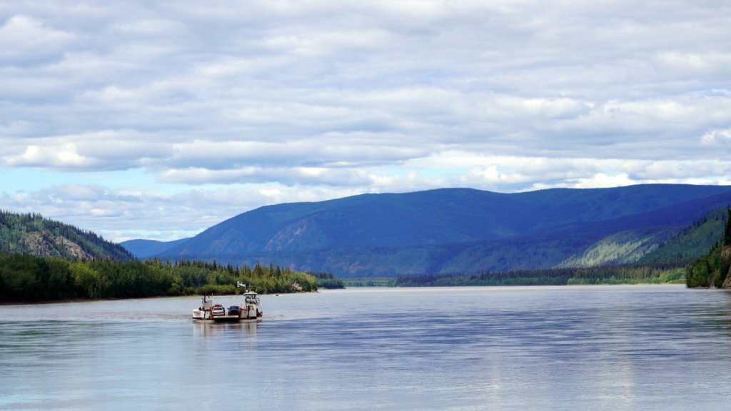
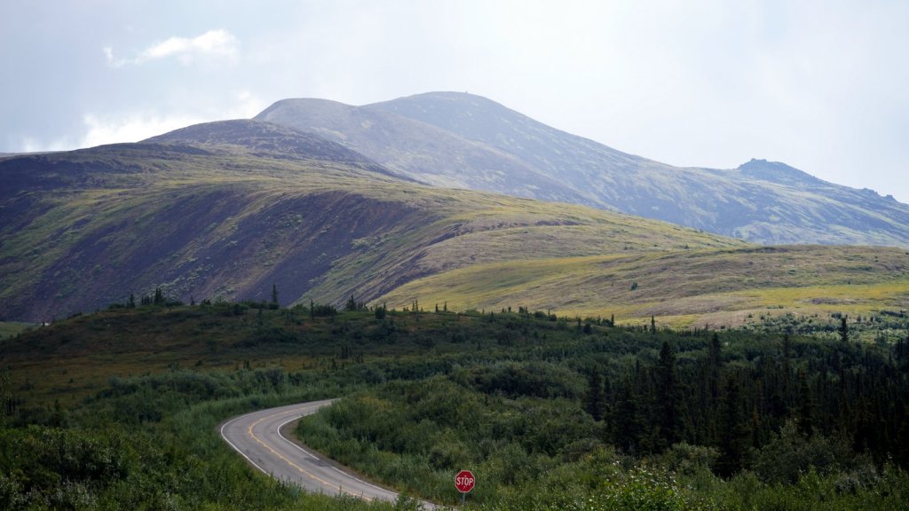
In the afternoon, we crossed the Yukon river by ferry (again free service) and slowly climbed out of the valley (350 m) to the Top of the world highway (800 m). The road to the USA border is partially paved and a pleasure to drive. It goes over the forested hill tops. After a steep climb, the US/Canadian border is at the top of one of these hill. The formalities were minimal. On the US side we drove the first 20 km over a paved road and then a well maintained graded road. The stories we read that it is a horrible road are exaggerated. We camped at a cleared area along the river before the town of Chicken.
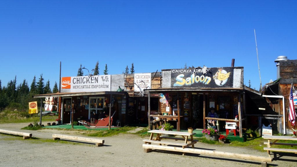
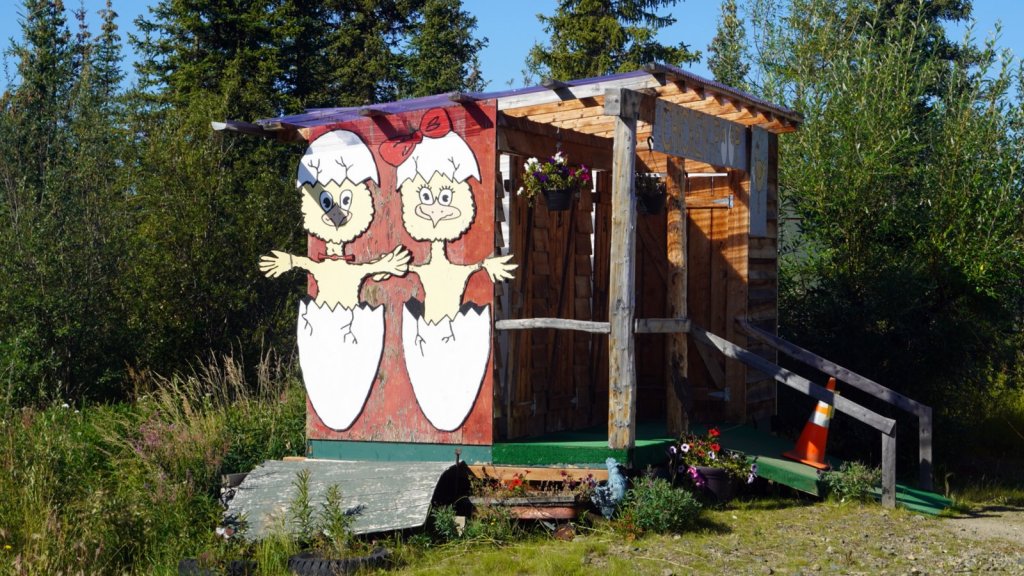
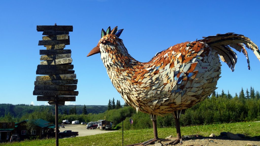
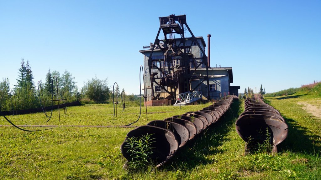
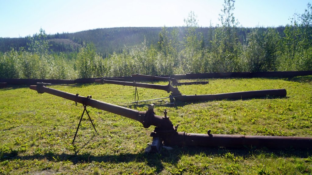
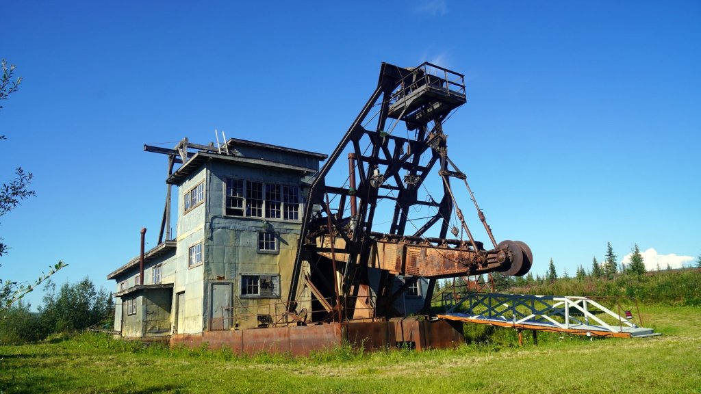
Chicken was a gold mining camp. There is still a large dredger which was used from 1959 to 1967 on display. Around the dredger are some tourist shops and a large RV camp site. At one of the shops we had a delicious chicken pie. The number of large RV trailers pulling a car had increased significantly. This mode of camping is favoured by many retired Americans. They sell their house and buy a large motor home to travel around North America. They make sure they are in the south during the winter.
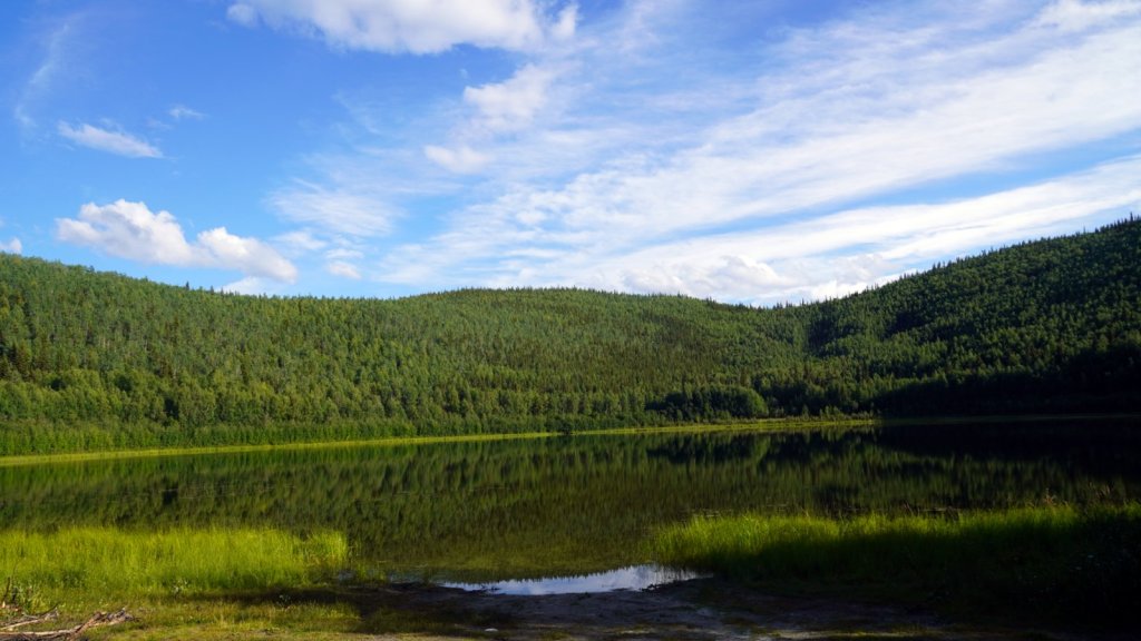
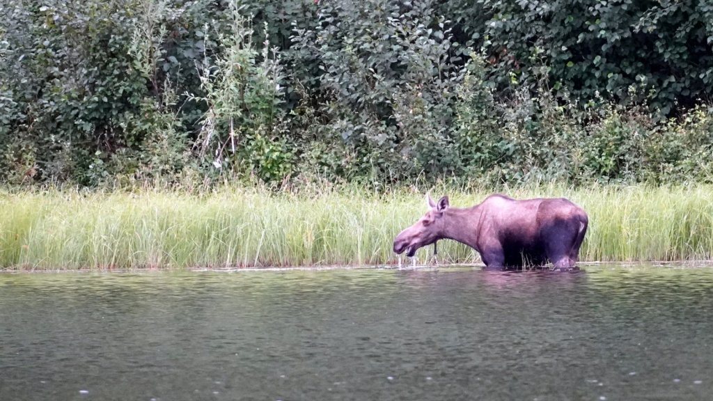
The road through the hills continues up and down till you reach the Alaska Canadian highway at Tok. This is a long stretched roadside town catering for the many tourist driving over the AlCan highway. We had a well deserved shower while our dirty laundry was tumbling in the washing machine and dryer. We also stopped at the Visitor centre to get more information about the Dalton Highway (road to Prudhoe Bay). After 2 hours, we drove on in the direction of Fairbanks. On the west side of the road you could see the high mountains of the Alaska Range. We found again a nice off the road secluded camp spot at a small lake. To keep the mosquitoes away we lit a fire (only our 3rd on this trip). On the other side of the lake a moose was grazing in the water. Again the light was too poor to take a decent picture. In the morning she was a bit closer-by but still too far away to get clear picture.
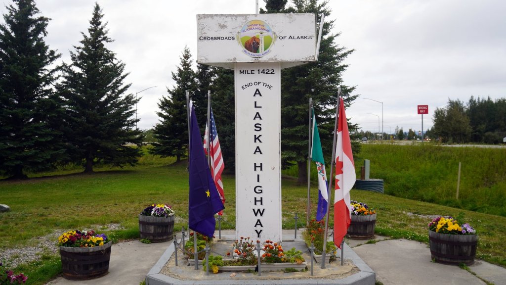
The drive further north is smooth. The highway does suffer from the melting of the permafrost at some points. This results in sinking of the road so it is sometimes a bit of a roller coaster ride. The 1488 km AlCan highway was built in record time in 1942. It was a military project so that material could be brought quickly up to Alaska from the states. Along the way we stopped at the historical monument celebrating the completion.
It rained most of the afternoon when we arrived in Fairbanks. The first stop was at Jiffy lube to get an oil change and then shopped for supplies for the trip further north. At Walmart there were quite a few RV’s parked in a designated area. Rudy did not want to overnight there and suggested to find a place just outside town on the road North. As mentioned at the beginning, that was not such a success.
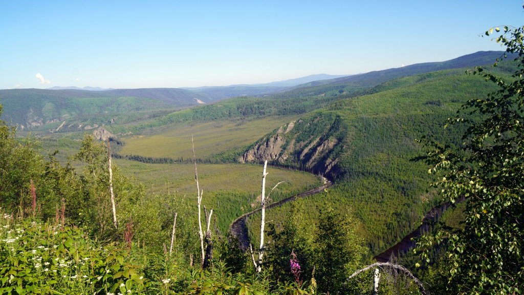
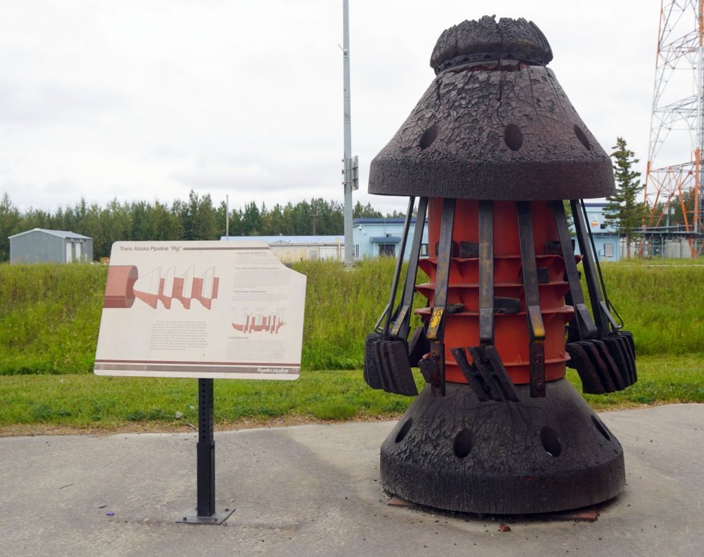
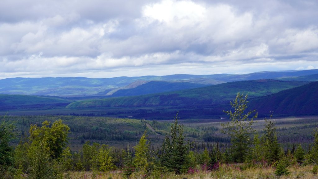
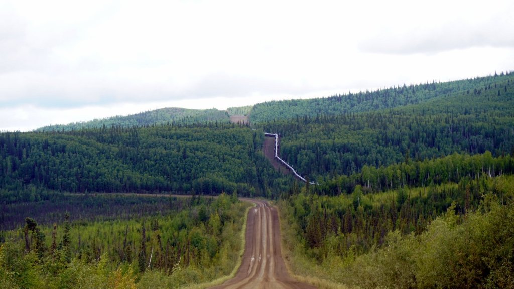
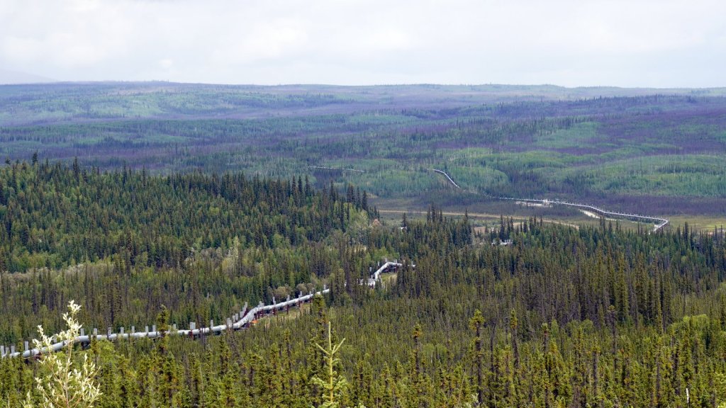
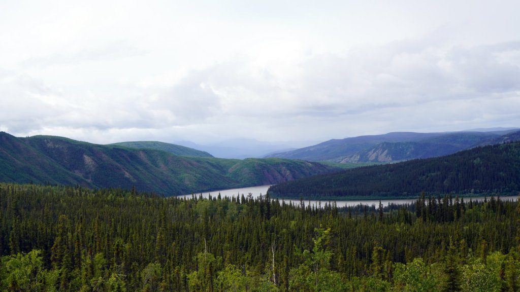
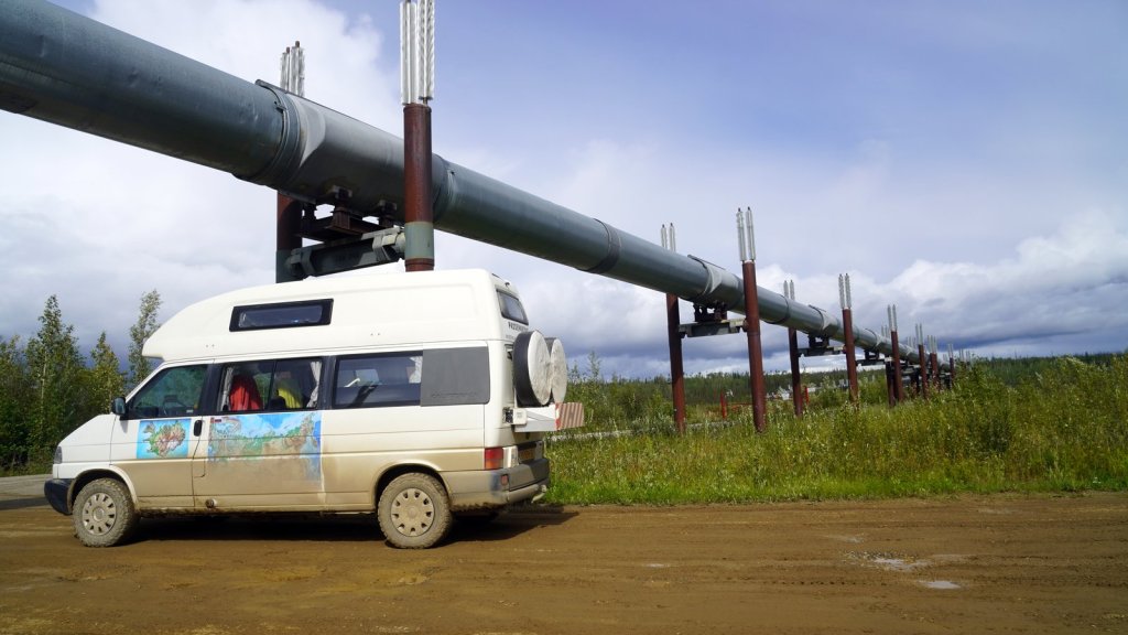
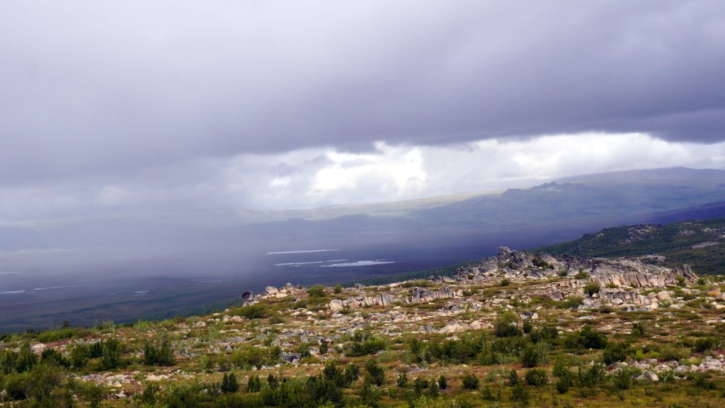
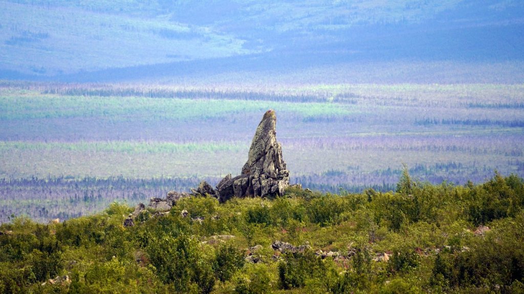
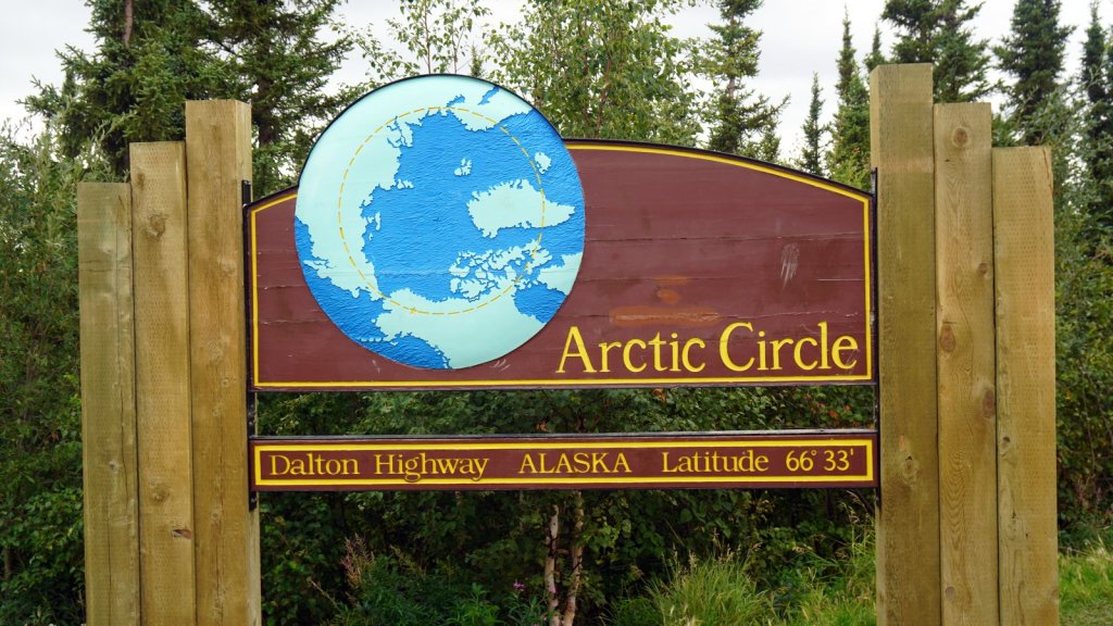
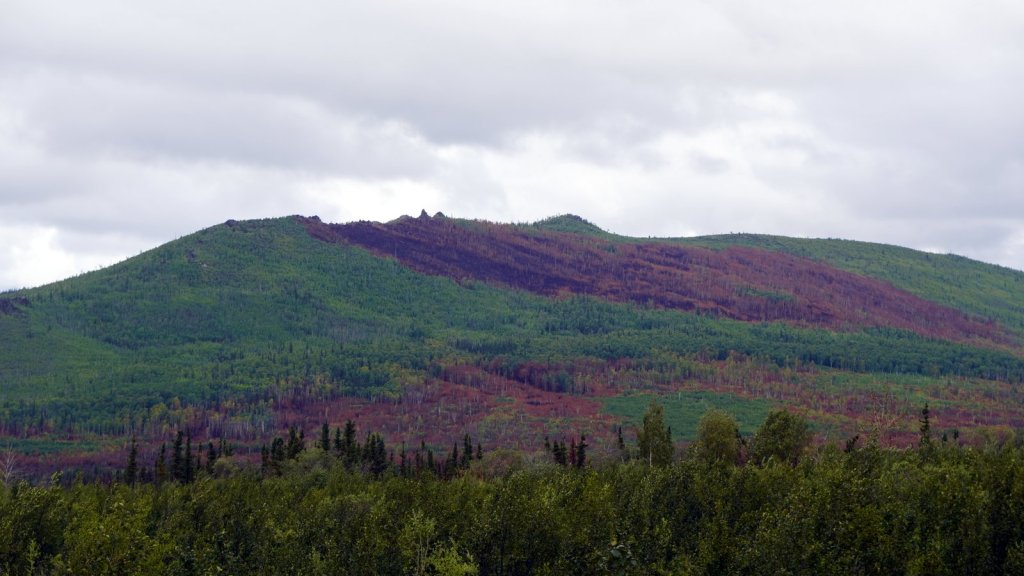
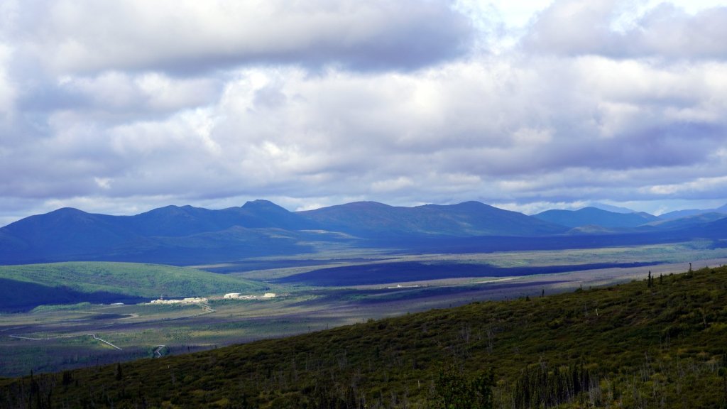
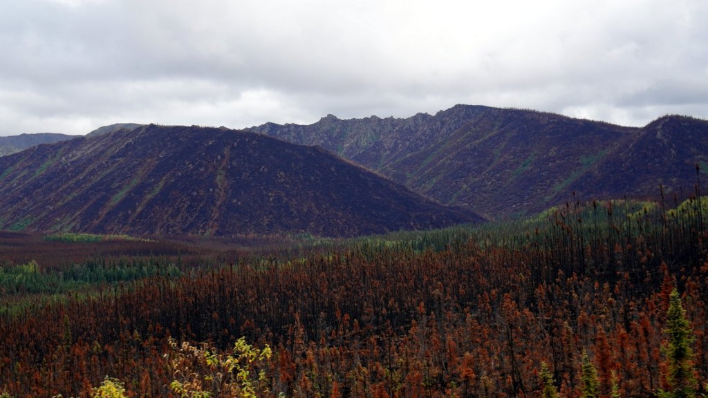
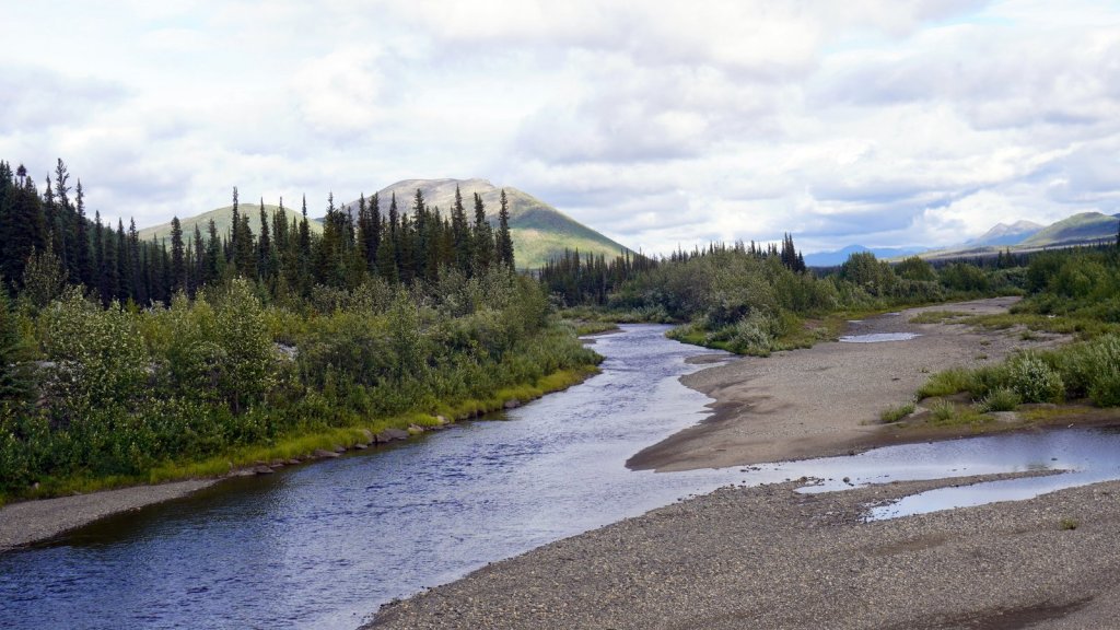
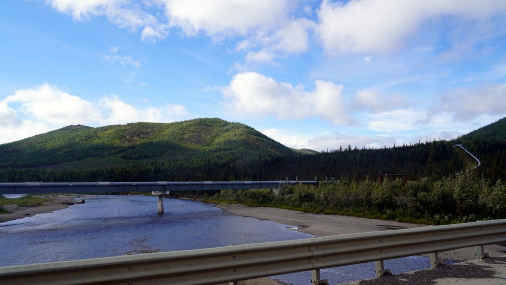
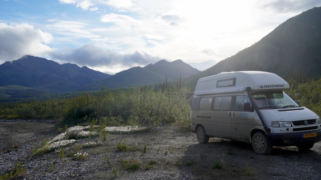
We drove some 420 km north mostly over the Dalton highway towards Prudhoe bay. The road is graded but at some areas there are long stretches of tarmac. The road was built to enable the construction of the 26”crude oil pipeline which runs from Prudhoe bay all the way to Valdez. All along the way you can see the pipeline resting on large steel frames snaking through the landscape next to the road. Since it was raining part of the way, the car is covered again in mud. The hills rise and fall from 150 m to 600 m. They are covered with trees. In some places you see the effects of the recent forest fires. In fact part of the road was only opened up some 5 days ago because of fire. While on the Dempster highway in Canada you drive the first stretch through mountains and over a pass of 1300 m, here you only come into the more interesting mountains area’s at the Brooks range. This is then 400 km from Fairbanks. We are now camping next to a wide fast flowing braided river at the start of this mountain range. We had planned only to drive half of this road. But now that the interesting part starts, we will have to do more than that. Moreover, over some 250 km further North there should be a herd of muskoxen grazing along the road. We cannot miss that.