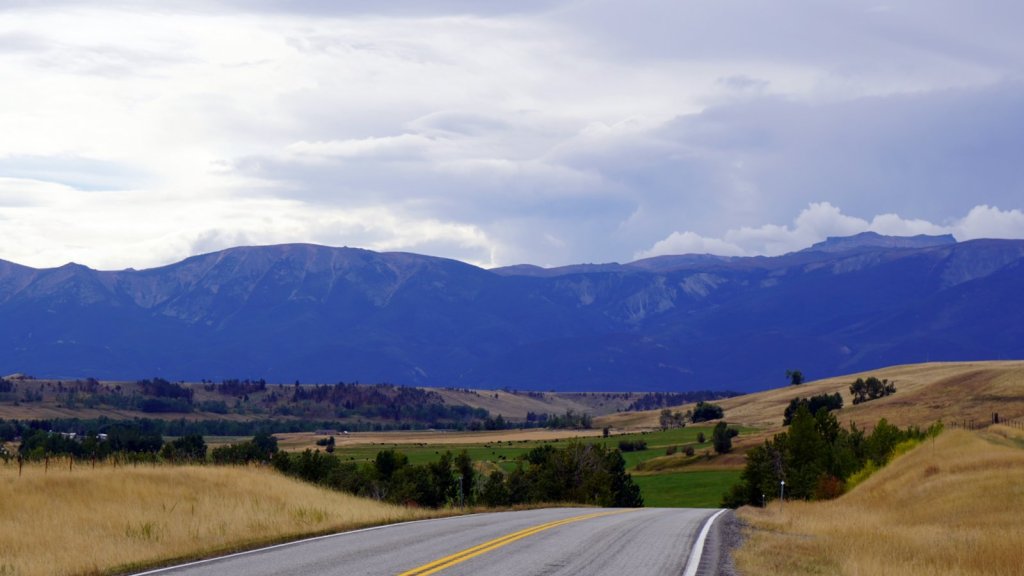
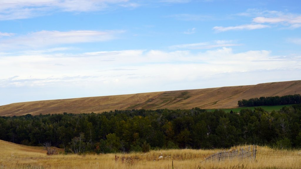
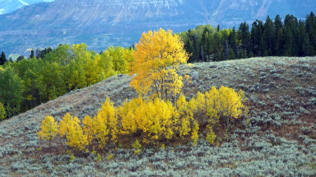
The road to Helena went though the state forest. It was relatively busy with commuters going to work and now and then a logging truck. You climb out of the forested hills over the MacDonald pass (1970 m) to Helena which just lies on the other side of the continental divide. Here it is much drier and traditional prairie land. Here and there the land is irrigated with large walking sprinkler systems to grow grass, wheat or corn. In Helena we dropped into Burger king since Rudy was desperate for a decent piece of meat. The oversized hamburger was however too much even for him. At Wal-Mart we stocked up on groceries for the next couple of days in Yellowstone NP. There are not much camping places in the open prairies. We settled for a provincial campground at the Missouri Headwaters. Here 3 different rivers come together to continue as the Missouri river which later flows into the Mississippi river and then down to the Gulf of Mexico. The area was explored by the well known Lewis and Clark expedition of 1807 to find the source of the river and then make it over the mountains to the Pacific ocean. With the help of the local Indians they made it across.
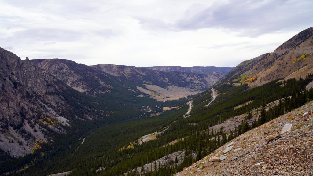
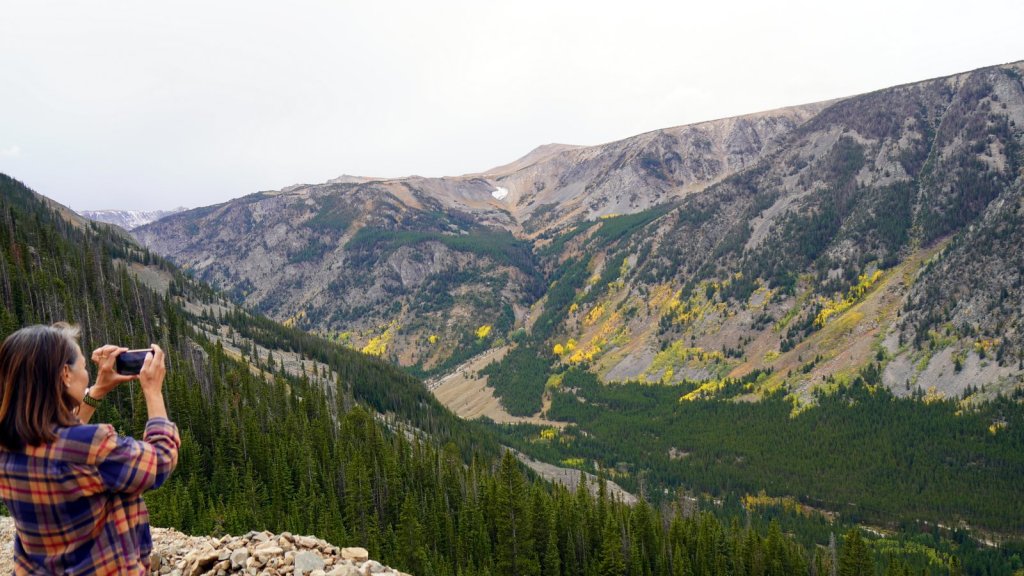
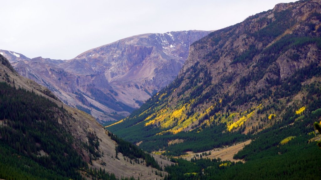
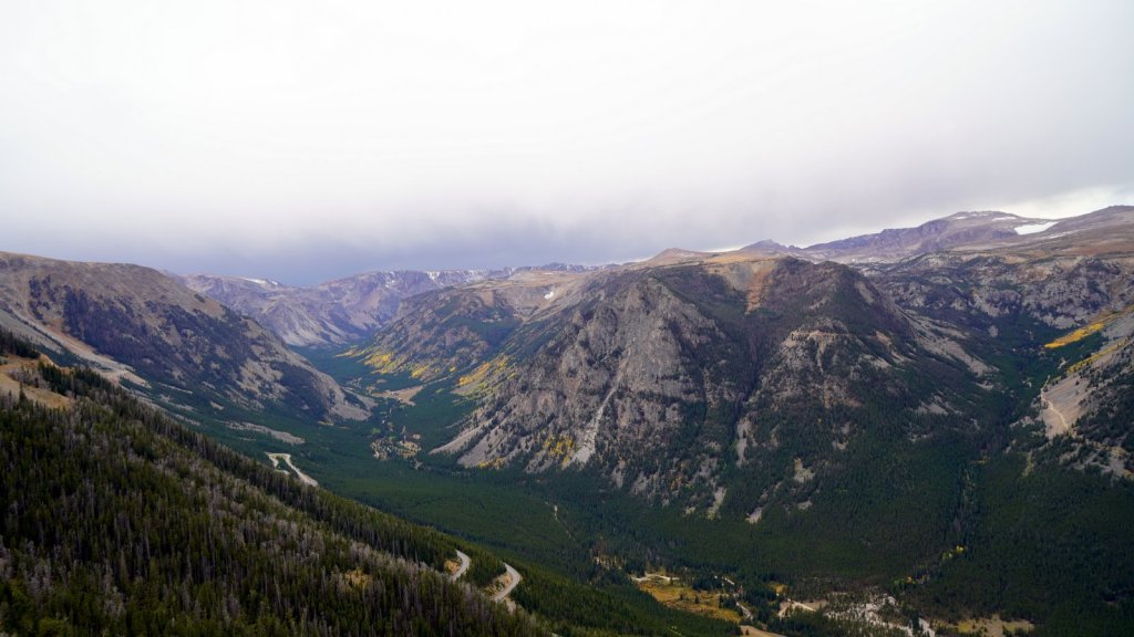
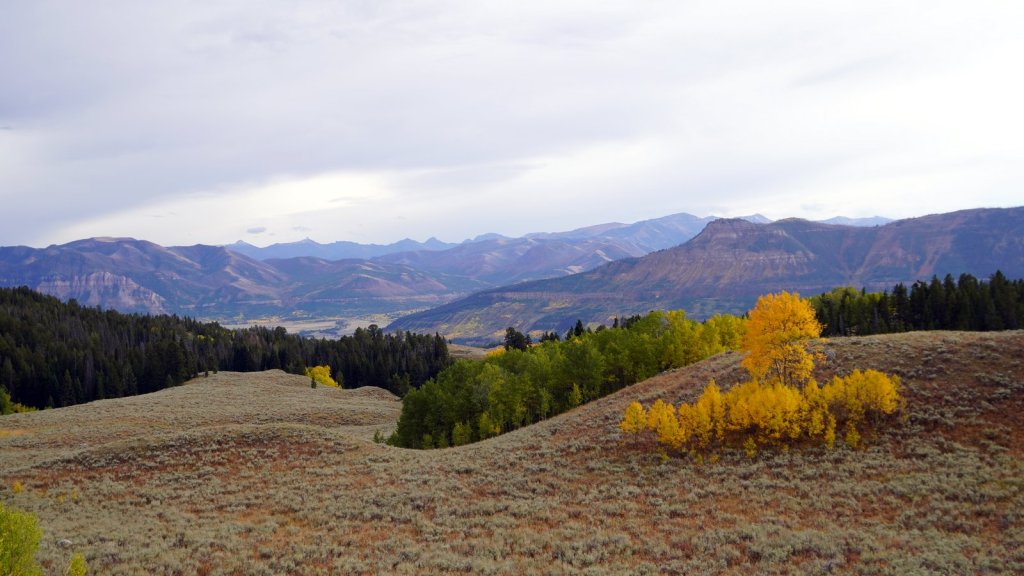
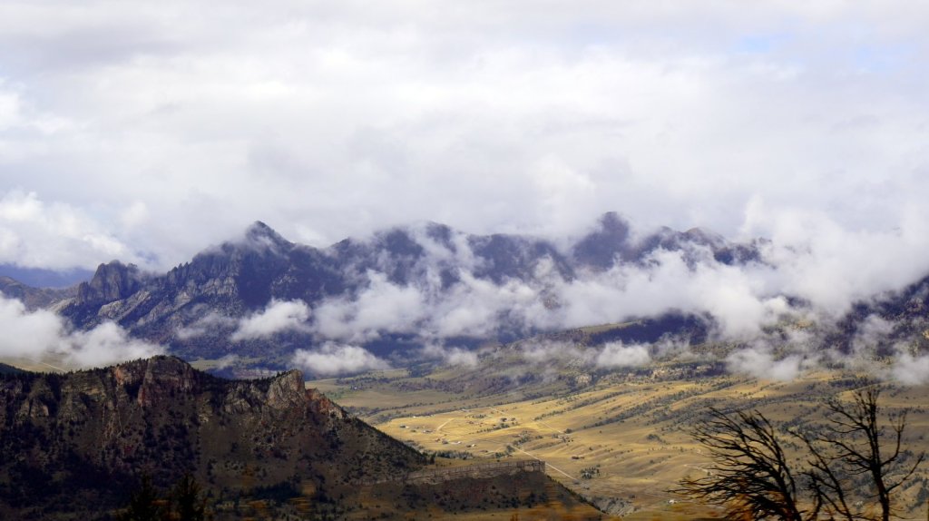
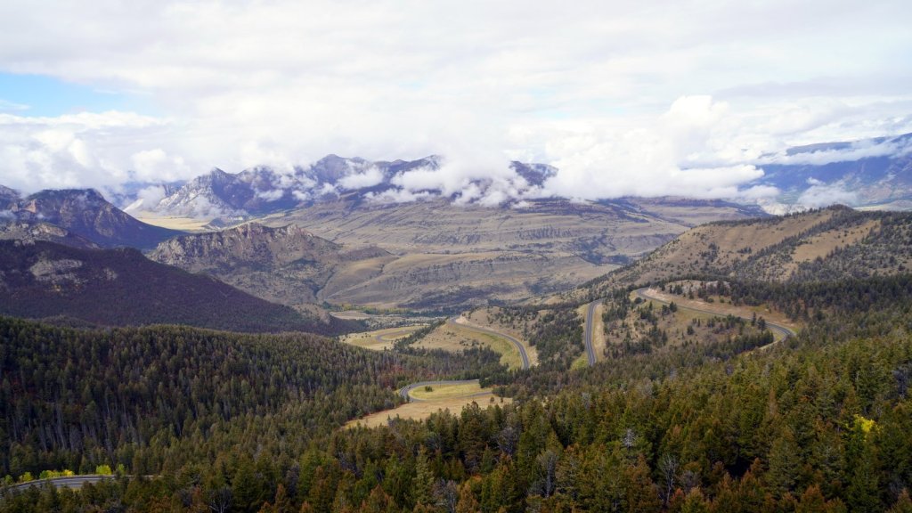
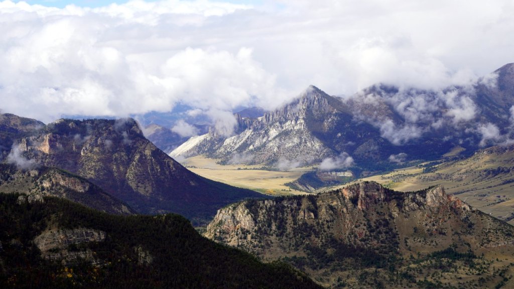
We followed Hwy 90 going east. This highway is the northern most Interstate across the US going from Boston to Seattle. It is busy and full of large trucks. Where there is a climbing section there is fortunately an overtake lane since our small 100 Hp engine has trouble getting up some of the steeper slopes. Based on recommendations from other travellers we met along the way, we turned off the highway at Columbus to go south to Red Lodge. This town is an accommodation town for visitors entering Yellowstone from the North east. However this entrance is closed because the road was washed out during a huge flood in June. The town itself had also some damage. After Red Lodge the Beartooth highway starts. This is a very scenic road climbing up the mountains towards Beartooth pass at 3338 m. From many point along the road you can look back down the valley and see how the road snakes up the mountain. On the other side of the pass you first stay a while above the 3000 m. The area is windswept and cold. No trees grow here. After a while you start to descend towards the closed (Northeast) park entrance. We found a secluded campsite at 2300 m on the Crazy creek with a view of Beartooth mountain.
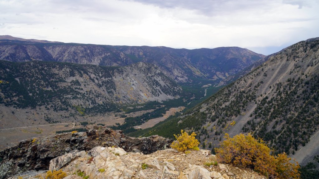
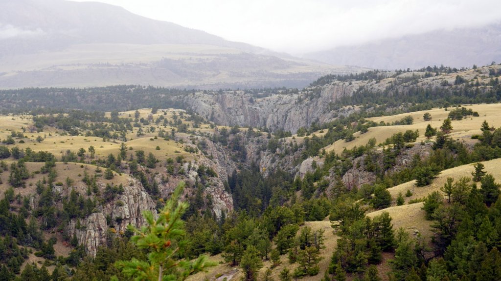
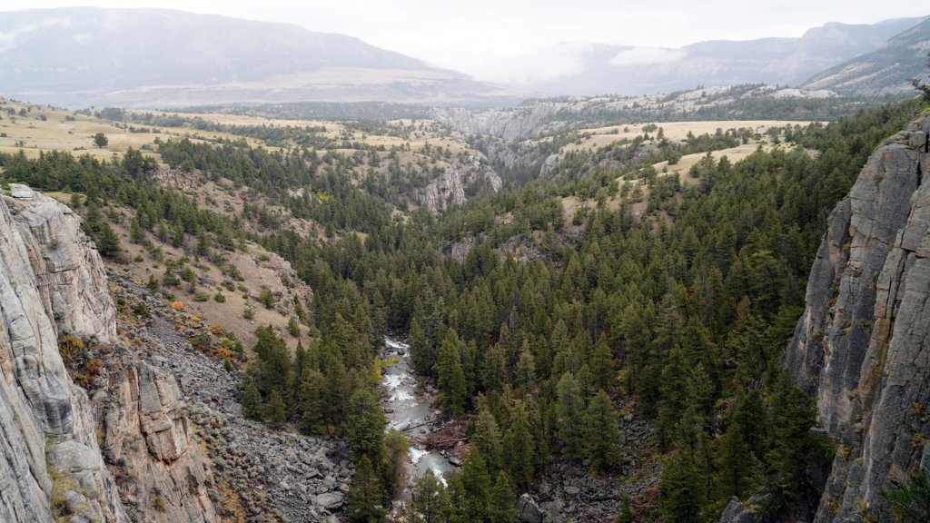
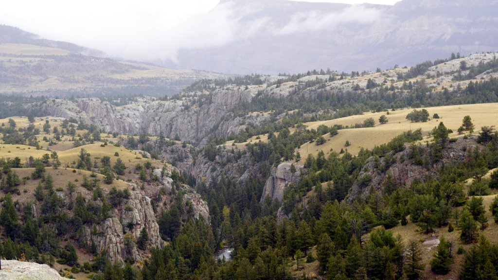
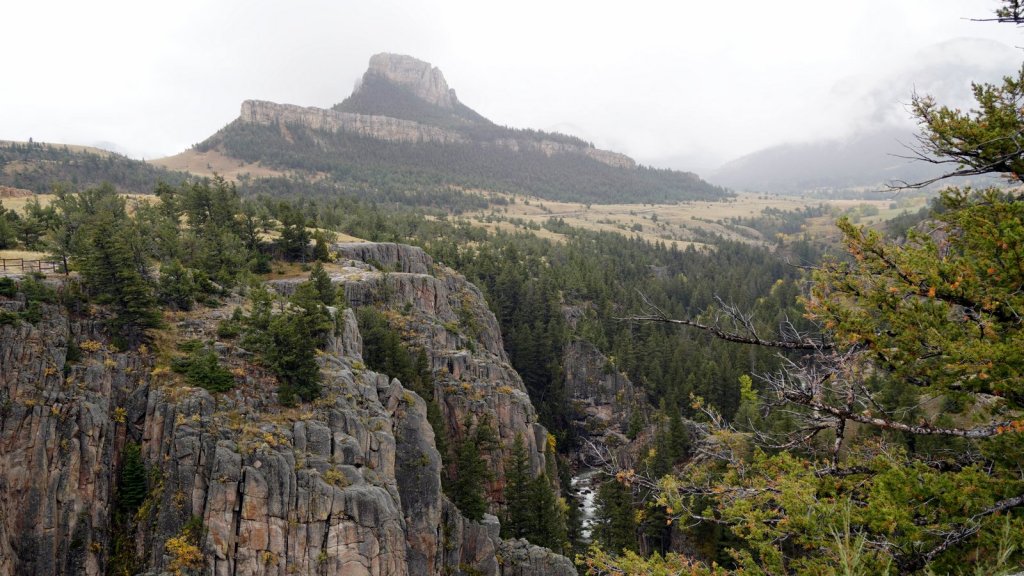
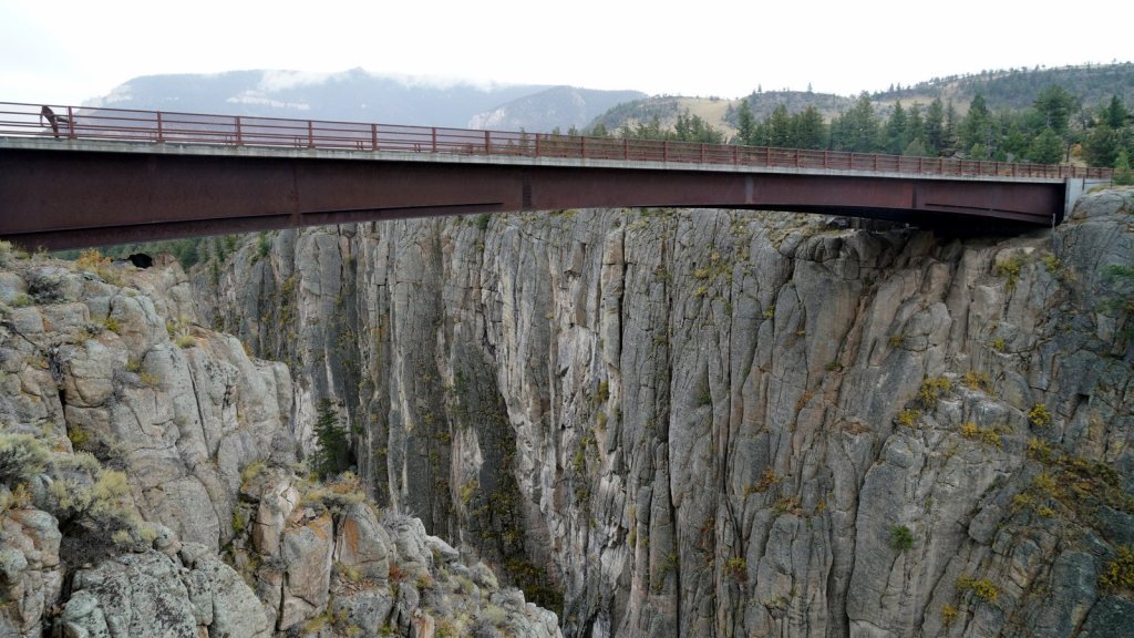
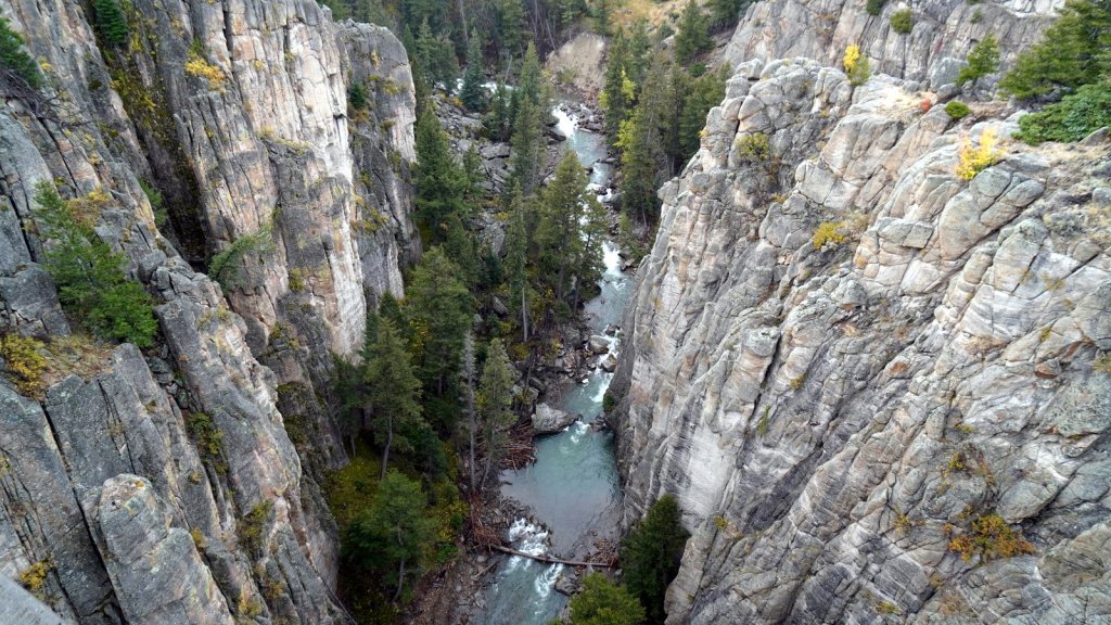
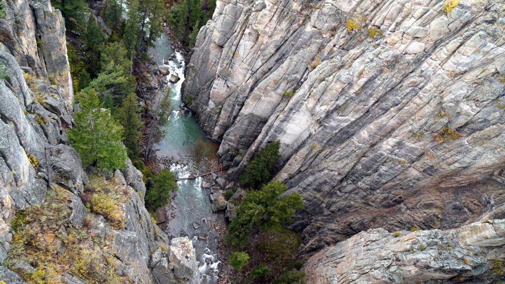
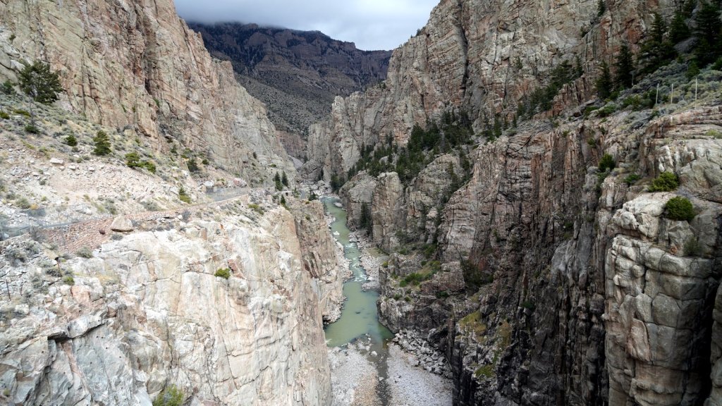
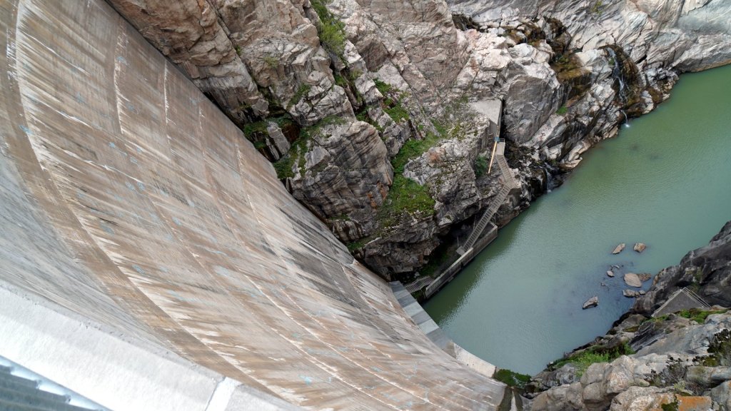
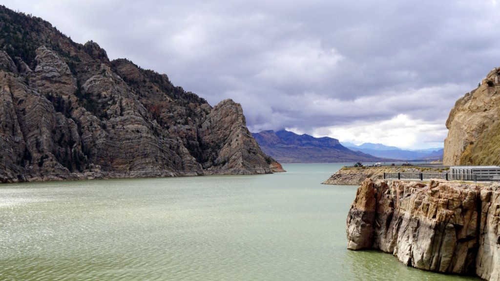
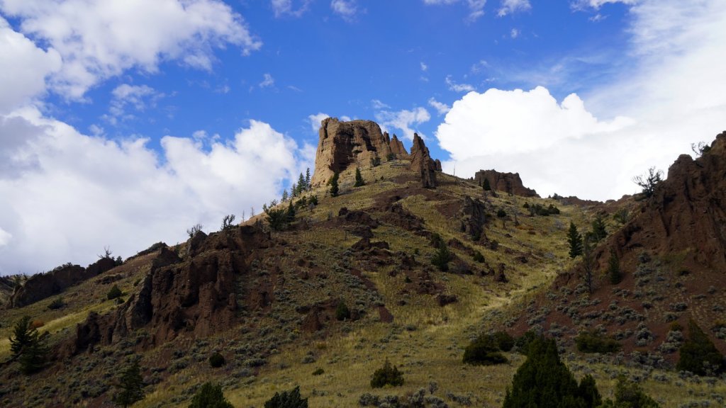
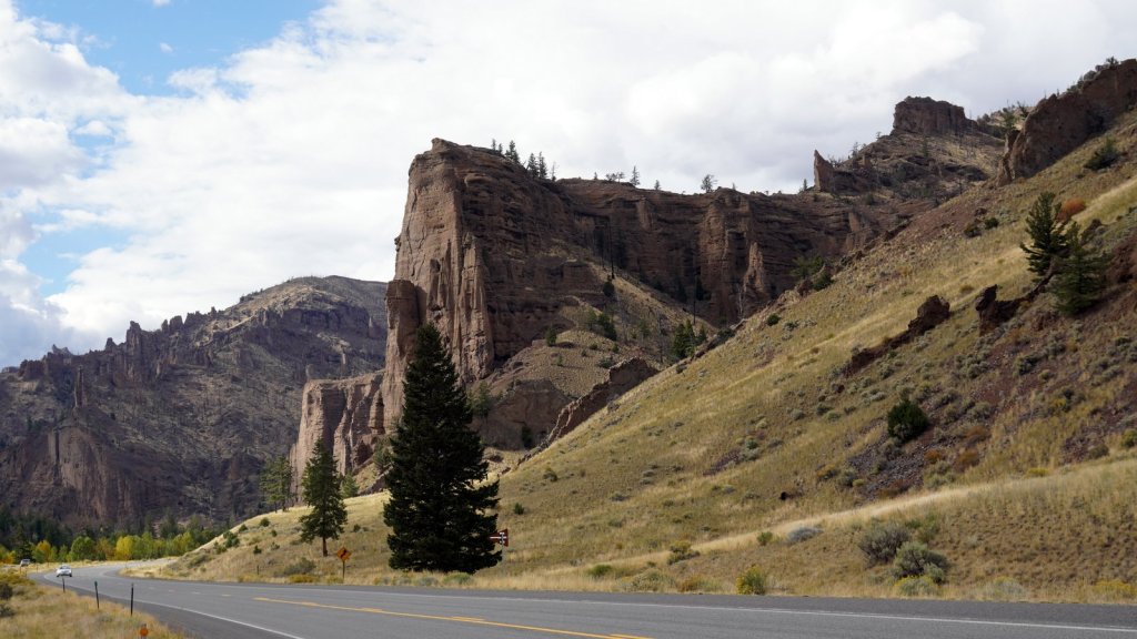
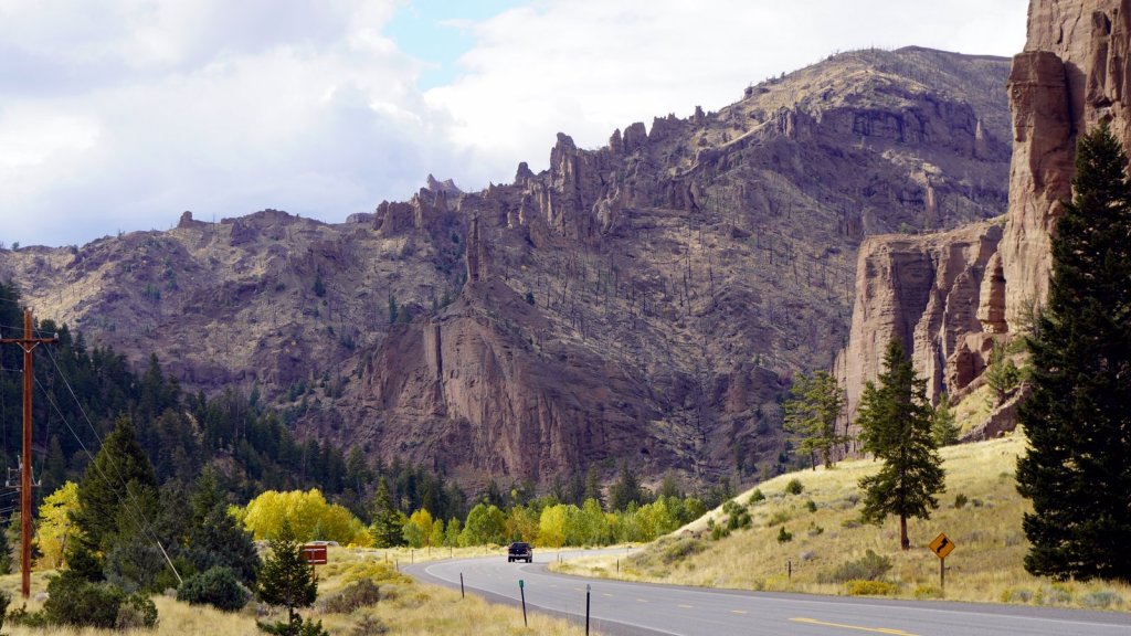
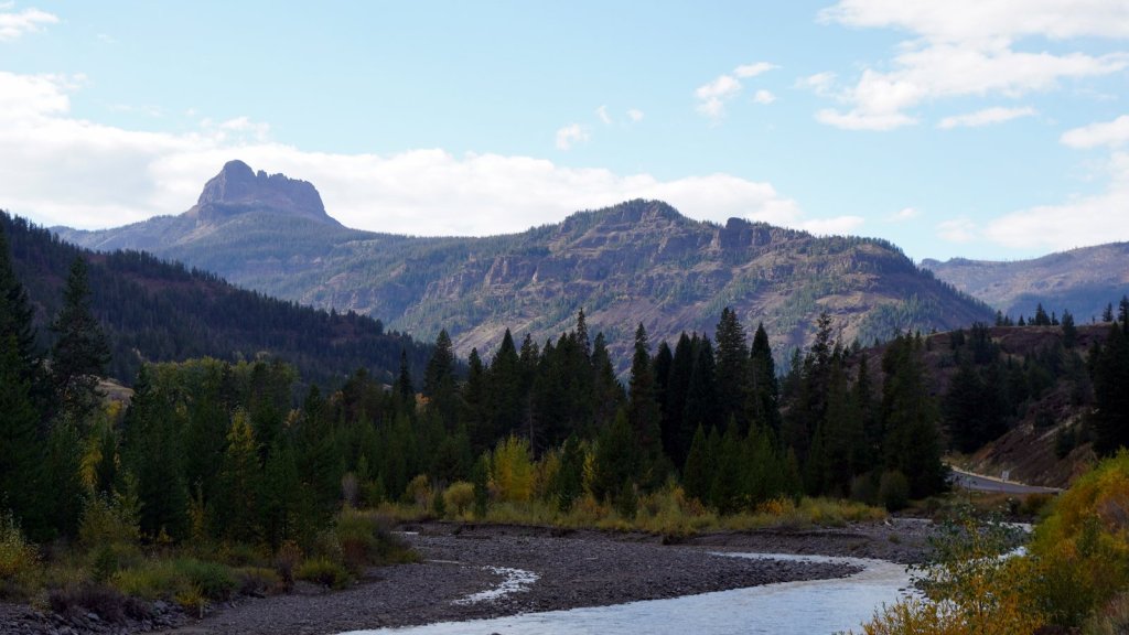
The following day we took the Chief Joseph highway towards Cody. It was a cold and wet day. It had rain last night. This section of the road crosses one of several Yellowstone river gorges going down towards Cody. Another great scenic road with lots of switchbacks. After a Taco lunch in Cody, we drove towards the east entrance of Yellowstone NP. Just outside town a dam was built in a narrow section of the Shoshone river gorge to create a water reservoir for irrigation of the land as well as to generate electrical power. At this time (1910) it was the highest dam in the world (>100m). We drove over the Sylvan pass (2675m) into the Yellowstone caldera with its large lake in the centre. To celebrate Jamaliah’s birthday we spent the night in the Lake Yellowstone Colonial Hotel.


Dag Ruud en Jamaliah, Op de eerste plaats feliciteren we jou Jamaliah met je verjaardag! Het was zeker wel fijn om een keer in een hotel te slapen. Wat een prachtige foto’s van het adembenemende landschap. Goede reis verder en geniet van al het moois!Groetjes, Ton en Elly XxxVerzonden vanaf mijn Galaxy
LikeLike