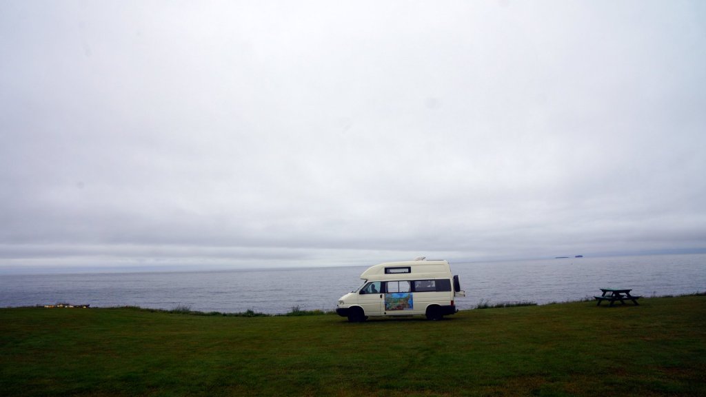
The sea was a lot choppier this stretch of the trip. Jamaliah had trouble sleeping and I also woke up several times. Very rough sea. We had a good (standard) meal on the ferry and a shower in the carbin before sleeping. After breakfast the boat arrived at Seydisfjordur in Iceland. The sea was a lot calmer so the last stretch went smooth. Entering the harbour (in the fjord) you can see many streams coming off the mountain as a result of melting ice. Summer is here. The sun was also shinning so the spirits were high. At the first waterfall along the road out of the fjord we stopped for a picture. No doubt a lot of waterfalls will follow. In the first town of Egilsstadir we retrieved cash at the ATM and did some shopping. Prices were, as expected high. The parking lot was full of tourist campers. Many of them are 4×4 version.
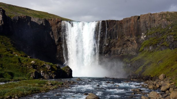
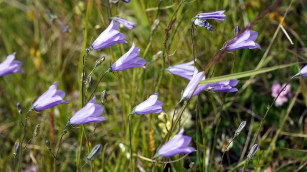
Our first waterfall 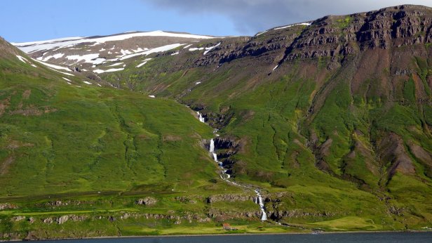
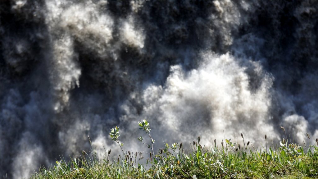
Melting water flowing down into the fjord
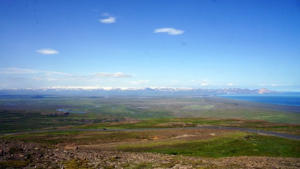
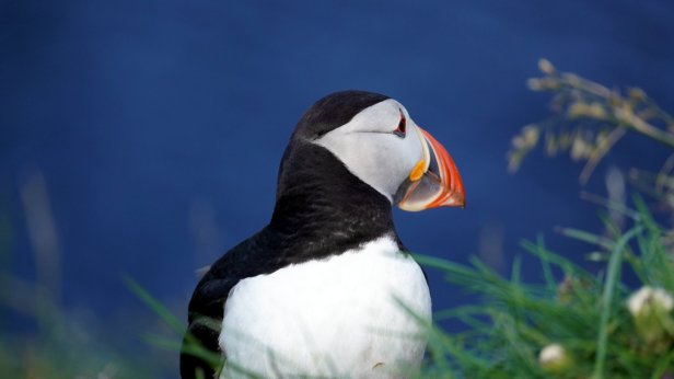
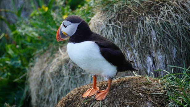
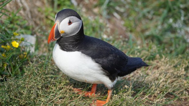
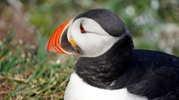
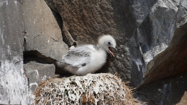
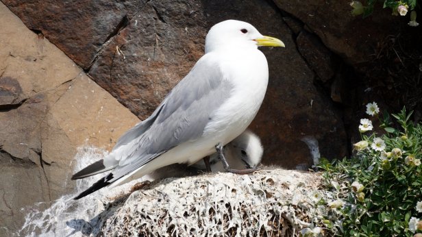
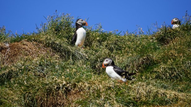
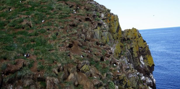
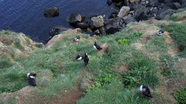
The first planned stop was some 94 km north on the coast at Bakkagerdi. This small village has a campsite (very busy but large enough) and a nearby puffin colony. You could really get close to the birds. The wind was blowing hard but it was sunny and therefore not cold. At the campsite we found one other California Exclusive camper amongst the many normal and 4×4 campers. This bird colony is obviously well known.
View from the campsite 
Puffins on the cliff 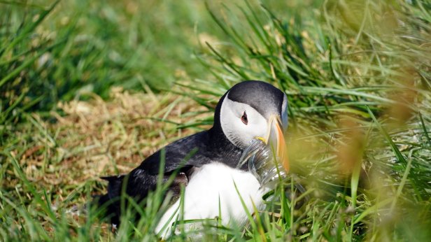
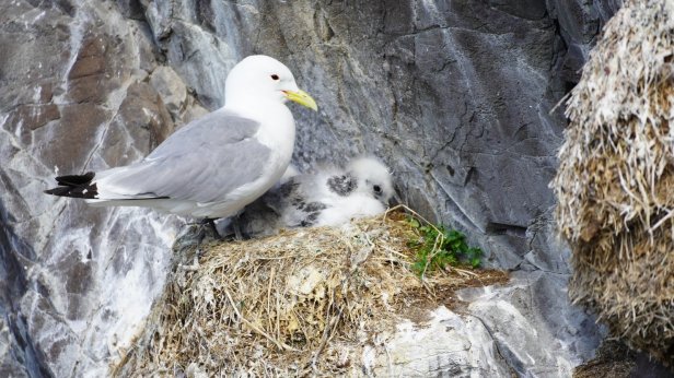
Kikiwake and chicks 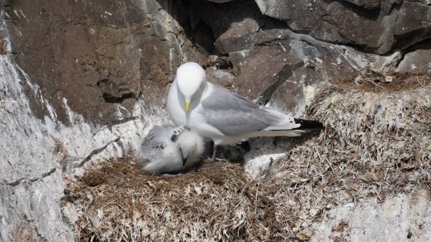
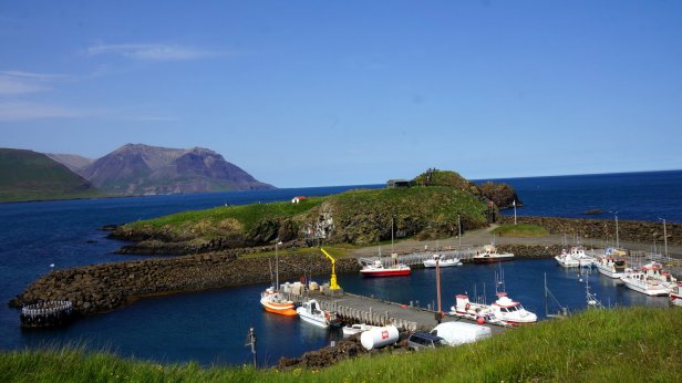
Harbour with “bird rock” 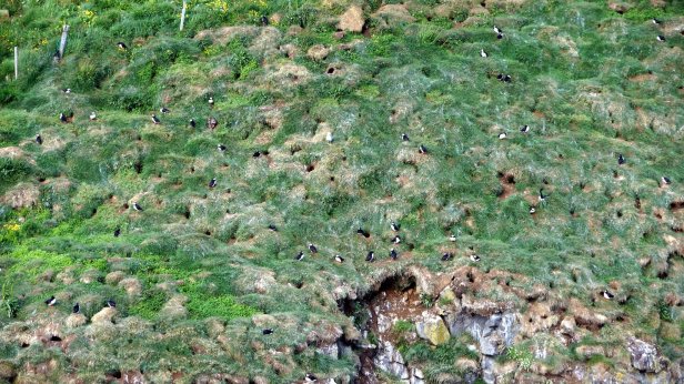
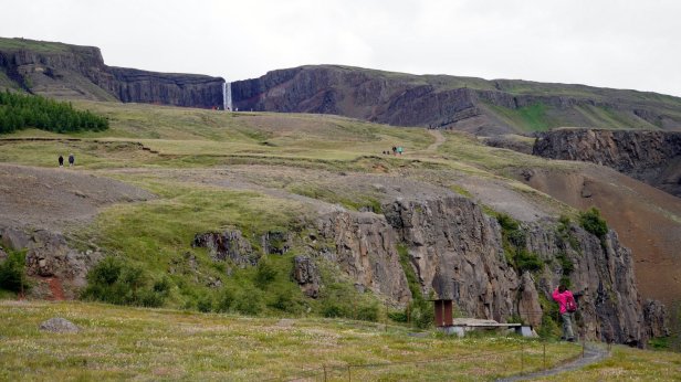
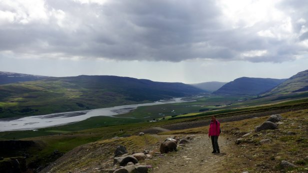
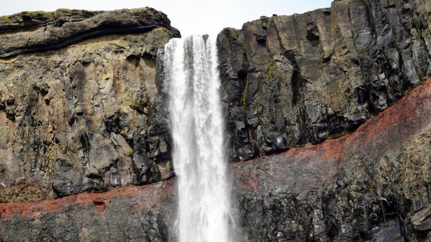
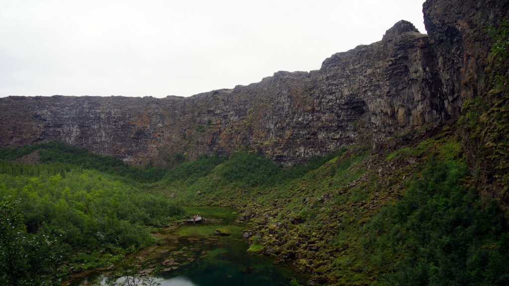
The next day. On the map a campsite is indicated next to a large hydro electric dam. That sounded good. Off the beaten track… However the campsite did not exist. On the way there we made use of the fine tarmaced construction road. First stop, on the long Lagarflot lake where we climbed up to the highest waterfall in Iceland called Hengifoss. The waterfall drops down a basalt cliff of 128 m. On the side you can clearly see the hexagonal pillars typical of slow cooling basalt. The way walking up was very windy but sunny. On the way down we had some rain.
Walk up to Hengifoss 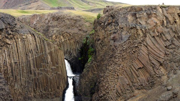
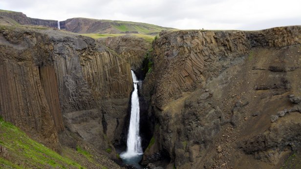
Hengifoss 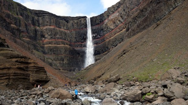

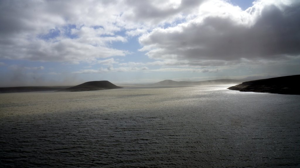
Hydro dam and lake 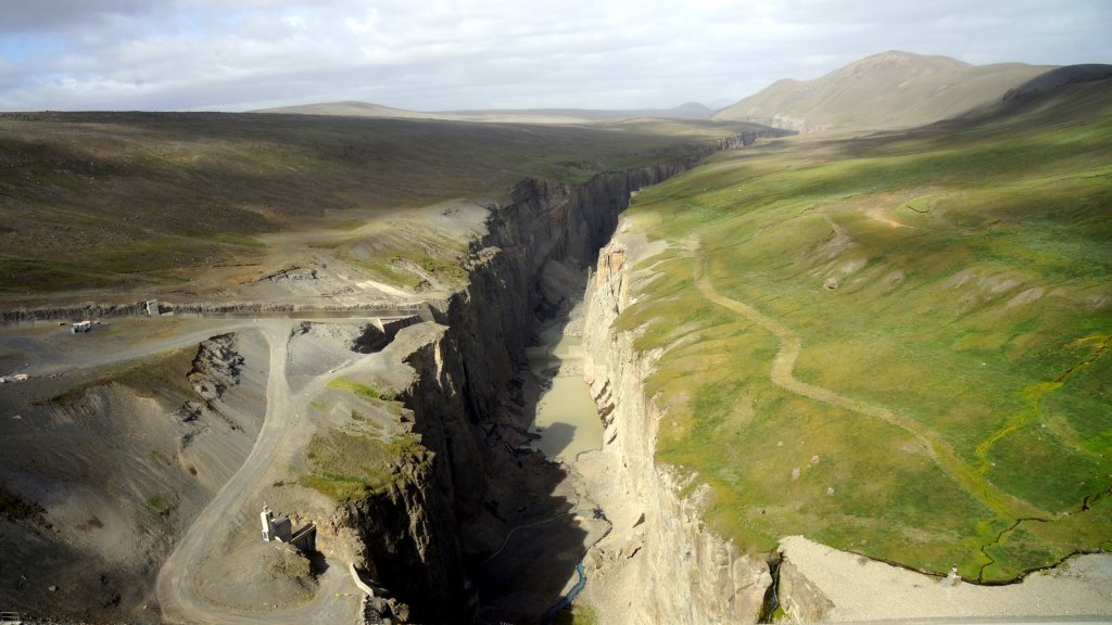
Spill over and origional gorge
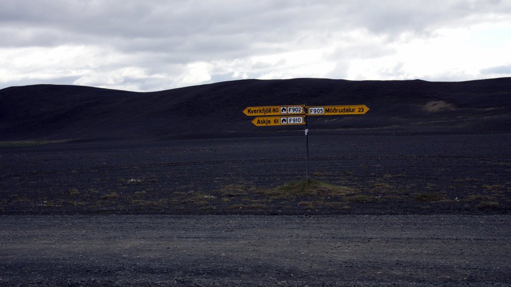
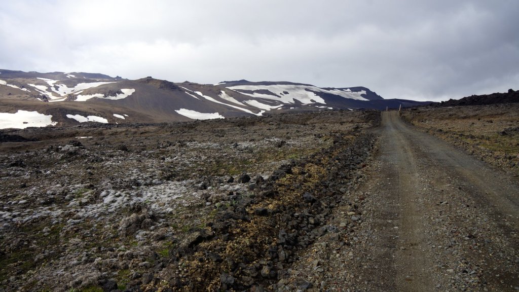
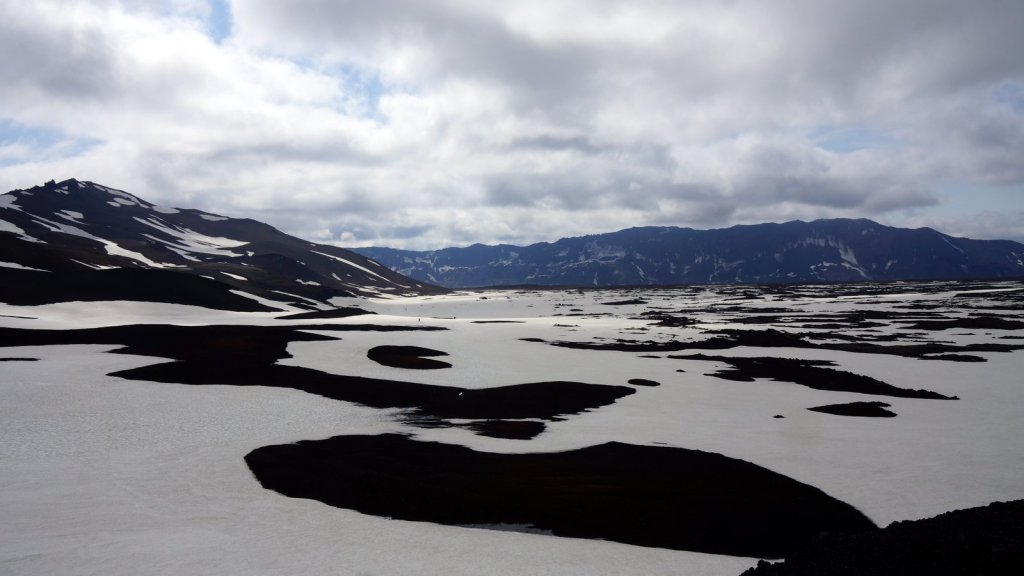
On not finding the campsite as indicated on the map, we did not know where to go. We started going North on the F910 road, one of the many roads accessible only by 4×4 cars. The Askja caldera, some 94 km further inland, was the only place where we knew there is a campsite and we wanted to visit it anyway. To get there we had to cross several small streams (the big ones had a bridge) and drive over/through the volcanic landscape. Parts of the track was corrugated and other parts very sandy with volcanic grid. At one point I was not paying enough attention to the road and we got stuck in the sand. With the differencial lock on, we managed to get out but did not have enough momentum to go through the next hole full of grit. We were stuck. No movement back and forth. The smell of the burning coupling was a sign to stop trying. I reduced the pressure in the tyres and before we knew it there was another 4×4 Land cruiser in front of us. He managed to pull us free using our long tow rope. Good we came prepared. A cold windy night was spent at the campsite (Dreki) near the caldera. We expected many more 4×4 campers there but there were only 5 cars, 3x 4×4 campers and 2 small cars with tent.
Folloing the F910 though the lava fields 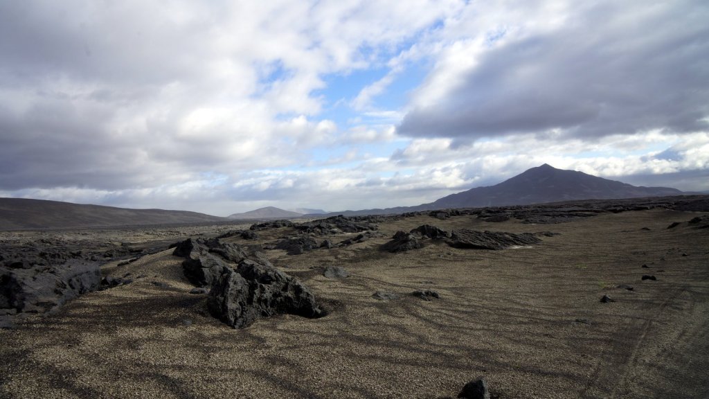

This crossing had a bridge
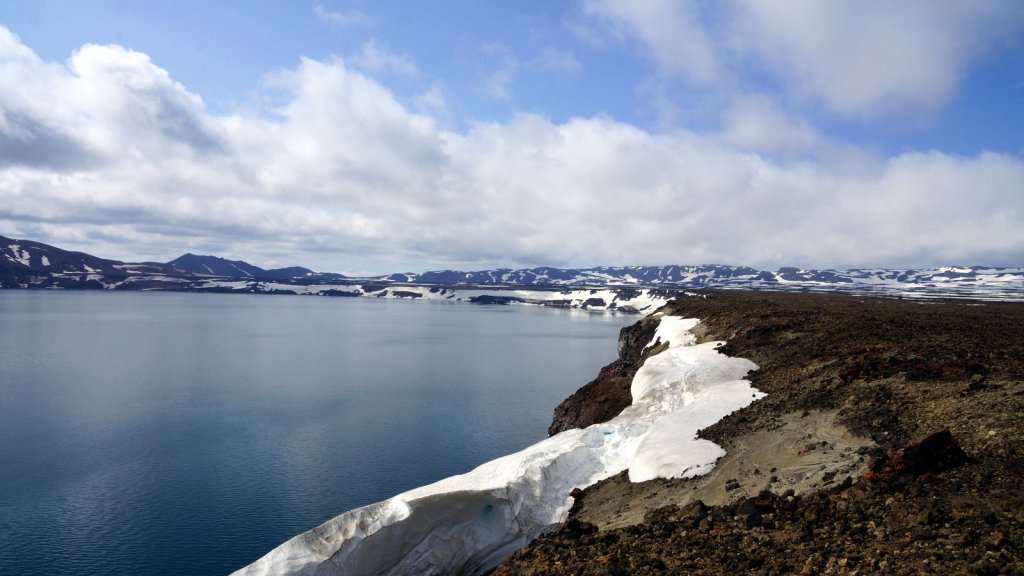
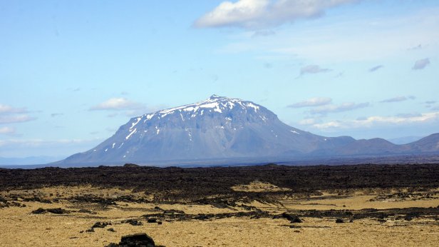
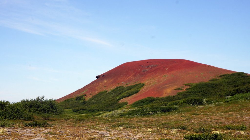
To reach the Askja caldera you first drive over a rough road leading though solidified volcanic rock from the 1875 eruption. After 8 km is a car park and you start your 1 hr+ walk to the caldera lake. First up a short sloop, then over a large melting snow field to the lake. This walk is tiring since you sink into the soft snow at every step. In the corner of the lake there is a secondary crater, Viti, which is actually more impressive. The sides are steep and in the bottom is milky white warm water which gives off a sulphur smell. On the way out, we met large groups of day-trippers walked towards us. The snow was getting more and more slushy. The empty car park was now full. We were ahead of the crowd fortunately. However when driving out we encountered many oncoming traffic (all 4×4 and some larger tour buses). We decided not to drive to far and settled for a nearby camping (20 km) in a green rock valley next to the impressive Herdubreid (1682 m) mountain. Still in the National Park. The site was fine, however you could not sit outside in the sun because of all the small flies (midgets).

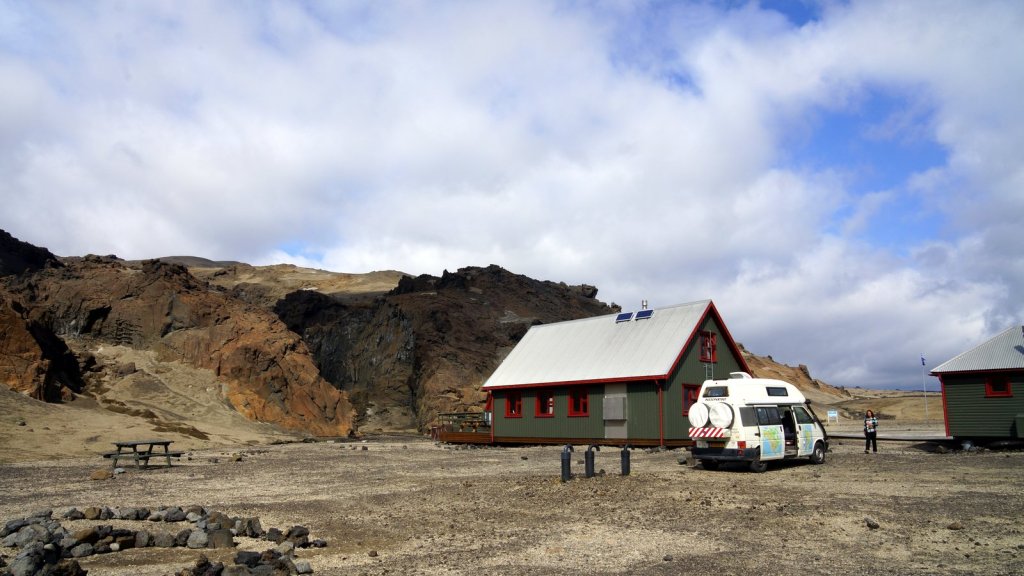
Dreki campsite 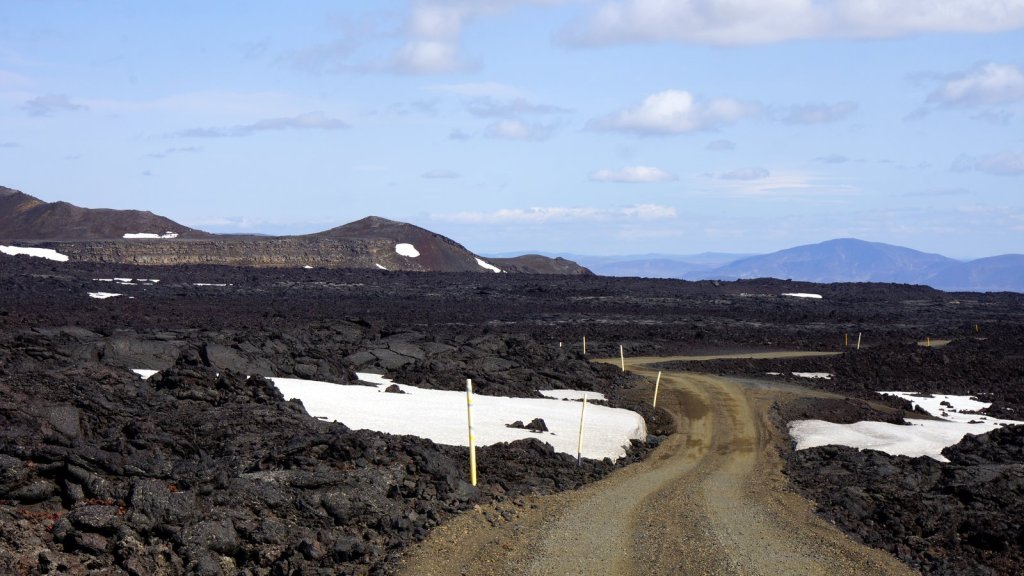
Rocky road to the crator rim 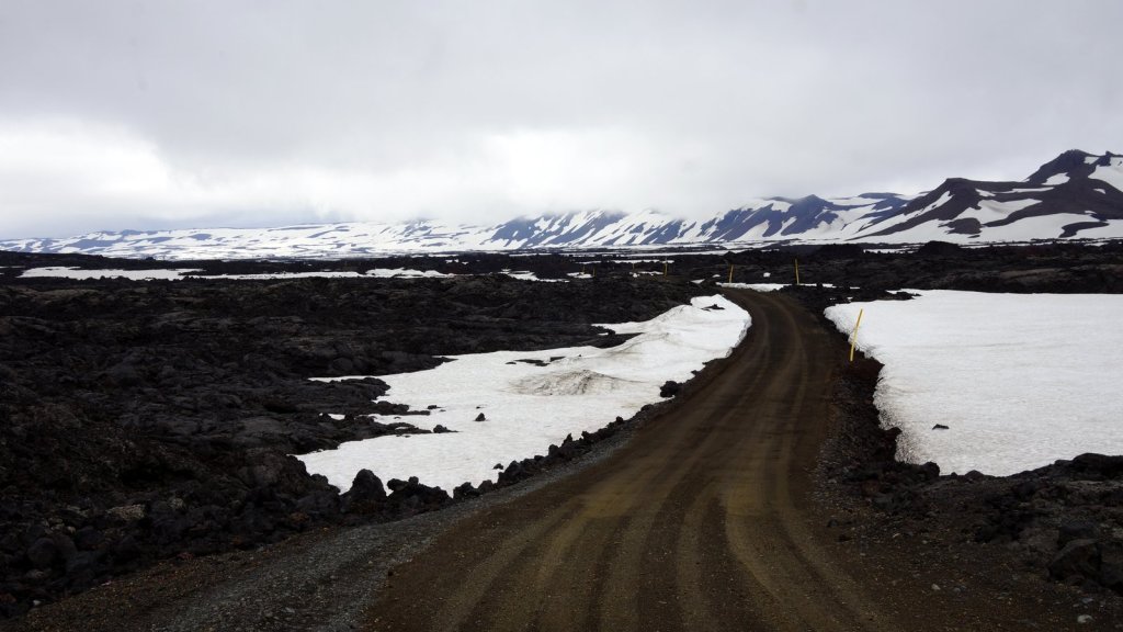
Long walk over the snow to the crator lake 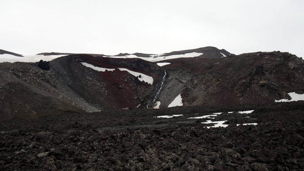
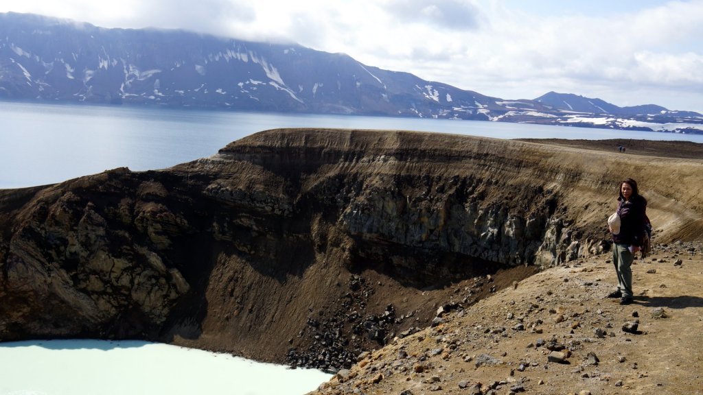
Small crator of Viti 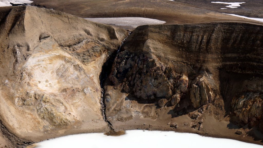


We had strong wind overnight and continued to the morning. The morning sun was strong and from 5.00 hrs it was shining into the camper. It even got a bit warm so we had to open more windows. Outside because of the wind, the midget were gone. A few km’s along the F88 towards the North there is a serious river crossing. There were more 4×4’s there. We asked one of the drivers to film us crossing the river. The water almost covered the tires and a bit splashed in via the open air-duct in the bottom. So now we know how deep/far we can go. If only you know beforehand how deep it is going to be. After the euphoria of this deep river crossing the rest of the 60 km drive north was fine. No serious sand and the corrugated sections are not too long.

Our campspot with flies 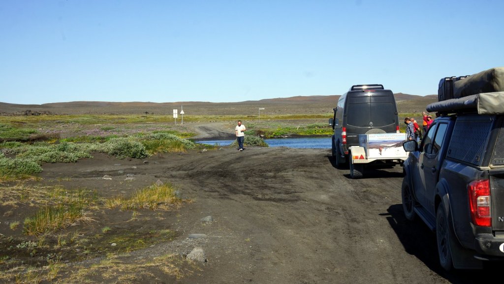
Who goes first 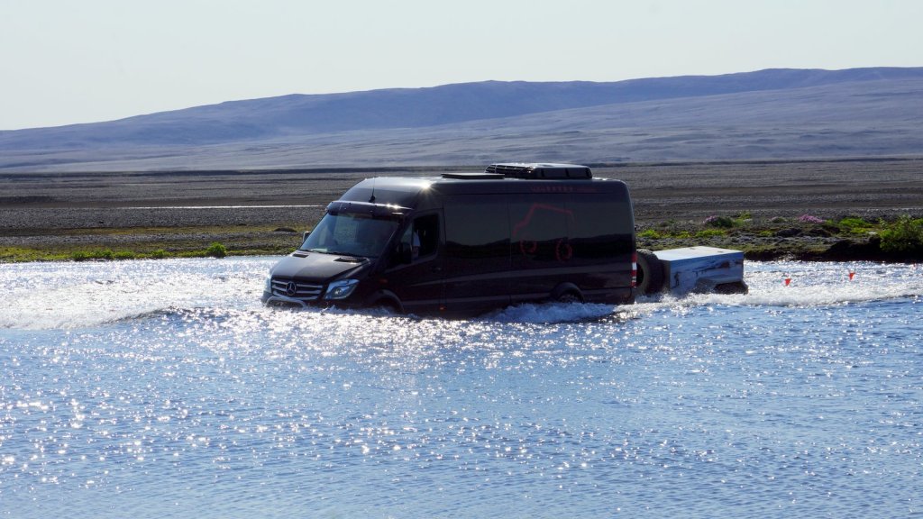
River crossing 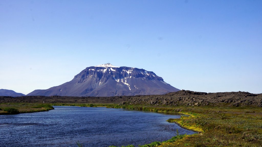
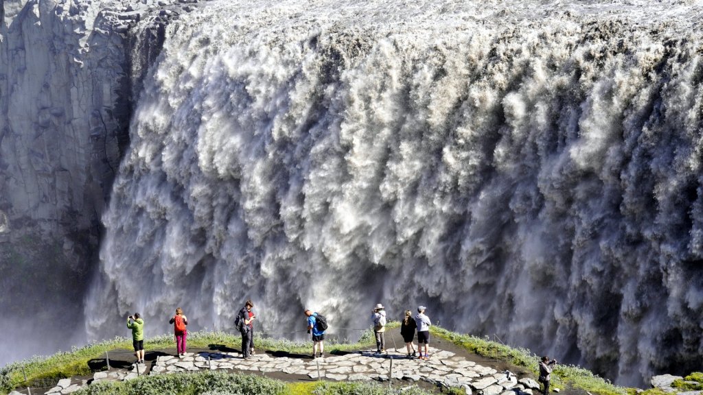
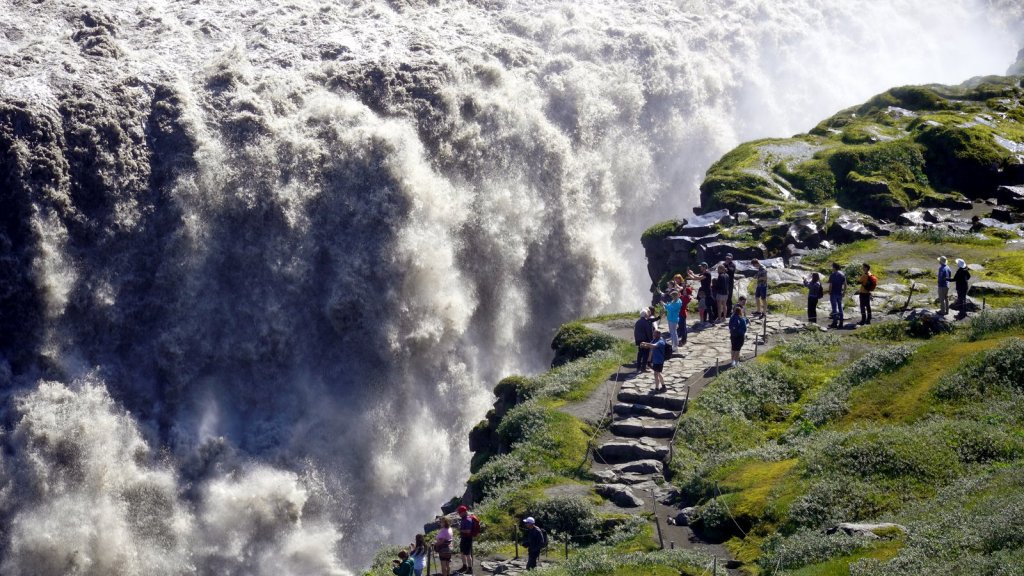
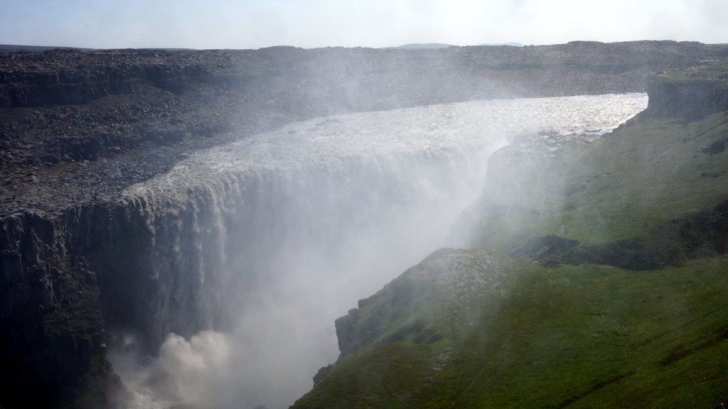
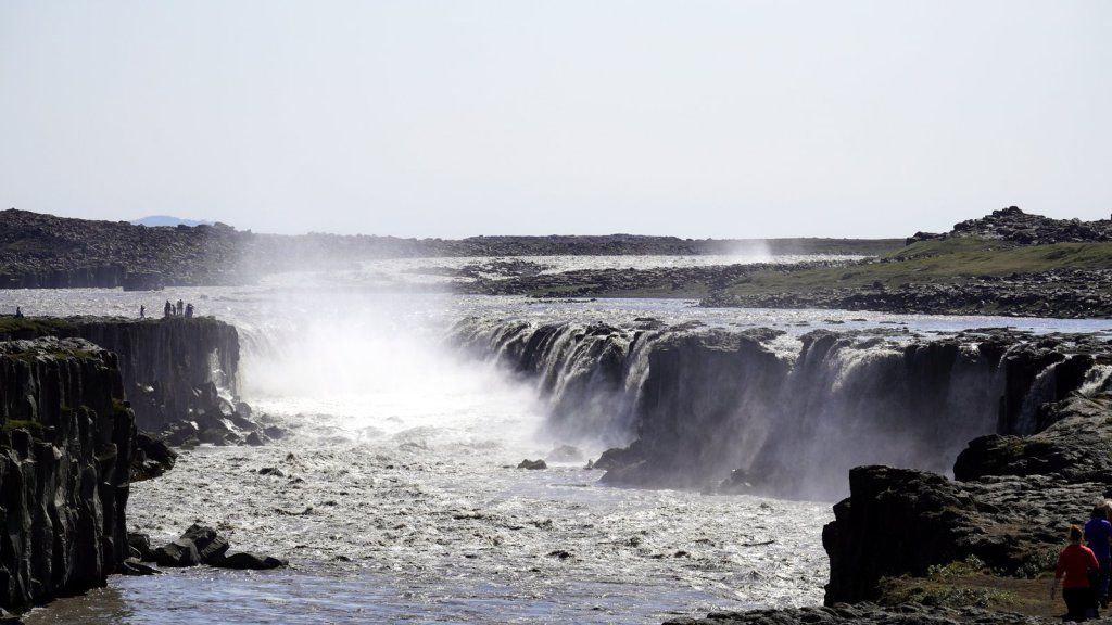
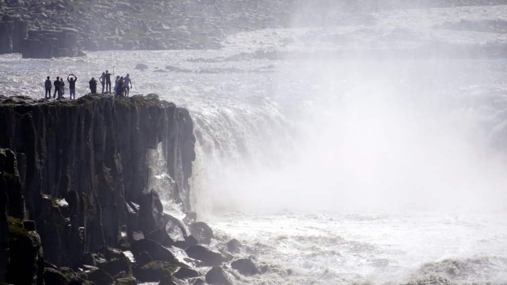
Driving on the tarmac again with soft tires was different. The camper floated a bit. At a petrol station we managed to pump up the tires again resulting in a much more stabile drive to a famous waterfall Dettifoss. The fall is actually in the river we have crossed up in the highlands and followed most of the way down. After a short walk from the crowded car park you reach this mighty waterfall. It is not so much the height but the large amounts of gray falling water that makes this fall impressive. The noise is deafening. Moreover the sun was in the right position so we had a beautiful rainbow.
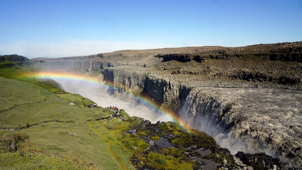
Dettifoss 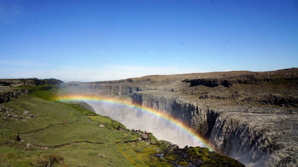
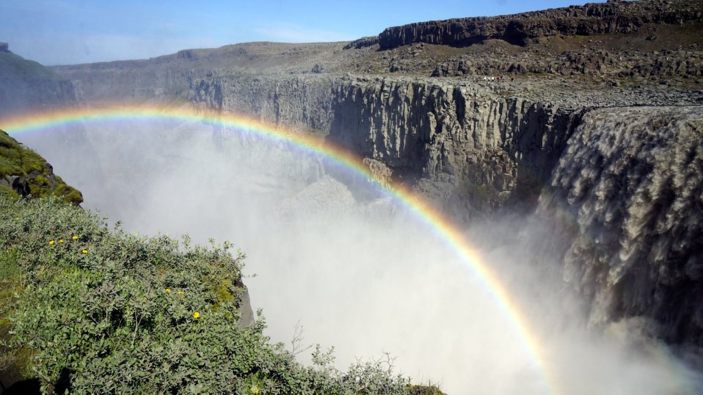
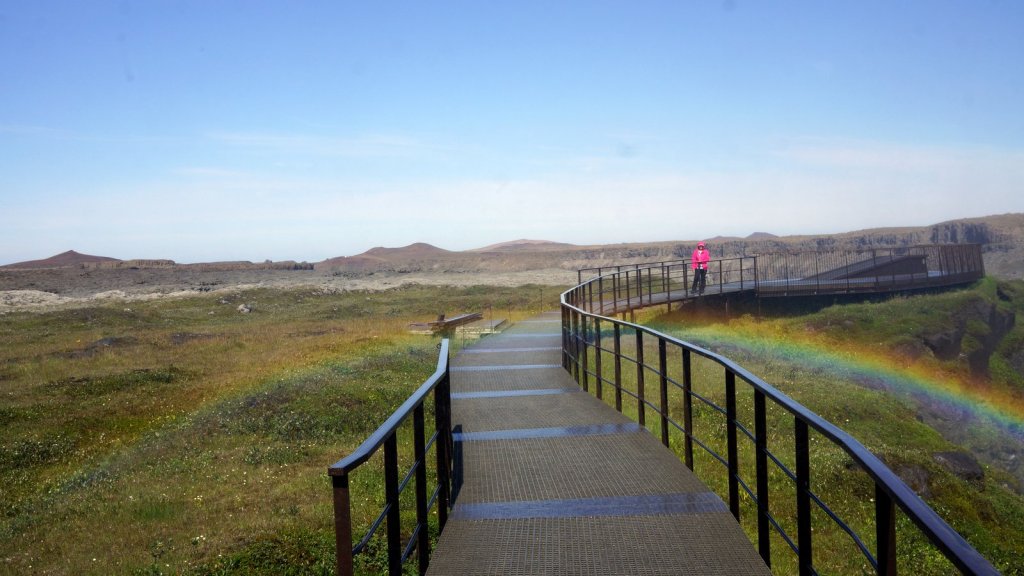
Jamaliah behind the rainbow 
Glowing grass 
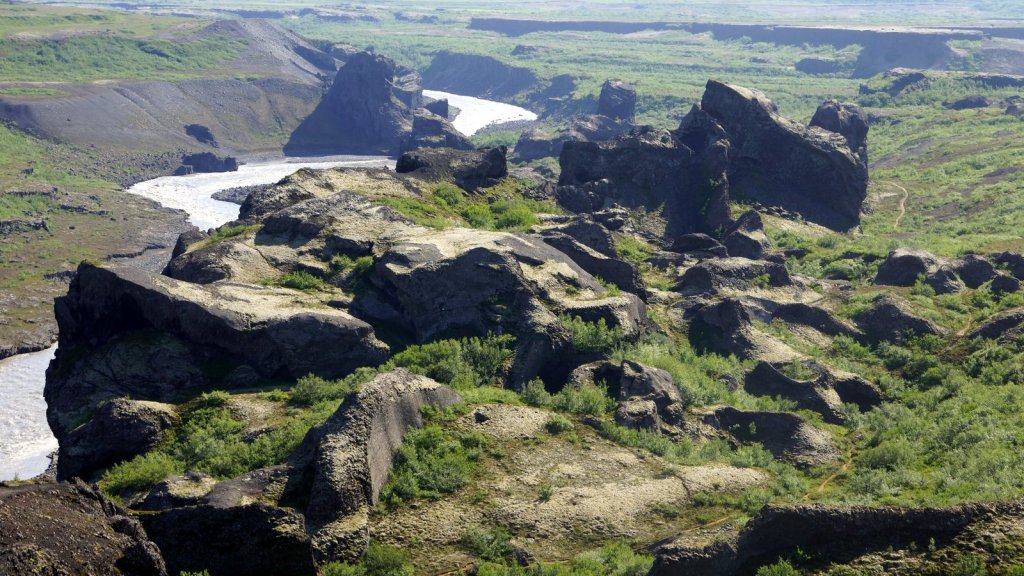
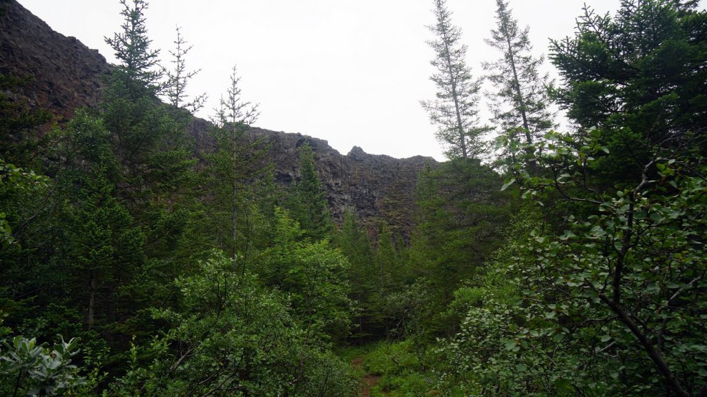
Further up the newly re-constructed 862 road at Hjodaklettar there is a turnoff toward a car park with a 2,5 km walk towards the before mentioned river gorge. Here it is not so much the waterfall that is attractive but the walk though the heather and what looked like grand berry plants. The view down to the river flowing in de gorge was ok and made more attractive by nearby red and black volcanic hills.
Hjodaklettar 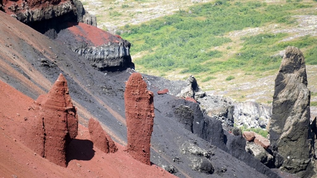
The night was spent further North at the coastal hamlet of Kopasker. This is our first campsite from our pre-paid camping Iceland card. Since we can use it for 28 nights it was about time we found a site. Actually one of the more enjoyable sites. There is a free hot shower. After the grit of the highland/dessert, it was very much appreciated. One advantage of travelling at this time of the year is that the sun never really sets. At 1:00 it is the darkest but at 2:30 it is almost bright again.
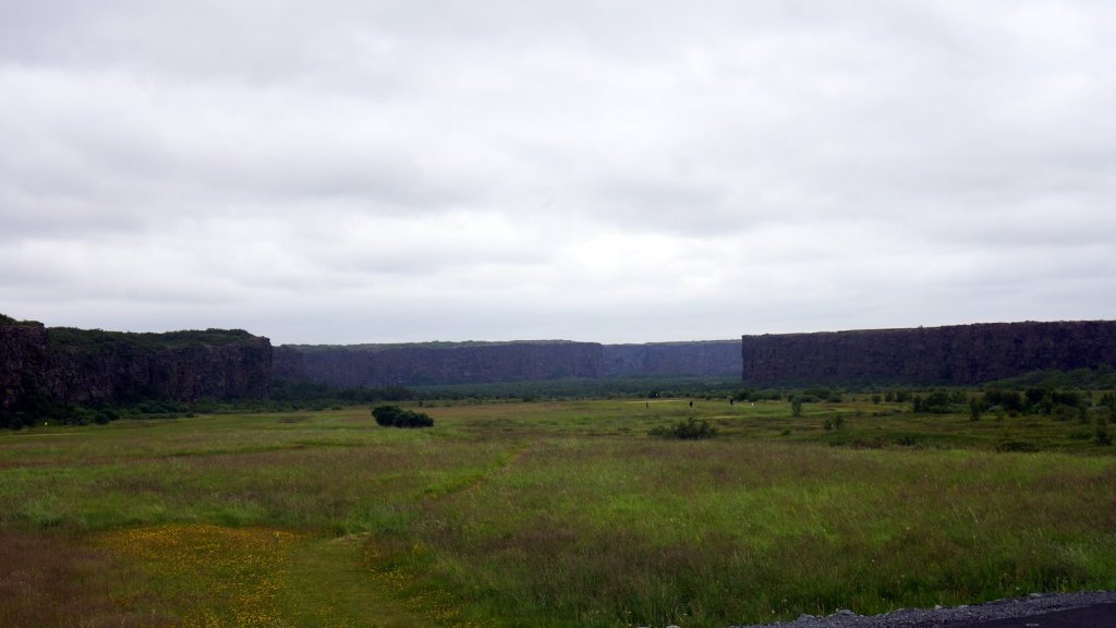
We drove back to the Asbyrgi cliffs which we had bypassed yesterday. 2 long walks in a day was enough. You enter the wide gorge/cliffs by car and drive to the end, though a forest of pine and birch. After a lovely walk through the trees you reach a small lake at the cliff front with various platforms for picture taking. It is not clear how this wide valley between the steep cliffs was formed. My theory is from river flow but at the visitors centre they talked about flash floods.

We drove further along the coastal road 85 towards Husavik where we have booked a whaling trip for the next day. Before reaching the town we stopped at the Manarbakki folk museum. It houses a large collection of local artefacts such as teapots, washing machines and other household curiosa. The campsite was so appealing that we drove 20 km back to it after grocery shopping and our first local meal (fish) in Husavik.
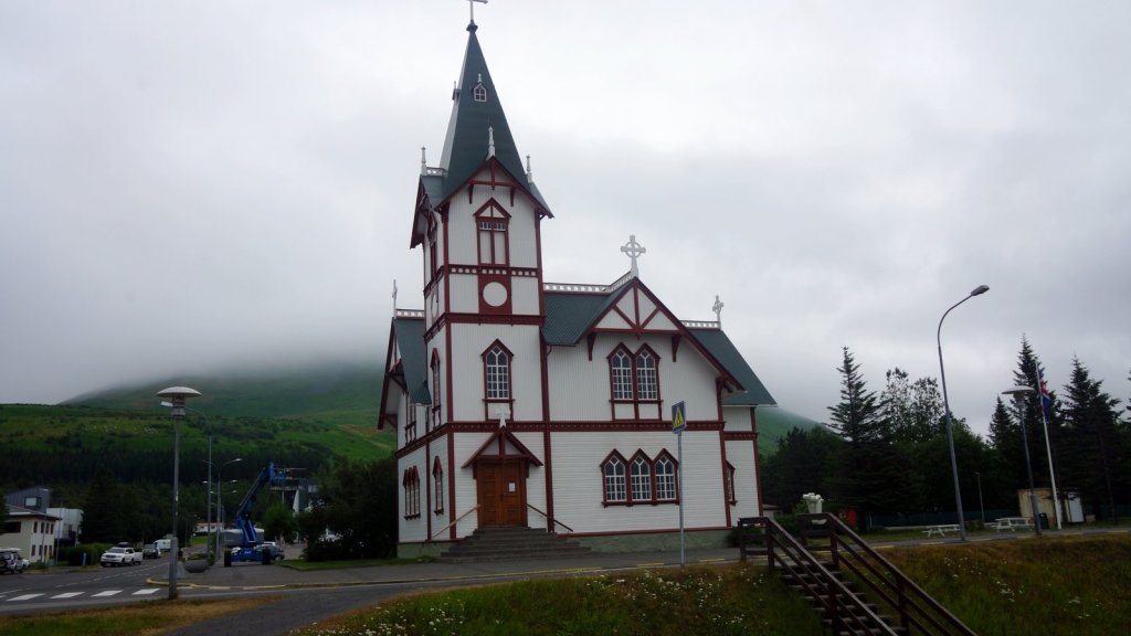
Church in Husavik 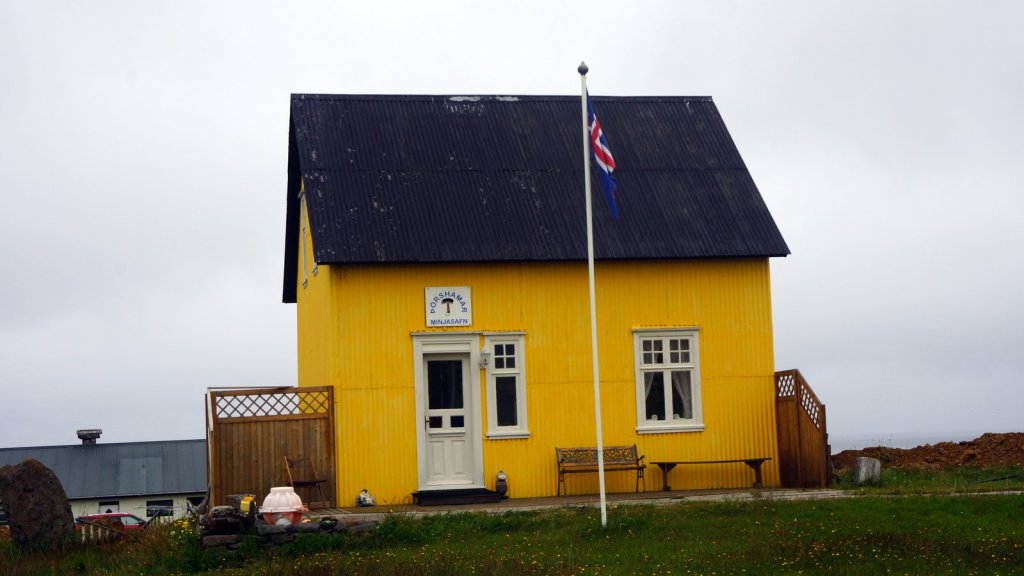
Folk Museum 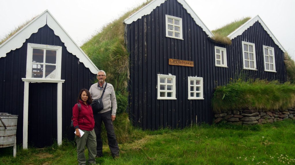
Campsite on the cliff

Great trip again guys. I guess you mean Jamaliah on top off the rainbow!
LikeLiked by 1 person
Prachtige foto’s. Spannende momenten voor jullie, door dat water…
Nog mooie dagen gewenst!!
LikeLiked by 1 person