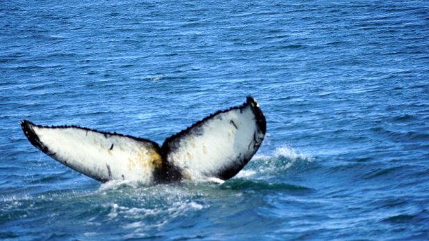
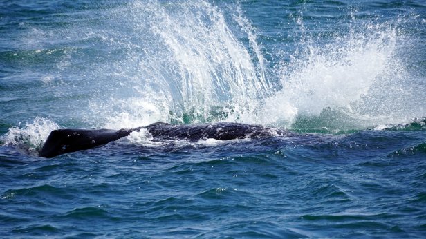
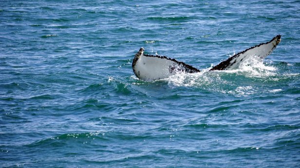
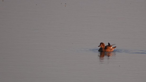
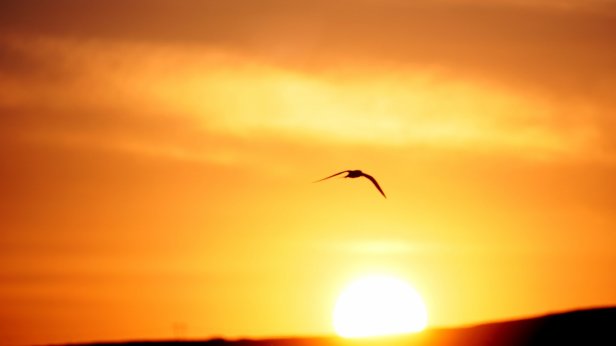
We took the first boat out at 9:45. The sun was shining and the sea calm. After some 45 min sailing out of the harbour northwards in the fjord, the guide spotted some dolphins swimming with the boat. A bit later we saw our first Minky whale. From a distance it look not much different than the dolphins we saw closer by. However some 20 min later a Humpback whale was spotted. We sailed towards it. The whale performed a real show for us and people on the boat were clapping. It was extraordinary. First some jumps out of the water and later he swam on its side and slapped with his fin first left then right hard on the water to remove excess coral growing on it. It was as if he was waving at us. A little later another humpback was seen. We only managed to see its tail fin several times when it dived down. Our 3 hours time was up and we had to sail back to the harbour. No need to say that everybody on the trip was happy with today’s catch.

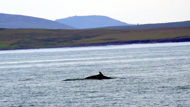
Minky whale 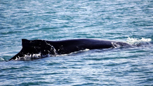
Humpback whale 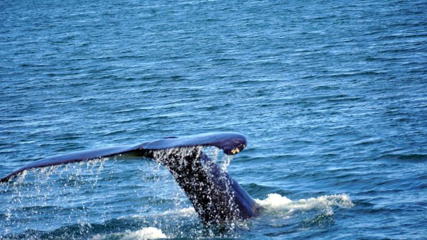
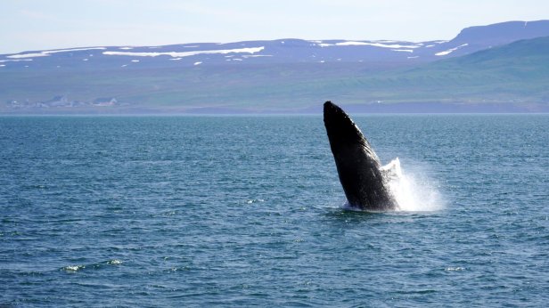
Liftoff 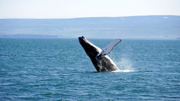
Turn 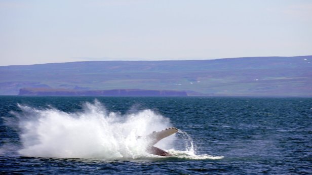
and splash 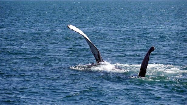
slapping 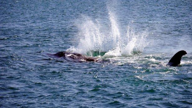
the water 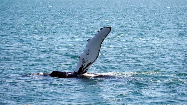
Diving down for 10 minutes 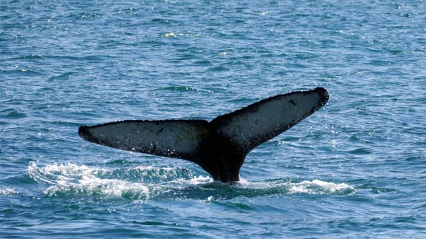
unpopulated shores of the fjord 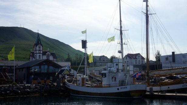
back in the harbour 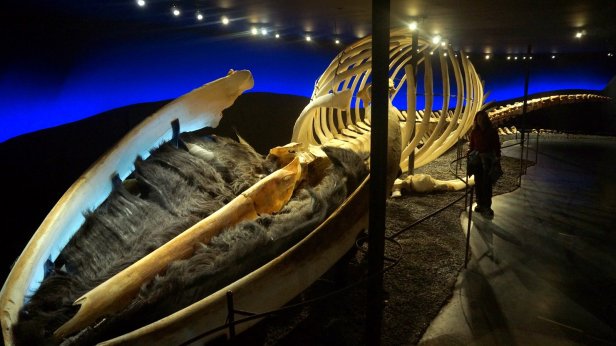
skeletan of a blue whale
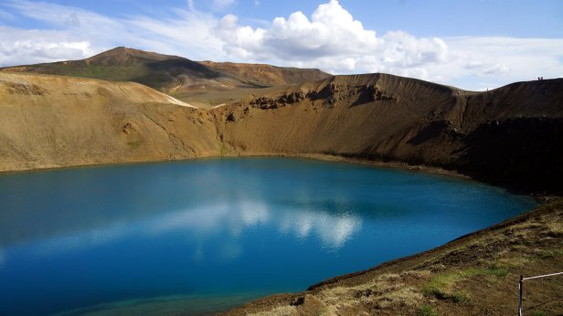
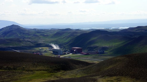
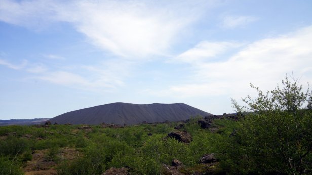
From Husavik there is a good road to the thermal area near the village of Reykjahlid. We first visited the remains of the Krafta volcano. Beside a small crater to walk up, there are fields of solid lava to walk over towards bobbling mud pools. The ground heat is used by a nearby power plant to generate electricity for the village and surrounding area. The heat is also used for generating warm water for house heating. This was noticeable at the camping because the warm water had a distinct sulphur smell. The campsite was located on the shore of lake Myvatn. The weather was still warm and sunny so we could sit outside and enjoy the view and later at 23:00 the sunset behind the mountains in the distance.
Viti explosion crator 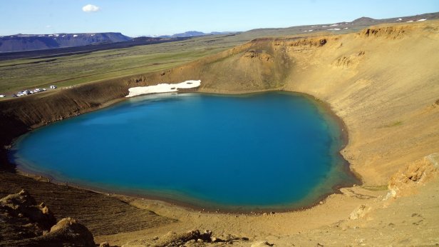
Powerplant 
Vulcanic landscape 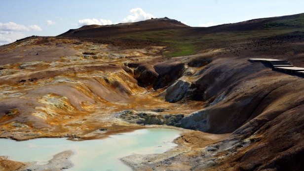
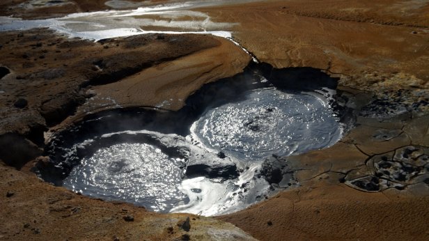
bubbeling mud 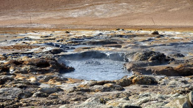

Sunset on the lake 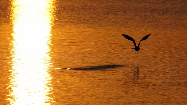
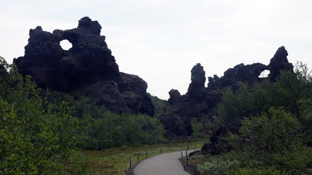
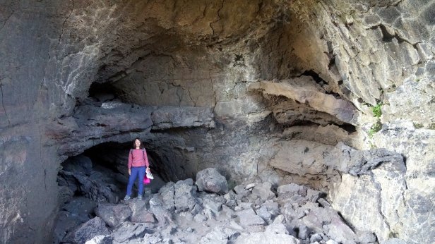
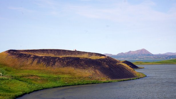
The next day was a relaxing day. We drove slowly round the lake, stopping at the sites to see, such as a cave (Grjotagja) which featured in the Game of Thrones (North of the Wall). In fact it was an old small lake over which the lave rim had collapsed during the last volcanic outburst in the 70ties. Further along there was a rocky park, Dimmuborg. Several routes are laid out in between the large volcanic pillars. There were a lot of visitors. The next stop along the lake was Skutustadir, where there is a short walk over and in between several small craters.

Game of Thrones cave 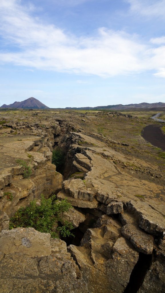
Collapsed lava layers 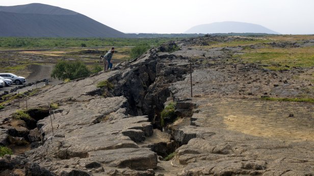

Lake Myvatn 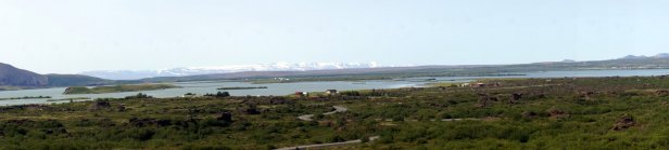

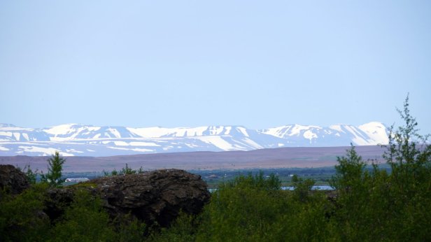
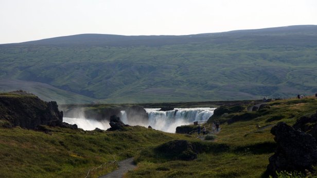
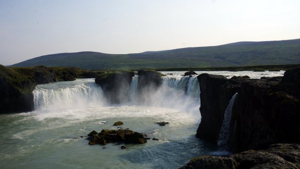
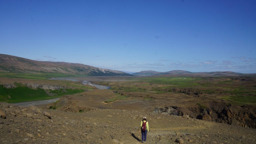
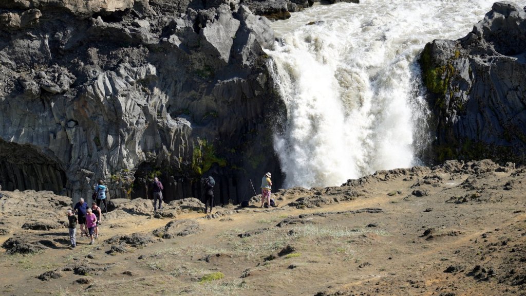
Route 1 continues over wide green rolling plains of grass. Some is harvest for the indoor cows but much of it seems unused. There are a few sheep rooming around but not many. Just after the lovely waterfall of Godafoss, we turned to the graded route 844. Jamaliah had discovered there is a camping some 26 km down the track. The road followed the Bardardulur river though a green valley with left and right a few farms and most likely holiday homes. We found the camping near a football pitch and a guesthouse/restaurant. There were only a few other campers on the large grass field. Later on guests for the guesthouse turned up and the dining room seemed full. The place is everything we hoped for: space, sunshine and not many campers like the night before at Myvatn lake.
22/7
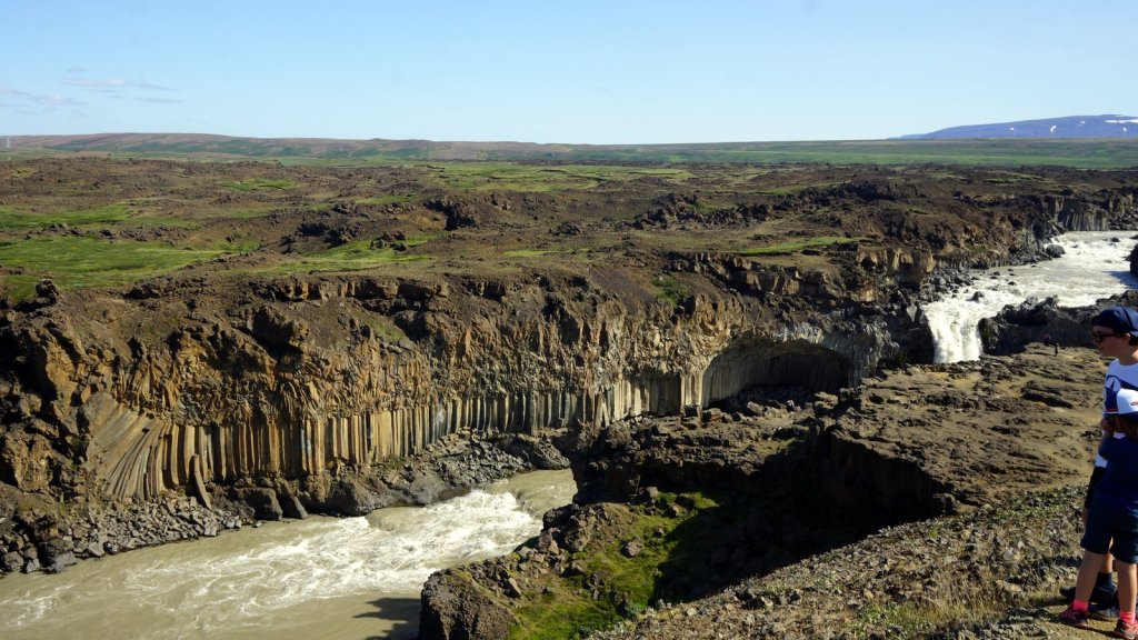
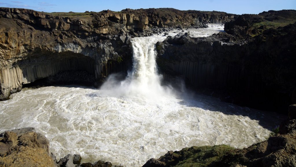
A bit further down the road you cross a bridge and the road number turns to F26 so you need a 4×4. That’s ok, we have it. Some 3.5km further is the Aldeyjarfoss waterfall. The river drops over a cliff of basalt pillars. Above is a massive basalt layer. Clearly the 2 versions of basalt can be seen. The only difference is the speed at which it cooled.
The wolk towards the watewrfall 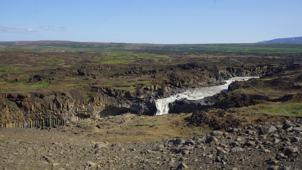
Aldeyjarfoss 
Bazalt pillars
We drove back on the other side of the river to the Godafoss turnoff on No 1. From there it was a smooth drive through/over the hills to Iceland’s second largest town Akureyri. Before leaving the waterfall, we were looking into driving further down on the F26 to another campsite in the highlands. The camper started however to make banging noises when applying power and turning the steering wheel. In Akureyri the noise was more pronounced. Most likely it was the left engine side CV joint again. Strange, because we had them both replaced before this trip. I could also not find anything wrong with the protection rubbers nor anything else underneath the camper. We dropped into a car workshop and the owner had a good look at both axels while we slowly turned around. It is most likely the CV joint. He checked on the internet and the only place they are available is in Reykjavik, some 400 km away. They could be flown in but he only had time to install them on the 5th of august. He gave us the address of 3 other garages in town. We drove past each one of them. None had time. What now. I called the VW store in Holland and they said that if I could bear the noise I could drive on!. The noise only comes when putting torque on the wheels and whilst turning the steering wheel. Driving straight and slow around bends is no problem.
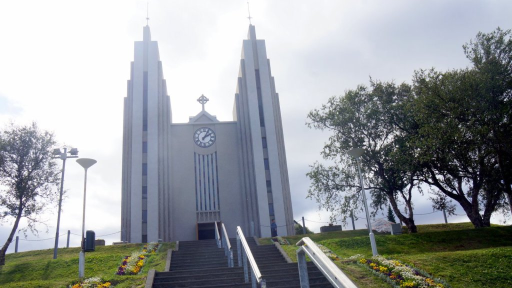
In Akureyri we parked the camper near the botanic garden and wandered through the park. It was well maintained by groups of young “volunteers?”. Everywhere flowers of all types and also different trees and bushes. Lots of parents with the standard Iceland black prams were strolling around. In the town, the Basalt pillar looking church stands out on a hill. Below is the main shopping/strolling/ eating/drinking street. All of which we did.
Akureyri church 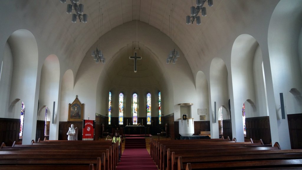
Akureyri 
Having decided that we were not going to terminate our holiday (by going straight back to Reykjavik to repair the camper), we drove further up along the coast to Dalvik and stayed at a large CCI campsite (camping card Island, for which we had prepaid but not used much to date).
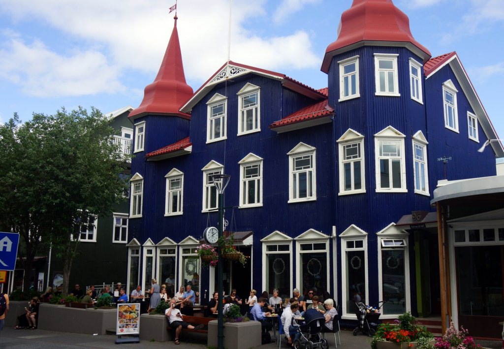
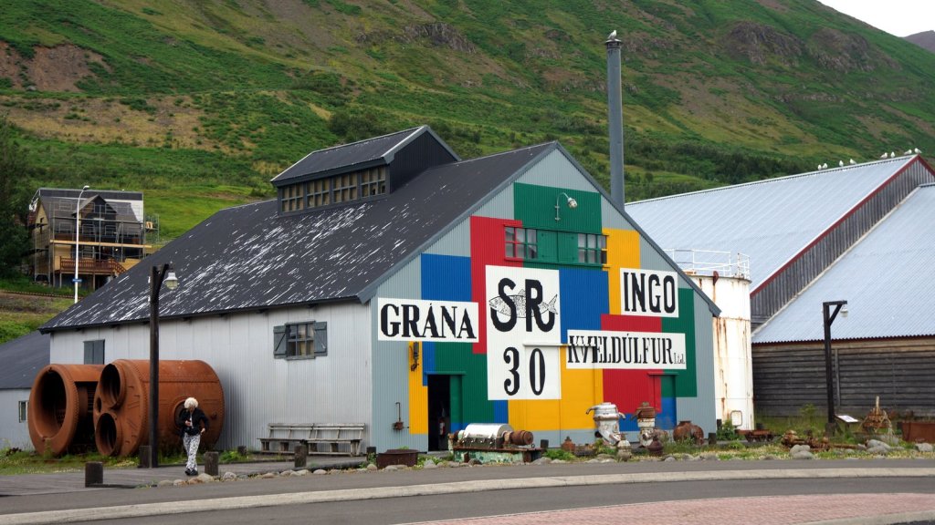
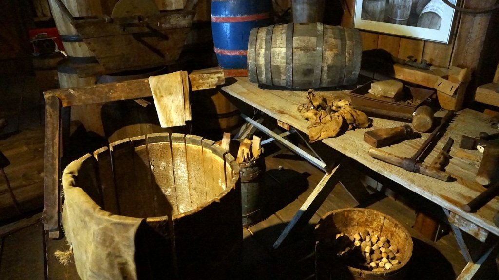
On Friday 23/7 the weather had turned to cloudy and rainy. We continued the 76 North towards the top of this mountain range to Siglufjordur. To get there we drove through several long tunnels through the mountains. Some are single lane with bypasses every 300 m and some double lanes. Siglufjordur was once the Herring capital of Iceland. For 60 years there was intense fishing of the Northern Icelandic sea till the fish ran out in 1968 and the town started to decline. Now the old fishing works are converted into a museum and many tourist come and visit this excellent museum, which show the complete story of what can be done with the herring: filleted and salted them in barrels, cook it for its oil, or canned them. The leftovers are converted into animal feed.
Siglufjordur 
Herring factory 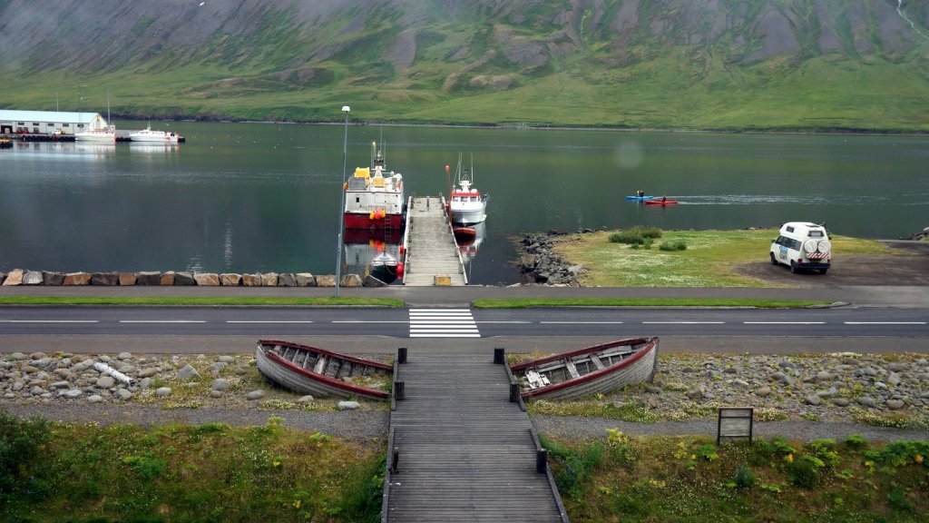
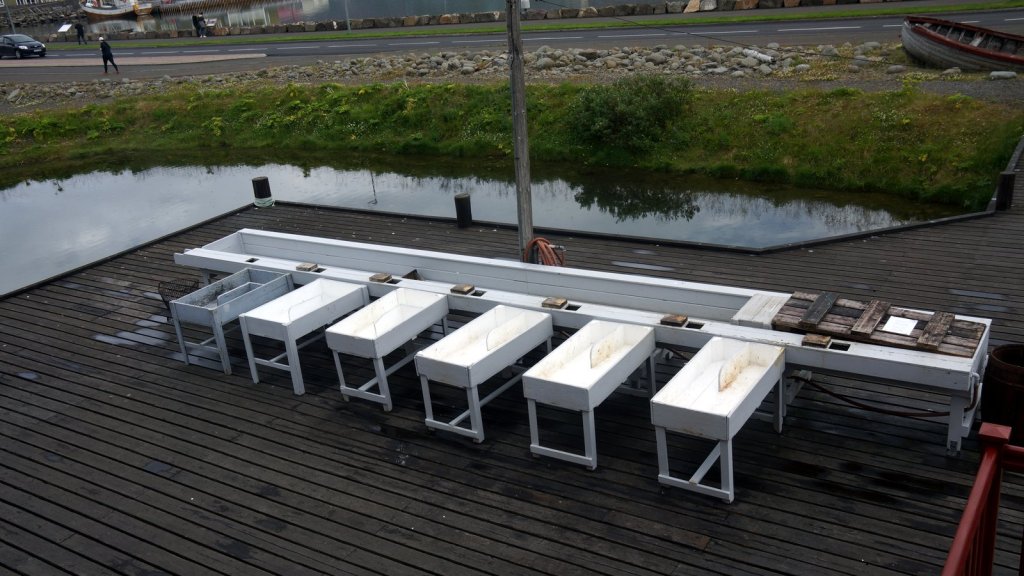
Filleting tables 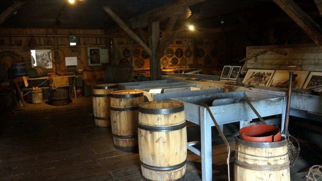
Barrel making 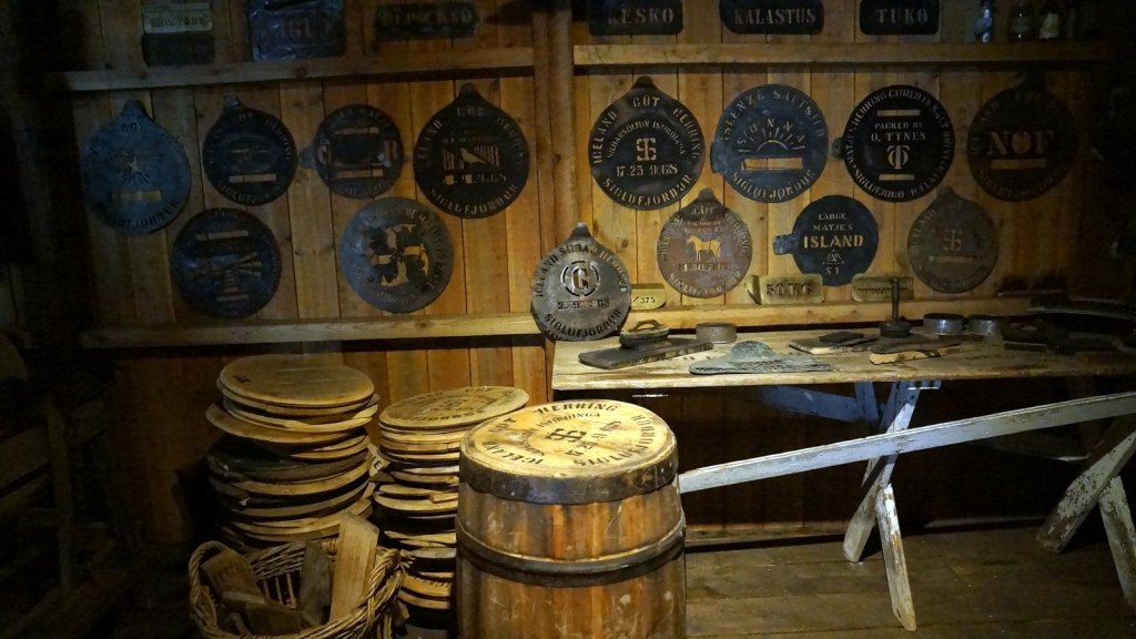
Barrel branding 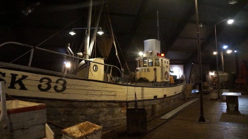
Fishing boat 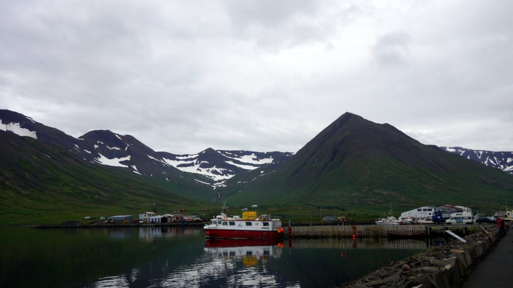
Harbour 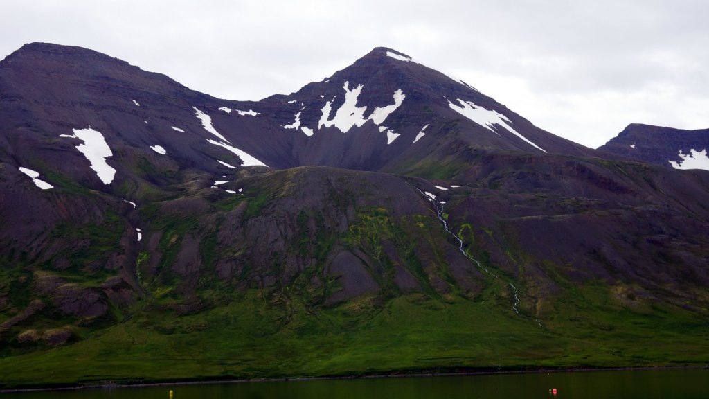
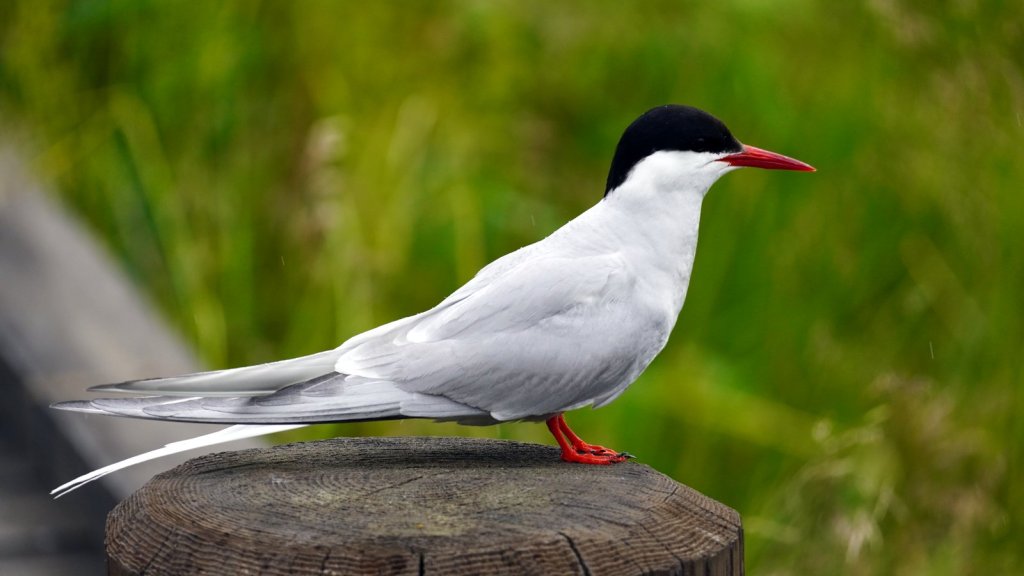
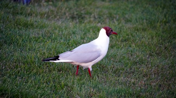
Tern 
Clif dropping waterfall along the road
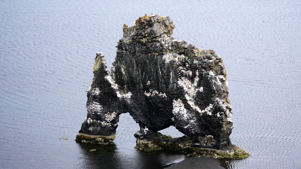
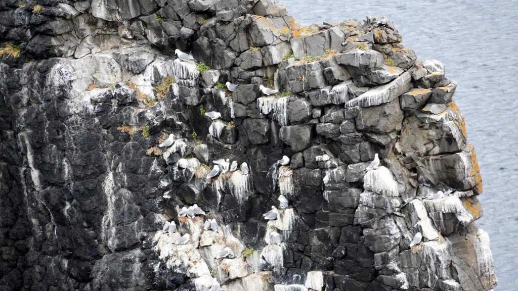
We drove on along the coastal road till we caught up with the main ring road No 1. This road is busy (compared to the smaller one we had just been on) so after some 50 km we turned off to follow the coastal road again, around another mountain range sticking out into the sea. Since it had rained the surface of the road had turned into mud. The car was covered with it. At the small hamlet of Osar there is a viewpoint onto a strangely formed rock in the sea just off the coast. Lots of seabirds are nesting there. The climb down was too steep for a close-up. We drove further around the peninsula over the well maintained mud covered road to Hvammstangi to another one of CCI campsite where the village has a music ”concert” in the evening.

Pracht foto’s van een geweldige reis.
Fijn dat je anderen zo laat mee genieten.
Dank daarvoor
LikeLike